|
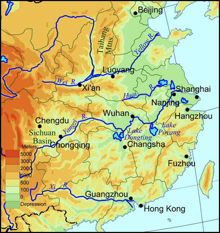
Two great rivers run through China Proper: the Yellow River in the north, and the Yangtze (or Yangzi ) River to the south. In fact, most of China Proper belongs to the drainage-basins of these two rivers. Both originate to the far west in the Tibetan Plateau. The much smaller Xi River cuts through southern China. The map below shows the current courses of these rivers, but over time there have been many changes. Sometimes the Yellow River has emptied south of the Shandong peninsula, rather than north of it as it does today. And for long periods, the Huai River emptied into the sea. |
||||
Why do most of the rivers in China flow from the west to the east?
How many of the major cities of China are on major rivers? |
||||
|
Rivers of China Proper |
||||
|
China Proper was separated from the vast territories of Outer China to the north by the Great Wall, a huge construction project and famous landmark of Chinese civilization.
To see pictures of the Great Wall, click here. |
||||
|
North China is dominated by the alluvial plain along the Yellow River (shown on the right). This part of China Proper is mostly flat and the soil, replenished by silt carried down by the river, is well-suited to agriculture.
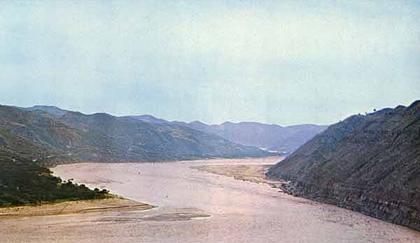
The Yellow River in its middle reaches is shown below. For more information about the Yellow River, click here. |
||||
|
||||
|
|
||||
|
The middle reaches of the Yellow River
|
||||
|
|
||||
|
||||
|
What crops do you think are suited to areas of loess soil? |
||||
|
||||
|
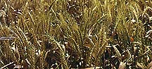
Wheat |
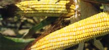
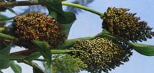
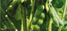
Staple crops of North China include wheat, corn, sorghum (a grass crop related to sugar-cane), millet and soybeans. Recently, thanks to new varieties and methods, rice has become more and more widely grown. |
|||
|
Corn |
Millet |
|||
|
Sorghum |
Soybeans |
|||
|
||||
|
The region drained by the Yangtze (Yangzi) River, loosely called South China, is hillier than North China. The region is also warmer and more humid.
|
||||
|
Rice fields, south of China
|
||||
|
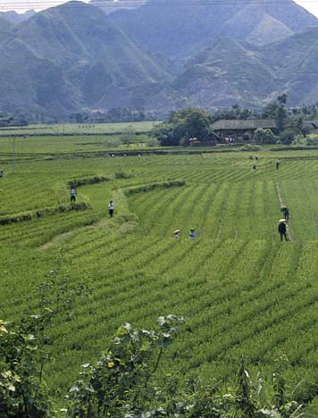
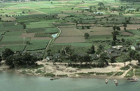
South China is covered by a network of rivers and lakes and their valleys. |
||||
|
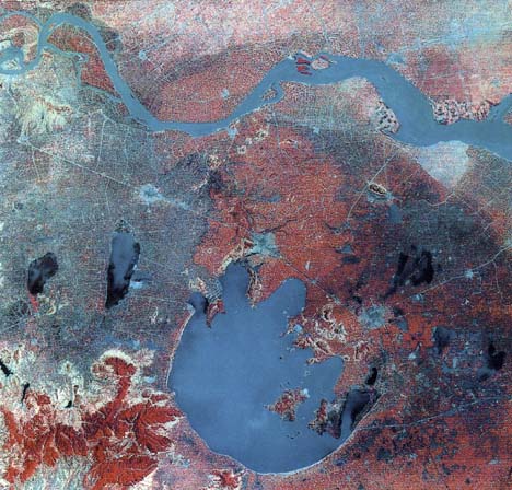
On the right is an infrared satellite picture showing the area around Lake Tai and the Yangtze River. The Yangtze River is near the top, Lake Tai, the half-moon blue shape, at the bottom. The region has been the most prosperous area in China since the tenth century, and is commonly called the "country of rice and fish." To learn more about the Yangtze River, click here. |
||||
|
||||
|
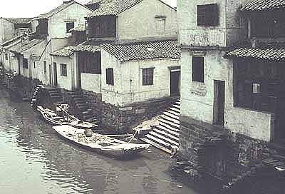
Rivers are an integral part of the daily life of people in South China. Below is a picture of Suzhou in Jiangsu province showing houses along the Grand Canal. From north to south, the Grand Canal is over 1,700 kilometers (roughly 1,100 miles) long, linking Hangzhou in Zhejiang province with Beijing in the north. An extremely important water project that was first started in the Sui dynasty (589-618), it connects several big rivers and provides an important means of transportation and communication. With the two pictures below in mind, how do you think the access to rivers and lakes would have made the lifestyle of people in the south different from that of people in the north? |
||||
|
The picture on the left shows a "street" scene from Suzhou. |
||||
|
Canal in Suzhou, 1980
|
||||
|
Although provinces such as Guangxi, much further west, are generally more mountainous, they still usually have navigable rivers.
|
||||
|
||||
|
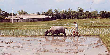
Rice is one of the staple crops of South China. Below is a picture of a farmer planting rice. When the fields are flooded like this, farmers allow fish to swim among the stalks. |
||||
|
|
||||
|
Plowing a rice field in Taiwan, 1967
|
||||
|
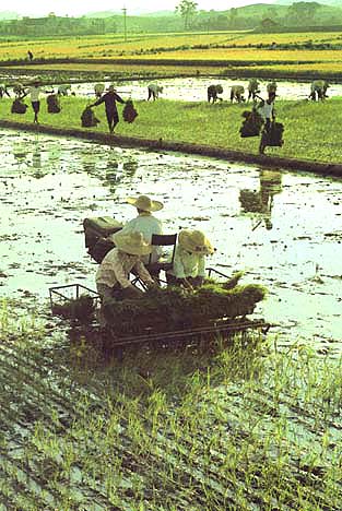
What do you suppose these people are doing in the picture on the left?
|
||||
|
||||
|
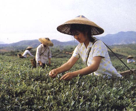
Tea is widely grown in the hilly regions in South China and many parts of West China, such as Sichuan province. In fact, tea is so popular in China that it is considered a basic necessity of life. |
||||
Why do you think tea is so popular?
|
||||
|
Picking tea in Zhejiang province
|
||||
| In the past China was overwhelmingly an agricultural society, but it has had large cities from early times. Today, China's largest cities look much like cities elsewhere, though some traditional styles of architecture and graphic arts can be also be found. | ||||
 |
||||
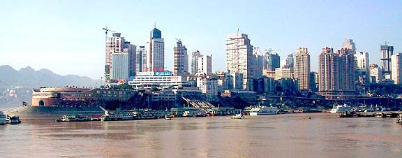
Chongqing, Sichuan, 2001
|
||||
|
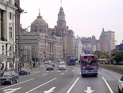
Much of
what can be seen on the Bund in Shanghai dates from the first half of
the twentieth century. The tall buildings further from the river,
below, have largely been built in the last ten years. |
||||
|
||||
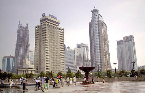
Is there anything about this scene you would be unlikely to see outside China? |
||||
Downtown
Shanghai,
2001
|
||||
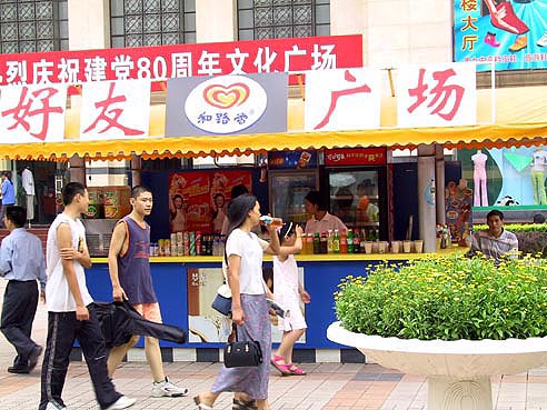
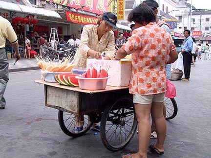
| Chinese cities, like cities everywhere, bring people together to buy
and sell.
|
||||
Chongqing
market, 2001
|
||||
For more on the sorts of clothing people wear today in China, see Eighties and Nineties in the unit on Clothing. |
||||
|
||||
Why would a Chinese city today have both skyscrapers and street vendors? What does their existence tell us about the Chinese urban economy? |
||||
Fruit vendor,
Shanghai, 2001
|
||||
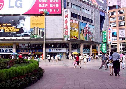
For more on the sorts of billboards and other advertising to be seen in contemporary Chinese cities, see the section on Contemporary Advertising in the Graphic Arts unit. |
||||
|
||||
Move on to Outer China |
||||

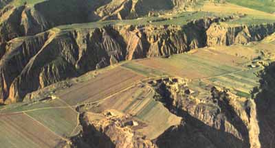 The
middle reaches of the Yellow River flow through the so-called Loess
Plateau, shown to the right and below. A type of soil that covers
extensive areas in Asia, Europe, and North America, loess is silty and
yellowish brown in color. It is a fertile soil that is conducive to
agriculture.
The
middle reaches of the Yellow River flow through the so-called Loess
Plateau, shown to the right and below. A type of soil that covers
extensive areas in Asia, Europe, and North America, loess is silty and
yellowish brown in color. It is a fertile soil that is conducive to
agriculture.

 Why do you think the farmers allow the fish to swim among the
stalks?
Why do you think the farmers allow the fish to swim among the
stalks?
