)
Mountains north of Beijing, seen on flight to Mongolia. |
)
Terraced fields along route from Lanzhou to Binglingsi Caves, China. |
)
Terraced fields along route from Lanzhou to Binglingsi Caves, China. |
)
The Ming fortress at the “Jade Gate,” Jiayuguan, Gansu Province, China. |
)
Irrigated agriculture at Jiayuguan, Gansu Province, China. |
)
The Mogao oasis, near Dunhuang, Gansu Province, China. |
)
The Mogao oasis, near Dunhuang, Gansu Province, China. |
)
The dry bed of the Daquan River in front of Mogao Caves, Dunhuang, Gansu Province, China. |
)
The snow-capped Qilian Mtns., S. of Dunhuang, China—the source of water for the oasis. |
)
The Mingsha Dunes, above the Mogao Caves, Dunhuang, Gansu Province, China. |
)
Han garrison building, Yumenguan (The Jade Gate), west of Dunhuang, Gansu Province, China, near where the Silk Roads divide. |
)
L. Kanas, Altai Mtns., northern tip of Xinjiang, China. |
)
Pasture land in the Altai Mountains of Northern Xinjiang (China). |
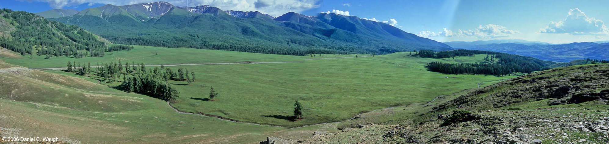
Panorama of pastures in Altai Mtns., far northern part of Xinjiang, China (not far from border with Siberia). |
)
Desert vista N. Xinjiang, China, near border with Kazakhstan. |
)
Irrigated farmland just below slopes of Tienshan Mtns., N. Xinjiang, China. |
)
Irrigated farmland, N.Xinjiang, China. |
)
Museum display three-dimensional map showing Bogdo Ula area of Eastern Tienshan Mtns. and Urumqi, capital of Xinjiang, China. |
)
Bogdo Ula, highest peak in the Eastern Tienshan Mtns., Xinjiang, China. |
)
L. Sayram, northern slope of Tienshan Mtns., Xinjiang, China. |
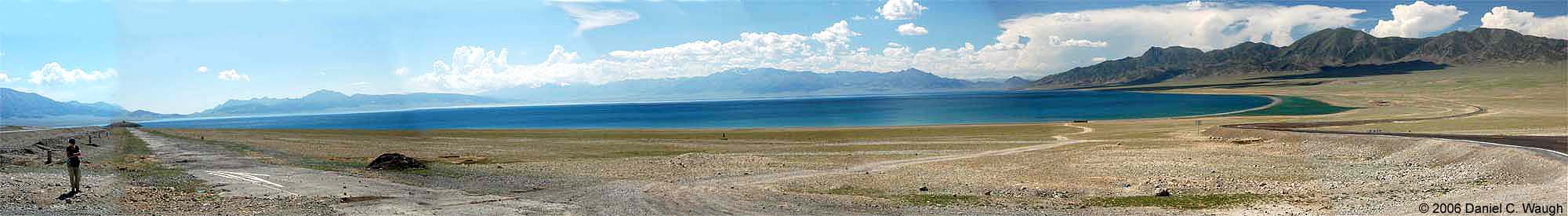
Panorama of L. Sayram, north slopes of Tienshan Mtns., Xinjiang, China. |
)
Pasture land near the slopes of the Tien Shan Mountains, not far from Sayram Lake, Xinjiang (China). |
)
Pastures at the pass leading from Lake Sayram to the Ili Valley, Xinjiang, China. |
)
A three-dimensional museum model of the Ili Valley region of Xinjiang, China. |
)
A three-dimensional museum model of the Ili Valley region of N. Xinjiang, China. |
)
A three-dimensional map model of the Ili Valley, view up the valley (from west). |
)
The Ili R. Valley, N. Xinjiang, China. |
)
A village along road leading down from Torugart Pass, Xinjiang, China. |
)
Irrigated farms, near Kashgar, Xinjiang, China. |
)
The Kaying Valley in mountains S. of Kashgar, Xinjiang, China. |
)
Mt. Kongur (7719 m.) as seen from near Karakul L., Xinjiang, China. |
)
Mt. Mustagh Ata (7546 m.), reflected in Karakul L. alongside the Karakorum Highway, Xinjiang, China. |
)
A farmstead in the Qaratash R. Valley, Xinjiang, China. |
)
A traditional cantilever bridge spanning the Qaratash R., mountains S. of Kashgar, Xinjiang, China. |
)
A rafik (manmade path) precariously perched above the Qaratash R., mountains S. of Kashgar, Xinjiang, China. |
)
Near the top of the Qaratash Pass (approx. 5100 m.), mountains S. of Kashgar, Xinjiang, China. |