|
The images here have been taken from NASA's "Visible Earth" web site which contains thousands of satellite photos of earth, available in large files that often contain exquisite detail. Keyword searches work quite well for locating images of interest, although one needs to be aware that often a search defined by one country name will not turn up all that is relevant to one's interest where the images transcend international borders. I have selected a few of the NASA photos for Inner Asia, in some cases cropped them, and added basic labels for countries and geographic features. The NASA site is a wonderful resource for Eurasian geography. |
|||
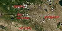
NASA satellite image of Altai Mountains in S. Siberia and N. Xinjiang. |
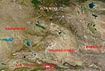
NASA satellite image showing area from W. Mongolia to E. Kazakhstan. |
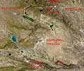
NASA satellite image of N. Xinjiang and adjoining regions. |
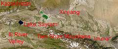
NASA satellite image of Tienshan Mtn. and Ili Valley region of Xinjiang, China. |
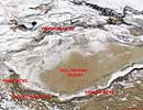
NASA satellite image taken in winter, showing snow cover in mountains around the Taklamakan Desert. |