|
Outer China is the huge area to the north and west of China Proper.
It ranges from 1,000 to 5,000 meters above sea level. The zone includes
part of Northeast China (also known as Manchuria), Xinjiang, Inner Mongolia, the Yunnan-Guizhou Plateau,
part of the Loess Plateau, and a stretch of mountains.
|
|
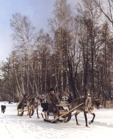
Among the domesticated animals in the Northeast are reindeer. |
|
Sleds pulled by
reindeer in Inner Mongolia
| SOURCE:
Zhongguo shaoshu minzu diqu huaji congkan zongbianji weiyuanhui,
ed., Zhongguo shaoshu minzu diqu huaji congkan, neimenggu
(Beijing: Minzu chubanshe, 1986), p. 106. |
|
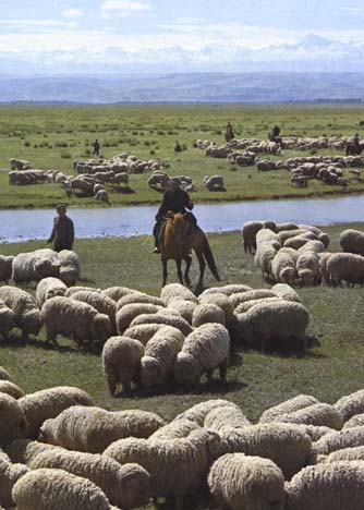
North of China Proper, the Inner Mongolian Plateau is a combination
of prairie, mountain, and desert, much of it suitable for raising sheep.
|
|
|
Sheep herding in Inner
Mongolia
| SOURCE:
Nongmuyu ye bu waishi si and Zhongguo nongxue hui, ed., Zhongguo
nongye (Beijing: Nongye chuban she, 1983), p. 146. |
|
|
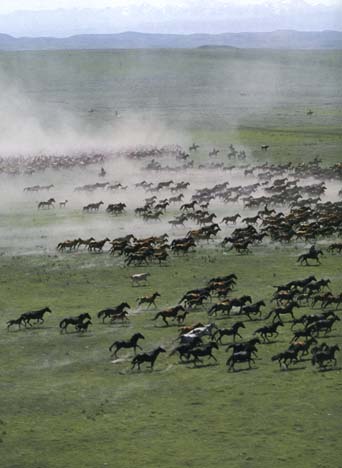
The Yili area of Xinjiang is famous for
its horses.
| MORE: In
contrast with the Mongol ponies, the Yili horses are of Arab
stock. During the Han dynasty (206BCE - 220CE), a tale
circulated of horses so high-spirited that they would sweat blood (in
reality, possibly caused by parasites), and it was for the
possession of these horses that the costliest military campaign in
the entire dynasty was waged. |
|
|
Group of horses in Yili Valley in Xinjiang
province
| SOURCE:
Zhongguo shaoshu minzu diqu huaji congkan zongbianji weiyuanhui,
ed., Zhongguo shaoshu minzu diqu huaji congkan, xinjiang
(Beijing: Minzu chubanshe, 1986), no page number available. |
|
|
Northwestern China has extremely dry weather, which is good for
growing such fruit as melons and grapes.
|
|
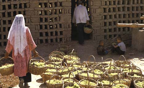 To the
right is a picture of ethnic Uighurs in Xinjiang province making
raisins. To the
right is a picture of ethnic Uighurs in Xinjiang province making
raisins.
|
|
Producing raisins in Xinjiang
province
|
| SOURCE:
Zhongguo shaoshu minzu diqu huaji congkan zongbianji
weiyuanhu, ed., Zhongguo shaoshu minzu diqu huaji congkan,
xinjiang (Beijing: Minzu chubanshe, 1986), no page number
available. |
|
|
|
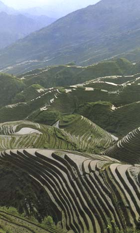
To the left is a picture of the Yunnan-Guizhou
Plateau in the southwest.
Considering the sharp elevation, why do you think people went to
such great effort to terrace the land?
| HINT:
Think of supply and demand. |
|
|
Terraced fields, south of China
|
SOURCE:
Nongmuyu ye bu waishi si and Zhongguo nongxue hui, ed., Zhongguo
nongye (Beijing: Nongye chuban she, 1983), p. 18.
|
|
|
|
 The
Tibetan Plateau in Southwest China occupies about one-fourth of the land
area of the PRC. It is composed of high and super-high mountains and
massive highlands, averaging between 4,000 and 5,000 meters (13,000 to
15,000 feet) above the sea level. The
Tibetan Plateau in Southwest China occupies about one-fourth of the land
area of the PRC. It is composed of high and super-high mountains and
massive highlands, averaging between 4,000 and 5,000 meters (13,000 to
15,000 feet) above the sea level.
|
|
The Tibetan Plateau as seen from a
satellite |
|
SOURCE:
Zhao Songqiao, Physical Geography of China (Beijing:
Science Press and New York: John Wiley & Sons, 1986),
illustration 1.
|
|
|
|
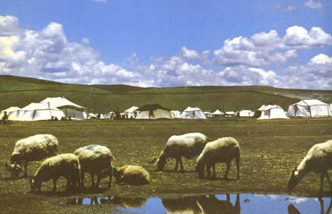 People
on the Tibetan Plateau live mostly in the river valleys. People
on the Tibetan Plateau live mostly in the river valleys.
In the summer, herders move their tents to new pastures.
|
|
Summer camps in Tibet
| SOURCE:
The Office of Research and Analysis Center, Security Department
of H. H. the Dalai Lama Gangchen Kyishong Dharamshala-176215,
ed., Tibet, An Enchanting Land (Kangra District, India:
the Office of Research and Analysis Center, Security Department
of H. H. the Dalai Lama Gangchen Kyishong Dharamshala-176215),
no page number available. |
|
|
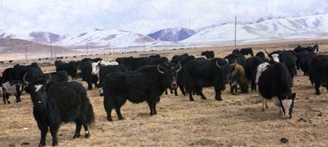
Yaks, depicted here, provide both milk used for butter and cheese and
wool used for felt.
|
|
Yaks in Tibet
| SOURCE:
Nongmuyu ye bu waishi si and Zhongguo nongxue hui, ed., Zhongguo
nongye (Beijing: Nongye chuban she, 1983), p. 38. |
|
|
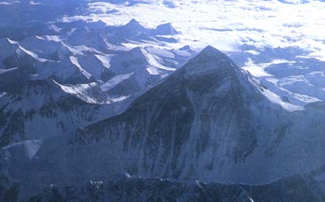
The highest point along the Tibetan Plateau, Mount Everest (known in
Chinese as Mount Zhumulangma) is also the highest mountain in the world.
It is located on the Sino-Nepalese border and rises 8,848 meters (29,028
feet) above sea level. |
|
|
|
The world's highest peak: Mt. Everest
|
|
SOURCE:
China Pictorial, ed.,
Across China (Beijing: China Pictorial Publishing
Company, 1985), p. 12.
|
|
|
|
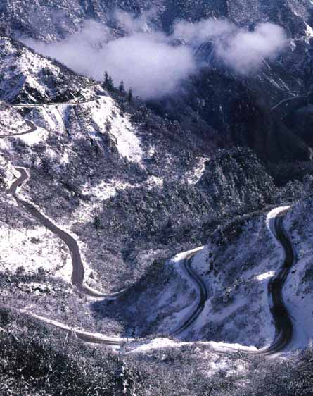
Called the "roof of the world," the Himalayan Mountains
along the Tibetan Plateau pose a great challenge to transportation and
communication.
Why would it be worth building highways like this to link Tibet to
the rest of China?
|
|
The highway
from Tibet to Sichuan Province
| SOURCE:
Zhongguo shaoshu minzu diqu huaji congkan zongbianji weiyuanhui,
ed., Zhongguo shaoshu minzu diqu huaji congkan, sichuan
(Beijing: Minzu chubanshe, 1986), no page number available. |
|
Move on to People |