Please see the main page of Race and Segregation maps 1920-2010. Here are two sets of historic maps. First a sequence by sociologist Calvin Schmid showing race distributions in 1920 and 1960. Below that is a set of rare maps by Paul Hatt showing the residences of racial groups and Jewish families in Central Seattle in 1939.
1920 and 1960 Seattle maps
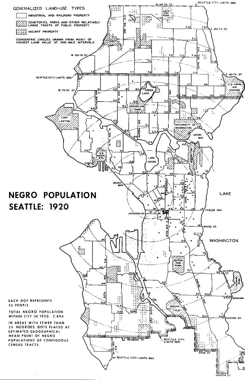
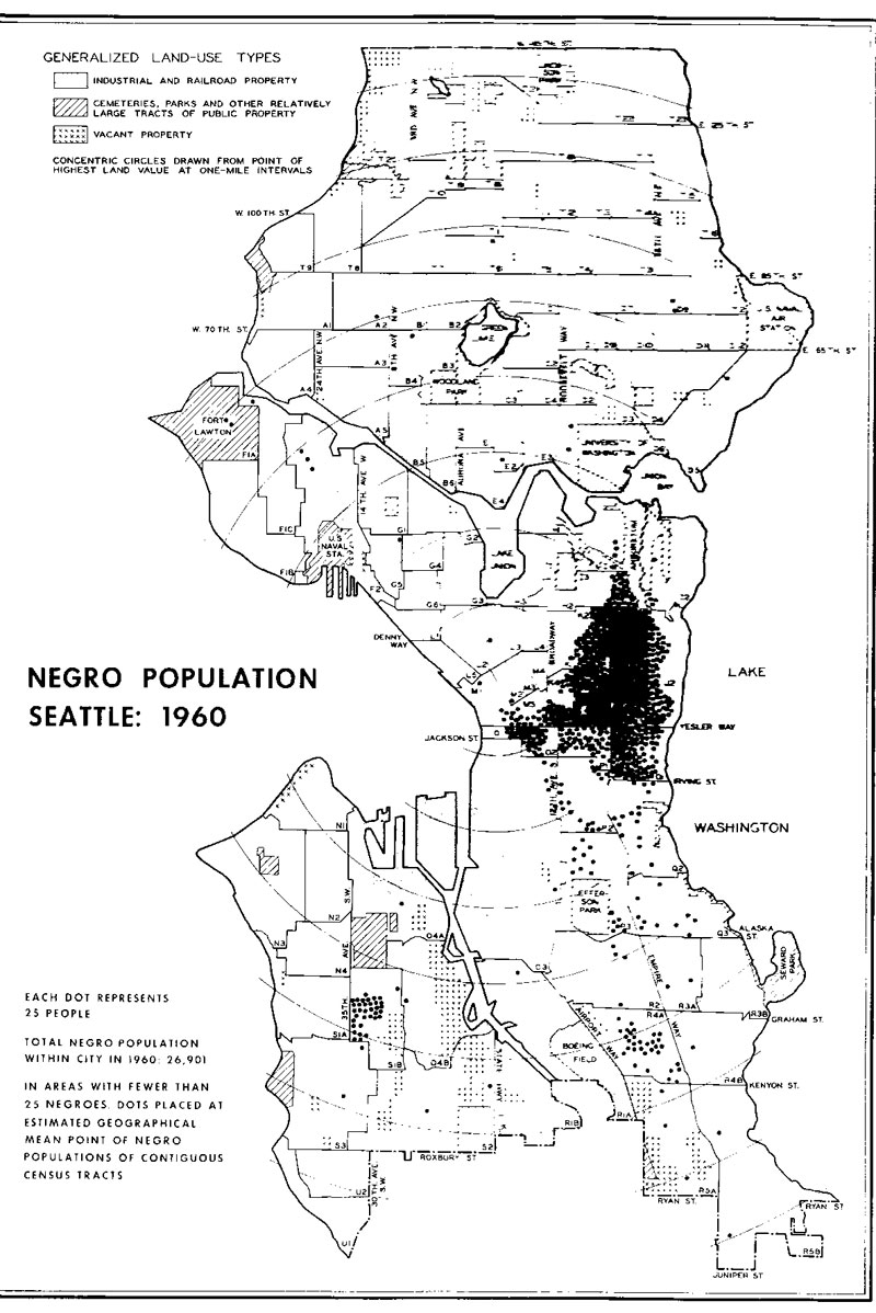
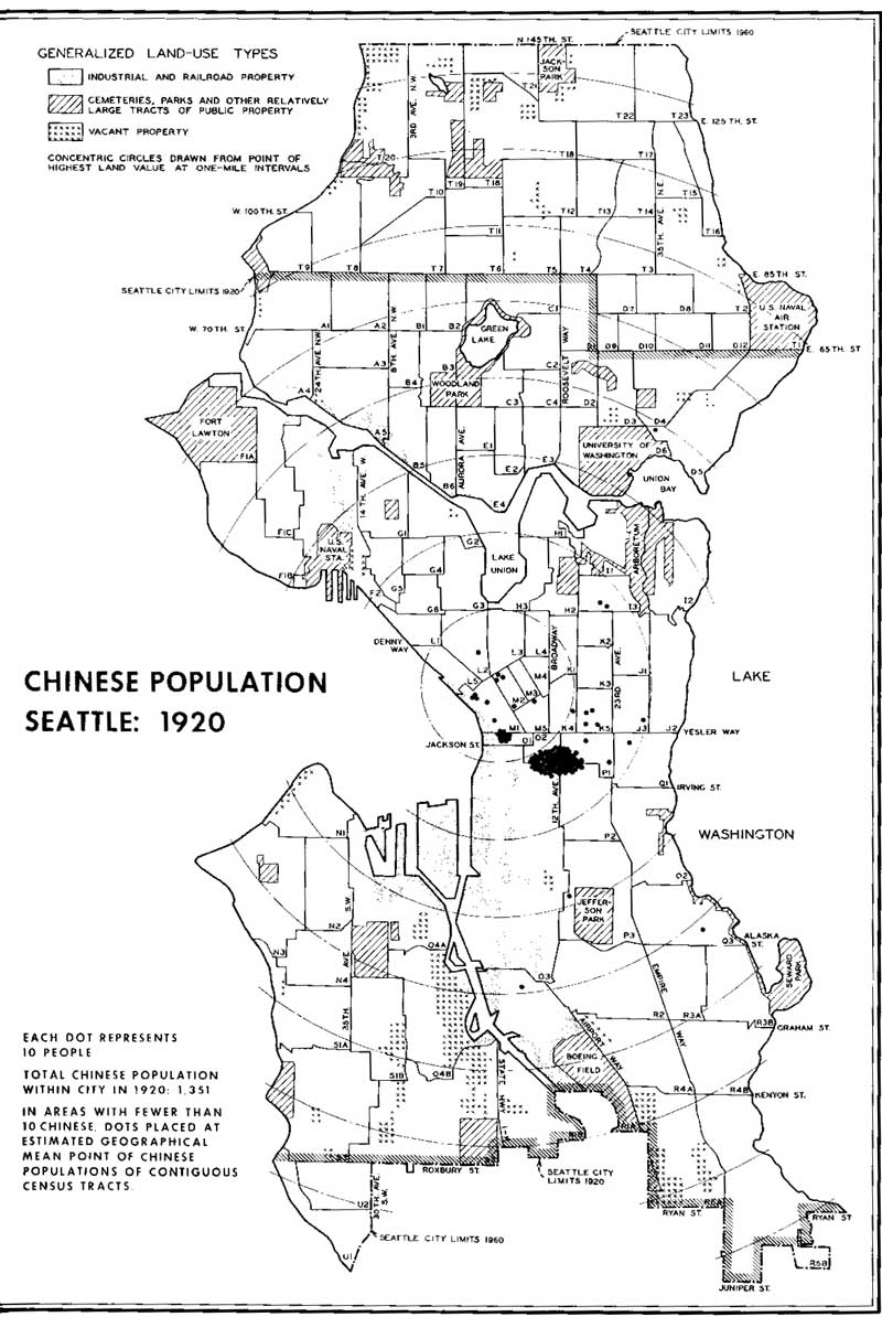
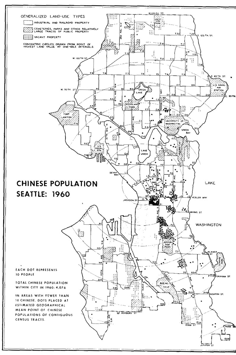
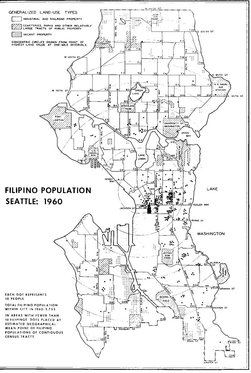
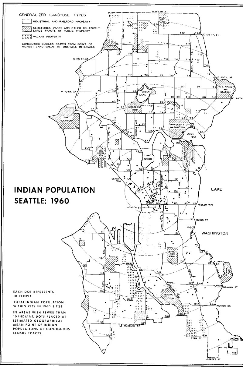
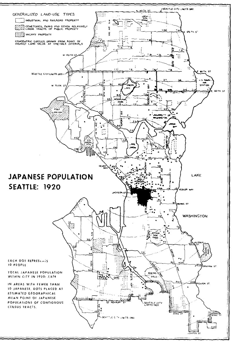
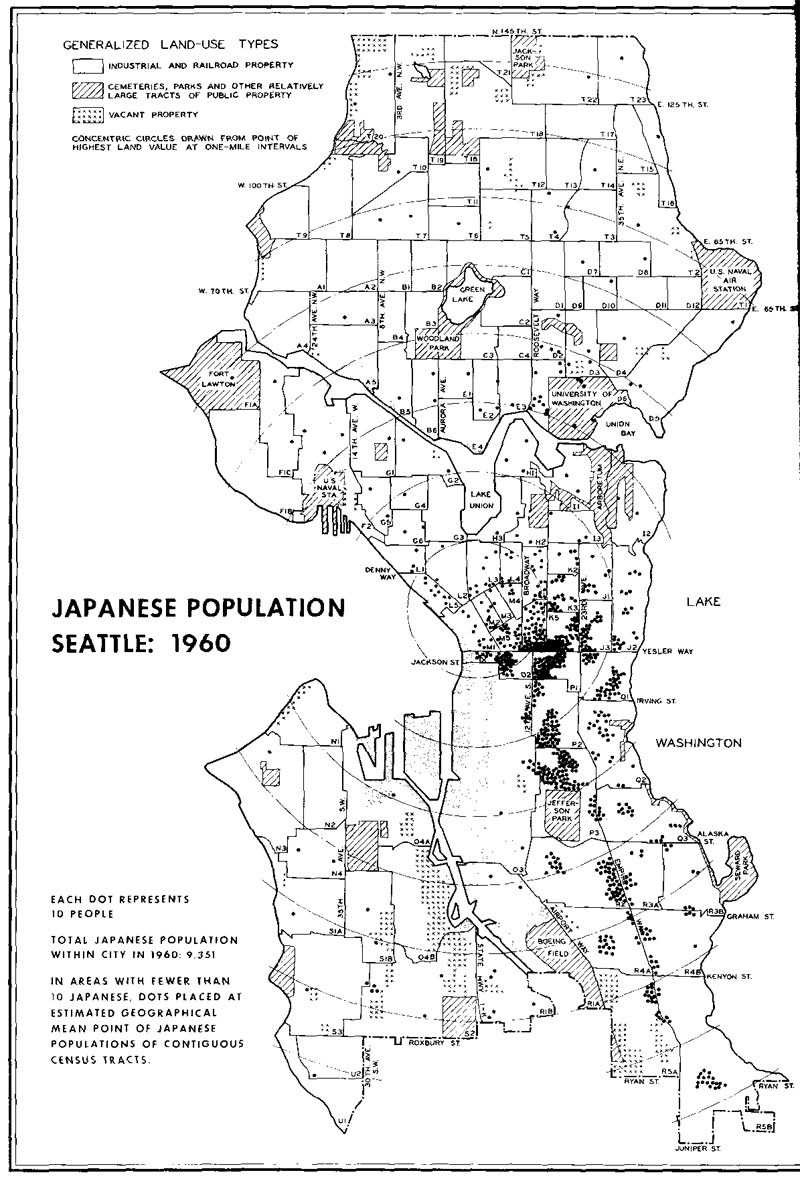
Here are maps of where Japanese Americans, African Americans, and Chinese Americans lived in 1920 and 1960 and where Native Americans and Filipino Americans lived in 1960. Click on the individual maps to see enlarged versions.
1920
1960
1939 Central Seattle maps
Sociologist Paul Hatt mapped the residential patterns of Seattle's minority communities in the downtown and central neighborhoods of Seattle using data collected in WPA Seattle Residential Survey. These detailed maps show each household and aare especially valuable for showing the concentration of Jewish families. Source: Paul Kichener Hatt, "A Study of Natural Areas in the Central Residential District of Seattle" (Ph.D. dissertation, University of Washington, 1945).

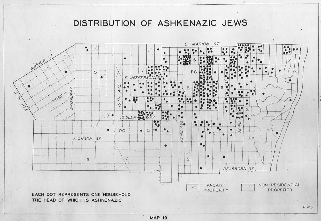

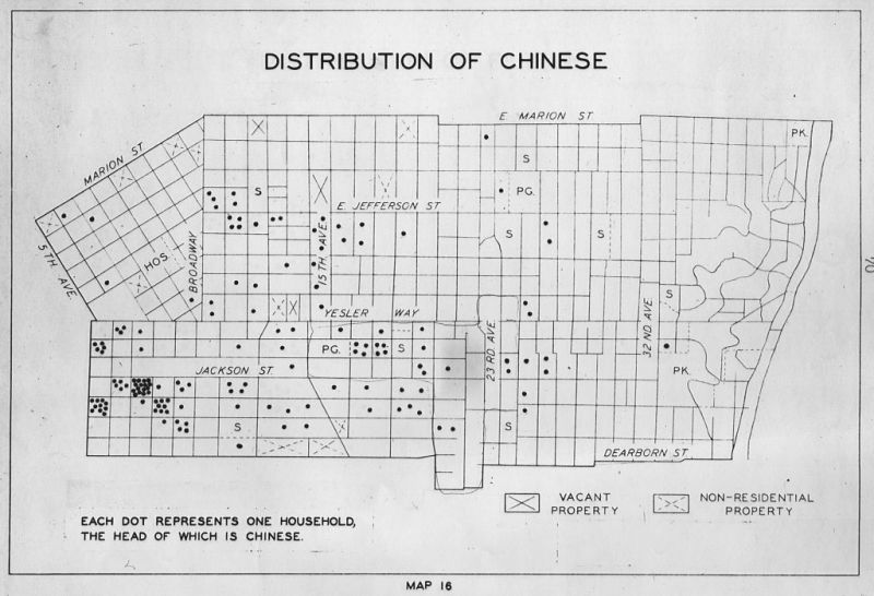
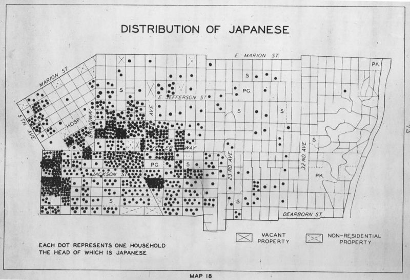
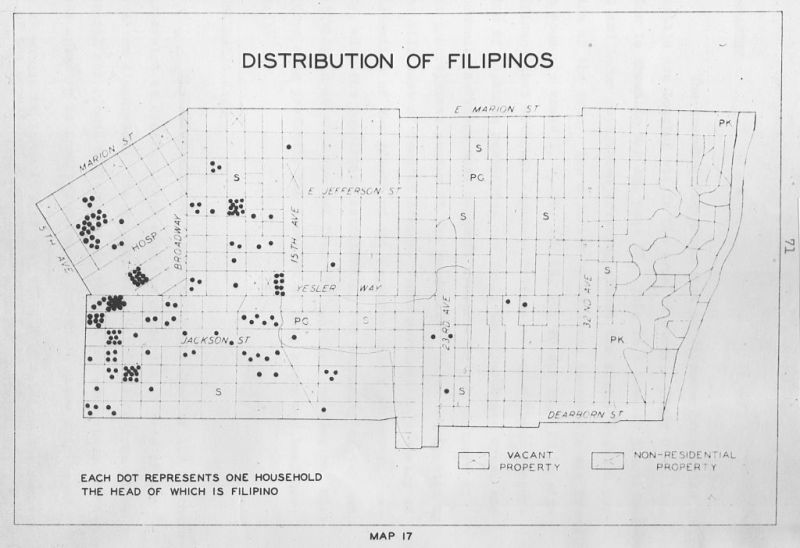
Sources: The 1920 and 1960 Seattle maps are from Calvin F. Schmid, Charles E. Nobbe, and Arlene E. Mitchell, Nonwhite Races, State of Washington (Olympia WA, 1968). The 1939 maps are from Paul Kichener Hatt, "A Study of Natural Areas in the Central Residential District of Seattle" (Ph.D. dissertation, University of Washington, 1945)