![]()
![]()
CTD Profile Plot Menu
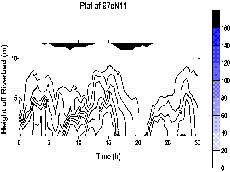
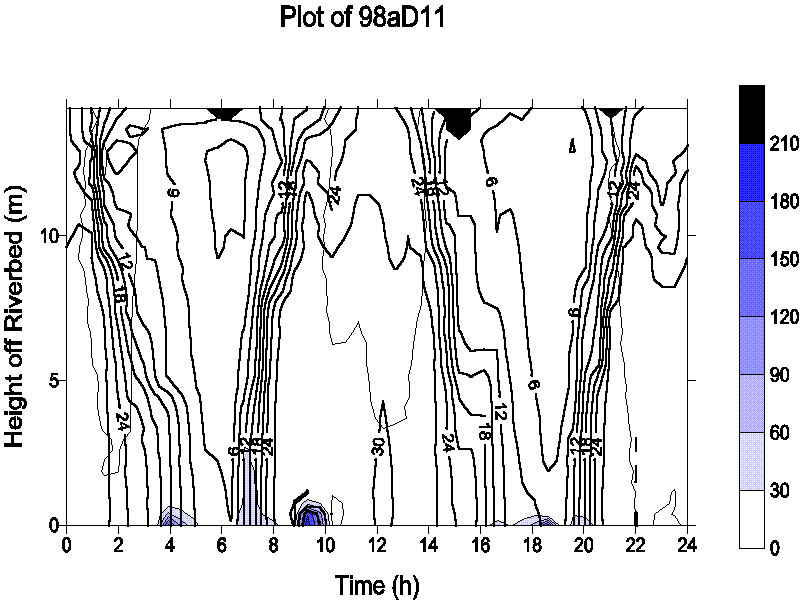
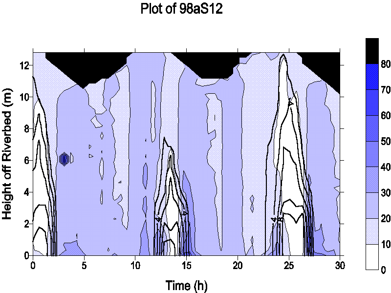
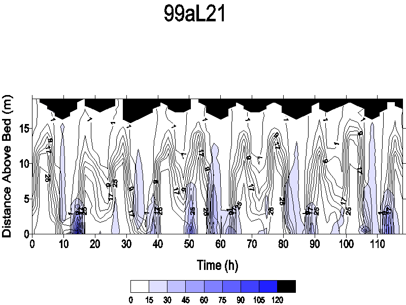
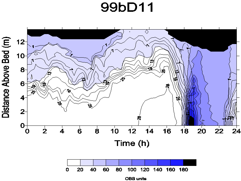
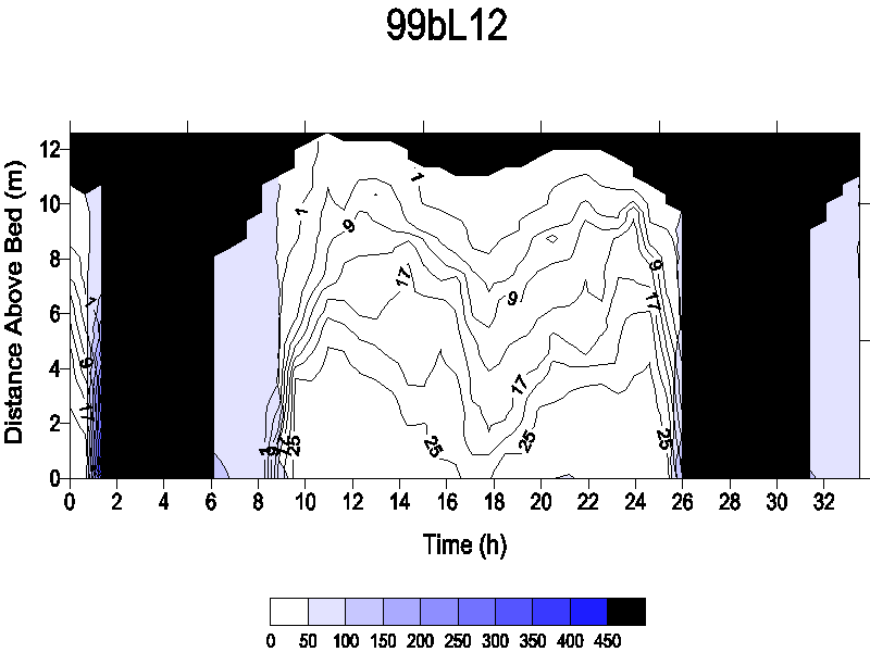
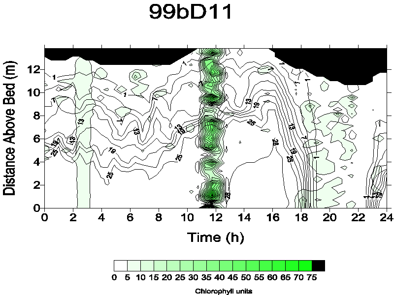
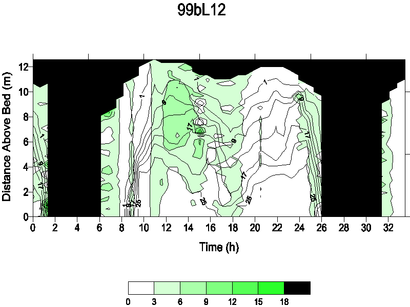
Select sampling series by year below. Heavy contour lines are labelled with salinity values while shading indicates measured OBS. Blacked out regions at the top of each plot represent areas of the plot above the water surface.
![]() Click on (D) to view the
raw data from that series profile.
Click on (D) to view the
raw data from that series profile.
1996: N11 and S11 from North Channel
1997a: North Channel station is S11; N11 and S12 from South Channel
1997b: North Channel stations are N11 and S11
1997c: North Channel stations are N12 and S11
1998a: North Channel stations are S11 and N11
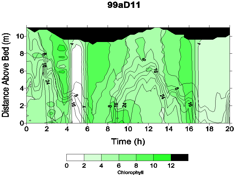
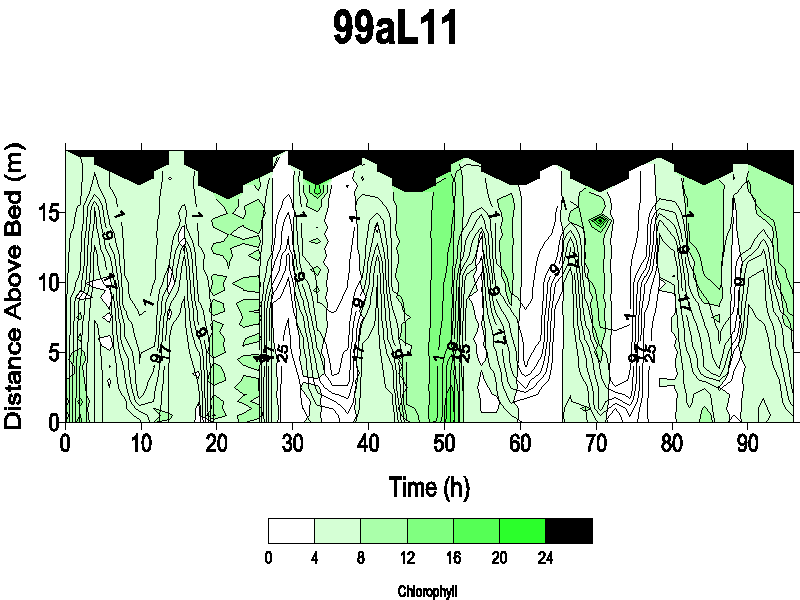
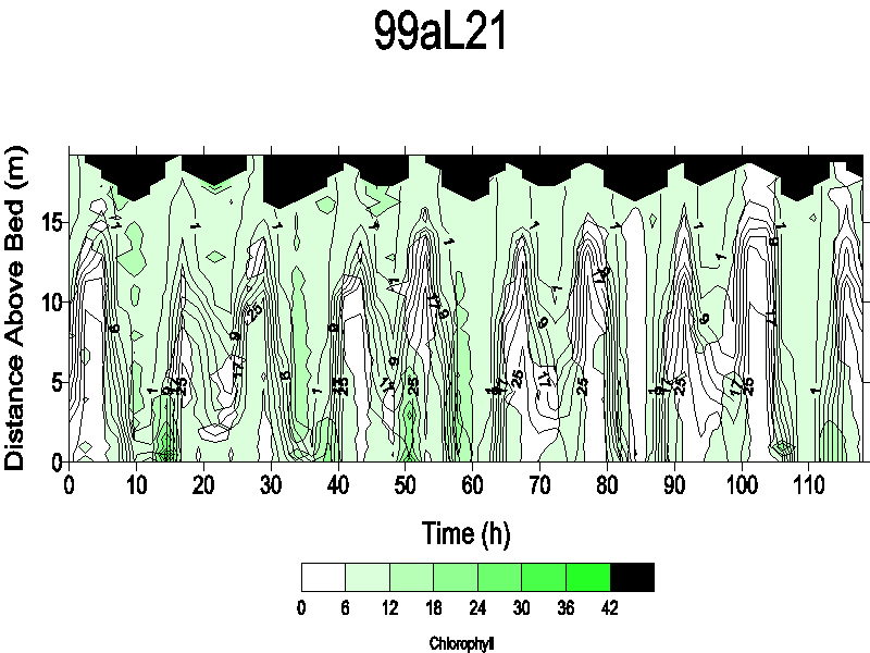
1999a: North Channel stations are L11 and L21
|
|
E11 | N11(D) | S11(D) | U11 | ||
|
|
D11(D) | E11 | E12 | E13 | F11 | F12 |
| N11(D) | S11(D) | S12(D) | U11 | U21 | ||
|
|
D11 | E11 | E21 | E22 | E24 | F11 |
| F12 | N11(D) | N12(D) | S11(D) | S12(D) | U11 | |
|
|
D11 | E11 | E12 | E13 | F11 | F12 |
| F13 | F14 | N11(D) | N12(D) | S11(D) | S12(D) | |
| U11 | ||||||
|
|
D11(D) | E11 | E12 | E13 | F11 | F12 |
| F13 | F14 | N11(D) | N12(D) | S11(D) | S12(D) | |
| U11 | ||||||
|
|
D11(D) | L11(D) | L21(D) | U11 | U21 | |
|
|
D11(D) | L11(D) | L21(D) | U11 | U21 | |
|
|
D11(D) | L11(D) | L12.1(D)* | L12.2(D)* | P11 | T |
| U11 | ||||||
|
|
D11(D) | L11(D) | L12(D) | P11 | T | U11 |
*1999bL12
series had OBS readings as high as 563. Plot L12.1 has an OBS
scale of 0 to 200, to capture more detail.
Plot L12.2 has an OBS scale from 0 to 450.
![]() Back to CRETM Home Page
Back to CRETM Home Page
![]()