Overview

3DFuels concept

3D fuel characterization for evaluating physics-based fire behavior, fire effects, and smoke models on US Department of Defense military lands (SERDP Project RC19-C1-1064)

The 3D fuels project is funded by the US Department of Defense Strategic and Environmental Research and Development Program to develop 3D fuels inputs for next-generation fire and smoke modeling. Our research team is collaborating with multiple organizations, including the US Department of Defense, Florida State Forest Service, University of Montana, The Center for Lands Management, and Washington State Department of Fish and Wildlife, to establish demonstration sites and collect integrated datasets of 3D fuels clip plots, terrestrial laser scanning (TLS), and airborne laser scanning (ALS). Plans are underway to continue 3D fuel characterization on pine-dominated sites in the western and SE United States and western grasslands that are representative of fuels commonly characterized for prescribed burning on US Department of Defense lands. Through this initiative, a library of tools and datasets are being developed to leverage multi-scaled estimates of 3D fuels tied with intrinsic fuel properties that can be used directly with the QUIC-Fire modeling initiative. Through these data, fire and fuel managers will be able to:

  1. Evaluate the effectiveness of fuels and thinning treatments as a result of not only alteration of surface and canopy fuels but changes in the effect of wind flow on wildland fire behavior.
  2. Inform the expansion of prescription margins for planning and executing prescribed burning and managed wildfires.
  3. Compare spatially-explicit fire radiative energy outputs with resolved fuel combustion and atmospheric interaction to improve models of smoke production and dispersion.

Rapid advances in remote sensing technology and wildland fire modeling are promoting innovations in fuels mapping and operational CFD models of wildland fire behavior and smoke. In the near future, these models will provide near real-time prediction of fire behavior and smoke based on 3D fuel characterization. Before these models can be widely used, more work is needed on fuel characterization and mapping methods to support model inputs. The 3D fuels project uses an innovative, hierarchical sampling framework to create building blocks and methods for next-generation fire and smoke modeling.
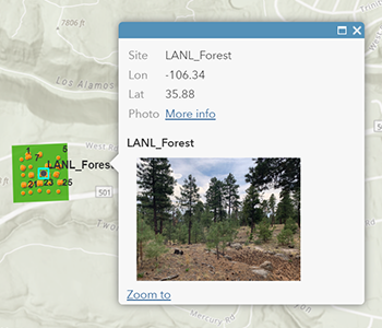
 

Project Team

Susan Prichard, project lead

University of Washington
School of Environmental and Forest Sciences
Fire ecologist

Roger Ottmar, PI

USFS Pacific Northwest Research Station
Fire and fuels specialist, federal PI

Jonathan Batchelor, PhC

University of Washington
School of Environmental and Forest Sciences
Remote Sensing and Geospatial Analysis Laboratory
Lidar and UAS

Michelle Bester, PhD

West Virginia University
Quantitative structural modeling of southern shrub fuels

Ben Bright, geospatial data manager

USFS Rocky Mountain Research Station
Geospatial data manager

Gina Cova, PhC

University of Washington
School of Environmental and Forest Sciences
Close-range photogrammetry

Jim Cronan, Co-I, field supervisor

USFS Pacific Northwest Research Station
Fire and fuels specialist

Brian Drye, software engineer

University of Washington
School of Environmental and Forest Sciences
3D fuels modeling

Paige Eagle, data manager

University of Washington
School of Environmental and Forest Sciences
3D fuels data manager

Andrew Hudak, Co-I

USFS Rocky Mountain Research Station
Specialist in 3D fuel characterization and remote sensing technologies

Maureen Kennedy, modeler

University of Washington, Tacoma
Quantitative Structural Modeling

E. Louise Loudermilk, research ecologist

USFS Southern Research Station
3D fuels sampling and analysis

Deborah Nemens, field manager and data analyst

University of Washington
School of Environmental and Forest Sciences
Fire and fuels specialist, field manager and data analyst

Russ Parsons, Co-I

USFS Rocky Mountain Research Station
3D fuel modeling and model sensitivity analysis

Eric Rowell, Co-I

Tall Timbers Research Station
Specialist in 3D fuel characterization and modeling

Carl Seielstadt, image collection

University of Montana
National Center for Landscape Fire Analysis
UAS-based photogrammetry

Carlos Silva, modeler

University of Florida
3D canopy fuel modeling

Nick Skowronski, Co-I

USFS Northern Research Station
Specialist in 3D fuel characterization and experimental burns

Study Details

▪ Study Areas

We are sampling 3D fuelbeds for regional fuel types in the southeastern (SE) and western US Explore interactive map of study sites with plot pictures (ArcGIS website).
that are most commonly burned within prescribed burning programs on U.S. Department of Defense and Department of Energy installations.

Sites by category are as follows:

  1. SE longleaf pine (mesic flatwood) understories (4 sites)
    3DFuels SE Flatwoods Understory
  2. SE loblolly pine-sweetgum forest understories (4 sites)
    3DFuels SE Loblolly Sweetgum Forests
  3. Western grasslands and grass-dominated pine savannas (4 sites)
    3DFuels Western Grasslands
  4. Western ponderosa pine forest understories (4 sites)
    3DFuels Western Ponderosa Pine
  5. Additional 3D Fuels sites

In this project, we are focused on some of the most commonly burned fuel types on DoD lands. We intentionally selected geographically distinct vegetation that has similar structures (e.g., southern pine and ponderosa pine forest understories). Through sampling of parallel fuel structures, we will evaluate how the process of 3D fuel characterization at the voxel level can be applied to structurally similar vegetation and fuels and customized to the fuel properties that may vary by species (e.g., S:V, bulk density) and fuel conditions that vary by geographic region and day-of-burn conditions (e.g., fuel moisture).

Southeast vs. West

▪ Hierarchical Sampling Design

Our hierarchical sampling design incorporates lidar, photogrammetry and field-based measurements to characterize canopy and surface fuels at each study site. Recent ALS data are a selection requirement for each site. Paired TLS scans and SfM imagery (where UAS is permitted) are used to cover a 200 x 200 m area. Ground-based destructive sampling is used to calibrate the 3D point clouds with sampled occupied volume and bulk density of understory fuels.

Coarse wood and stumps are not adequately sampled by either 5x5 m plot scans or destructive plots. We plan to use synoptic TLS and SfM scans to survey coarse wood and will use a combination of measured and published bulk density values to estimate the biomass of these fuels.

Hierarchical sampling design
3DFuels field sampling

▪ Field Sampling

Samples from all consumable fractions of live and dead fuels are collected in 3D sample plots and analyzed in the laboratory to build a library of surface fuel properties including bulk density by vegetation and fuel type. For shrub and tree species with complex architecture, foliage and branch samples are collected and individually scanned with TLS, facilitating 3D modelling of shrubs, trees and other plants as coherent geometric structures. The 3D sample plot dimensions are 0.5 m on each side in x and y, and 1-2 m in z., segmented into 10-cm vertical strata. For more details, please see: Hawley et al. (2018).

Voxel sampling of a forest understory plot at the Sycan Forest site (south central Oregon):

Voxel Survey using 3D frame

Voxel Survey using 3D frame

Clipping vegetation for biomass measurement

Clipping vegetation for biomass measurement

Voxel Sampling Frame

Voxel Sampling Frame

TLS

Eric Rowell and Michelle Bester conducting terrestrial lidar scanning at Lubrecht Experimental Forest, MT

Field crew in FL

Susan Prichard, Lyndsay Lascheck, Jesse Thoreson and Nick Tripodi field sampling at Tates Hell State Forest, FL

Drone scanning

Jonathan Batchelor collecting drone-based photogrammetry scans at Tenalquot Prairie, Center for Natural Lands Management, WA

▪ Intrinsic Fuel Properties Library

A fuel properties database and online library is being developed to house published and measured values for fuels at the object (e.g., shrub or litter layers) and element (e.g., grass blades or pine needles) scales. Values will be used to parameterize fields in 3D fuel models with computational inputs to computational fluid dynamics (CFD) models that cannot be measured remotely. We also will develop quantitative models that relate remotely sensed attributes with fuel properties.

Fuel property Unit Definition
Ash fraction Proportion Fraction of completely consumed fuel that is ash, reflecting mineral content
Bulk Density g/cm3 Mass per volume of vegetation or fuel, including interstitial air space (e.g., bulk density of in-situ litter or duff) (g/cm3)
Char fraction Proportion Remaining mass of a fuel particle after incomplete combustion (black ash)
Fuel moisture content Percent Fuel moisture content (%) expressed as the percentage of fuel that is water, measured by taking the gross weight minus the dry weight of fuel
Heat of combustion MJ/kg The amount of heat released from a known mass of a substance during combustion
Packing ratio Proportion The fraction of a known volume occupied by fuel particles -- calculated as the bulk density divided by the particle density
Particle density Mg/mm3 Mass per volume of fuel element (leaf, fine branch, stem) (mg/mm3)
Specific heat kJ/g The amount of heat (kJ) required to raise the temperature of the mass of a given substance by unit temperature (C°)
Surface Area to Volume Ratio (S:V) cm2/cm3 Ratio of surface area to volume (cm2/cm3)

▪ Object-based Fuel Characterization

Fuel can be distilled down to individual objects that comprise elements within a fuelbed. Individually, these objects each occupy a specific volume and often have different fuel properties, such as bulk density, varying with fuel type. In physics-based computational fluid dynamics (CFD) models such as FIRETEC (https://www.frames.gov/firetec/home) and WFDS (https://www.fs.usda.gov/pnw/projects/wildland-urban-interface-fire-dynamics-simulator-wfds), objects are often aggregated to represent total fuels and bulk density for a discrete volume (e.g. voxel grid cell).

Hi-res simulations

We are using multiple approaches for object-based fuels characterization:

  1. High-resolution simulations, in which individual fuel vegetation types (e.g. grasses, leaf litter, coarse woody debris) or objects will be described as three dimensional meshes that have a specific surface area and fuel mass that can be predicted as a function of unit mass per unit of surface area (g/cm2). These simulations can be assembled into mixed representative fuelbeds and distilled to estimate bulk density and mass per unit volume (g/cm3).
  2. Quantitative structural modeling (QSM) is an analytical technique that distills point clouds with mathematical models that systematically and iteratively filter and fit various shapes to the objects present in a point cloud, thereby accounting for the incomplete nature of LiDAR scans due to occlusion and point densities.
  3. QSM
  4. The third method is segmentation and classification of surface and canopy fuel strata using combinations of point cloud metrics and UAS digital imagery. Point cloud objects and fuels characterization uses a new prototype algorithm to separate points into four fundamental categories and assignment of mass and volume.
 

Wildland Fire Management Applications

Our 3D fuels datasets and modeling steps will be used to generate inputs to CFD models and 3D fuel characterization. These will be used to develop new operational models of fire behavior, smoke and other fire effects. A key advantage of our 3D fuel modeling approach is that voxel fuels are treated as scalable building blocks and the process of partitioning point cloud data into voxel fuel inputs can be widely applied to other fuel types and complexes.

Members of the 3D Fuels team were recently awarded funding from the US Department of Defense ESTCP for a 3-year project to transition our 3D fuels datasets to an online understory and canopy mapping tool called FuelsCraft.

Scalable building blocks

With advancements in remote sensing technologies and modeling platforms comes the opportunity to transform the questions and analyses that can be done in support of wildland fire management. The following are a list of topics that can be addressed with the support of 3D fuel characterization and next-generation fire and smoke modeling:

  1. Fuel treatment effectiveness research with high-resolution simulations of fire spread, heat release and duration, and smoke production.
    • Improved modeling will advance a managers ability to explore treatment strategies including managed fuel breaks, prescribed fire lighting patterns and how treatments might be optimized for suppression tactics during wildfire events.
    • Smoke impacts to communities from prescribed fire and wildfire events can be integrated with fire behavior modeling and fuel treatment decision support.
    • With integrated fire and smoke modeling that use the same inputs, smoke feedbacks to fire behavior also can be considered in wildland fire management decisions.
  2. Near real-time CFD modeling will greatly expand support to wildland firefighting operations including:
    • Improved fire behavior prediction with existing 3D maps of fuels from available imagery (Google Earth, ALS), topography and gridded wind/weather scenarios.
    • Evaluation of direct and indirect suppression operations and optimization of resources.
    • Through much more reliable fire behavior predictions, inform land managers with expanded opportunities to manage unplanned ignitions for resource benefit.
  3. Carbon storage and flux analysis. High-resolution, 3D maps of canopy and surface fuels provide a baseline for wildland fire events and change analyses using pre and post-fire imagery.
 

Team Publications

Batchelor, J., Rowell, E., Prichard, S., Nemans, D., Cronan, J., and Moskal, L.M. In review. Quantifying vegetation moisture levels with terrestrial lidar scanning. Remote Sensing.

Bester, M.S., Maxwell, A.E., Gallagher, M.R., Skowronski, N.S. and McNeil, B.E. In prep. Synthetic Forest Stands and Point Clouds for Model Selection and Feature Space Comparison. Remote Sensing.

Bester, M.S., McNeil, B.E. and Skowronski, N.S. In review. Lidar-Based Quantitative Structure Modeling Of Architecturally Different Shrubs. Ecological Modeling.

Bester, M.S., McNeil, B.E., Skowronski, N.S., and Prichard, S.J. In prep. Linking LiDAR-Measured Architectural Traits to Flammability of Understory Shrubs. In prep. Methods in Ecology and Evolution

Cova, G., Prichard, S.J., Rowell, E., Kane, V. In prep. Evaluating close-range photogrammetry for 3D understory fuel characterization. Canadian Journal of Remote Sensing.

Hawley, C.M., Loudermilk, E.L., Rowell, E.M. and Pokswinski, S. 2018. A novel approach to fuel biomass sampling for 3D fuel characterization. MethodsX 5: 1597-1604.https://doi.org/10.1016/j.mex.2018.11.006

Hudak, A.T., Kato, A., Bright, B.C., Loudermilk, E.L., Hawley, C., Restaino, J.C., Ottmar, R.D., Prata, G.A., Cabo, C., Prichard, S.J., Rowell, E.M. and Weise, D.R. 2020. Towards spatially explicit quantification of pre- and postfire fuels and fuel consumption from traditional and point cloud measurements. Forest Science fxz085, https://doi.org/10.1093/forsci/fxz085.

Kleydson, D.R., Silva, C.A., Consenza, D.N., Mohan, M., Klauberg, C., Schlickmann, M.B., Xia, J., Leite, R.V., Almeida, D., Atkis, J.W., Cardil, A., Rowell, E., Parsons, R., Sanchez-Lopez, N., Prichard, S.J., and Hudak, A.T. 2023. Crown-level structure and fuel load characterization from airborne and terrestrial laser scanning in a longleaf pine (Pinus palustris Mill.) forest ecosystem. Remote Sensing. 15(4): 1002. https://doi.org/10.3390/rs15041002

Prichard, S.J., Keane, R., Loudermilk, E., Rowell,  Chappell, L, Hall, J. Hornsby, B., Hudak, A., Loudermilk, L., Lutes, D., Ottmar, R. and Rowell, E. 2022. Fuels and Consumption Chapter. National Smoke Science Assessment, USFS Washington Office.

Prichard, S., Ottmar, R., Hudak, A., Kennedy, M., Parsons, R., Rowell, E., Silva, C., Skowronski, N., Batchelor, J., Bester, M., and Cova, G. 2020. 3D Fuels Work Plan. SERDP Project RC19_C1_1064

Rowell, E. 2019. Influence of fuel heterogeneity and a novel fuel rendering technique on fire spread predictions. US Department of Defense SERDP program research project, RC-19-1170.

Rowell, E., Loudermilk, E.L., Hawley, C., Pokswinski, S., Seiestad, C., Queen, L., O’Brien, J.J., Hudak, A.T., Goodrick, S. and Hiers, J.K. 2020. Coupling terrestrial laser scanning with 3D fuel biomass sampling for advancing wildland fuels characterization. Forest Ecology and Management 462: 117945. https://doi.org/10.1016/j.foreco.2020.117945
[PDF]

Rowell, E., Prichard, S.J., M. Bester, J. Cronan, B. Drye, E.L. Loudermilk, D. Nemens, and N. Skowronski. In prep. Characterizing understory fuel structure and biomass in pine-dominated forests using coupled terrestrial lidar scanning and field sampling. International Journal of Wildland Fire.

Rowell, E., Prichard, S, Varner, J.M., and Shearman, S.J. 2022. Chapter 6: Re-envisioning fire and vegetation feedbacks. Wildland Fire Dynamics: Fire Effects and Behavior from a Fluid Dynamics Perspective. Cambridge University Press.


Website design adapted from a templated.co template.

Osceola TatesHellA TatesHellB Aucilla Sycan-G LANL-G Tenalquot Glacial Sycan-F LANL-F Methow Lubrecht Blackwater Pebble Hill Fort Stewart