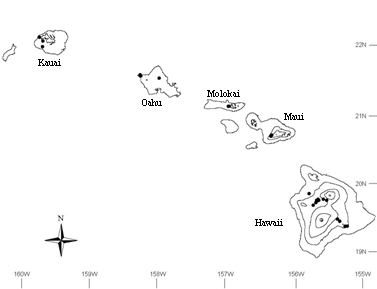
Figure 1-Approximate sampling locations in Hawaiian Islands.
Wright, Clinton S.; Ottmar, Roger D.; Vihnanek, Robert E.; Weise, David R. 2002. Stereo photo series for quantifying natural fuels: grassland, shrubland, woodland, and forest types in Hawaii. Gen. Tech. Rep. PNW-GTR-545. Portland, OR: U.S. Department of Agriculture, Forest Service, Pacific Northwest Research Station. 91 p.
Single and stereo photographs display a range of natural conditions and fuel loadings in grassland, shrubland, woodland, and forest types in Hawaii. Each group of photos includes inventory information summarizing vegetation composition, structure, and loading, and as appropriate, woody material loading and various site characteristics. The natural fuels photo series is designed to help land managers appraise fuel and vegetation conditions in natural settings.
Keywords: Hawaii, biomass, fuel loading, natural fuels, Metrosideros polymorpha, ohia, Dodonaea viscosa, a'ali'i, Styphelia tameiameiae, pukiawe, Eragrostis atropioides, hardstem lovegrass, Pennisetum setaceum, crimson fountain grass, Urochloa maxima, guineagrass, Melinis minutiflora, molassesgrass, Casuarina equisetifolia, beach sheoak; Pinus elliottii, slash pine; Pinus radiata, Monterey pine; Pinus pinaster, maritime pine; Eucalyptus globulus, Tasmanian bluegum.
COOPERATORS
This publication was developed by the USDA Forest Service, Pacific Northwest
Research Station, Fire and Environmental Research Applications Team, in cooperation with
the Department of Defense, Pohakuloa and Makua Training Areas; the State of Hawaii,
Department of Natural Resources, Division of Forestry and Wildlife; the National Park
Service, Hawaii Volcanoes National Park; and the USDA Forest Service, Pacific Southwest
Research Station.
ACKNOWLEDGMENTS
Special recognition is due Rhonda Loh, Allison Ainsworth, Chris Dunham, Bryan
Cornelius, and Jack Minassian, Hawaii Volcanoes National Park; Wayne Ching, Patrick
Costales, Alvin Kyono, Glen Shishido, and Steve Evans, State of Hawaii; Andy Beavers, Ron
Borne, and Paul Malispina, Center for Ecological Management of Military Lands, Colorado
State University; and Gayland Enriques, Department of Defense. David Wright, Jennifer
McCormick, Sonya Schaller, Elizabeth Barker, Anny Schmidt, and Shelaine Curd, USDA Forest
Service, Pacific Northwest Research Station, performed the field work.
Partial funding for this project was provided by U.S. Army Garrison, Schofield Barracks, Hawaii - USAG HI DRM MIPR-9JFOREV035.
AUTHORS
Clinton S. Wright and Roger D. Ottmar are research foresters, and Robert
E. Vihnanek is a supervisory forester, Pacific Northwest Research Station, Pacific
Wildland Fire Sciences Laboratory, 400 North 34th Street, Suite 201, Seattle, Washington
98103. David R. Weise is a supervisory research
forester, Pacific Southwest Research Station, Riverside Forest Fire Laboratory, 4955
Canyon Crest Drive, Riverside, CA 92507.
INTRODUCTION
In Hawaii, the protection and preservation of populations of rare, threatened, and endangered plant species, and unique plant communities is a primary concern. The impact of human settlement on the native flora and fauna that developed in Hawaii, the most isolated land mass on the planet, have been documented previously (Loope 2000). Recent increased human occupation and the introduction of non-native grasses is widely believed to have increased the occurrence and size of wildland fire (D'Antonio and Vitousek 1992). Many areas previously occupied with agricultural crops such as sugarcane and pineapple have been abandoned and are now occupied by non-native grasses and shrubs. With the exception of Nihau, every major island now has a significant wildland-urban interface. Thus, the land area of the Hawaiian Islands is a matrix of native and non-native vegetation and ecosystem types.
A large percentage of the land area of the Hawaiian Islands has historically been, and is currently, managed by various branches of the United States military, the National Park Service, and the State of Hawaii. This places the Departments of Defense and the Interior and the State of Hawaii in the role of stewards of extensive, undeveloped tracts of land containing an abundance of endemic species and unique plant communities. However, many nonnative species are thriving in Hawaii after having been intentionally or unintentionally introduced. To effectively manage these lands requires a more comprehensive accounting of current conditions. Such an accounting can be accomplished by using a combination of remote sensing and ground-based inventory. A photo series is a land management tool that can be used on the ground to quickly and inexpensively inventory and evaluate living and dead biomass in a variety of ecosystem types. Efficient ground-based inventory techniques allow for verification of remotely sensed data. With sufficient information, land managers can more effectively plan and implement treatments (e.g., prescribed fire, vegetation management, harvesting, noxious weed control, etc.), and wildfire fighting and prevention activities while minimizing negative impacts on valued resources.
Mapping and description of the vegetation of Hawaii has been limited in scope. Detailed description of the vegetation of upland native forest and woodland communities on Hawaii and Maui occurred as part of an effort to map habitat for endangered Hawaiian birds (Jacobi 1990). The NOAA Coastal Change Analysis Program produced a statewide vegetation map, but the vegetation is classified into 22 broad groups (e.g., grassland, deciduous forest, shrub/scrub, and tundra). Other current mapping and vegetation description efforts include the USGS Geographical Approach to Planning for Biological Diversity (GAP) program. The anticipated completion date of GAP analysis for Hawaii is in 2004. Various methods of describing the plant communities in the Hawaiian Islands also have been developed (see, for example, Buck and Paysen 1984, Gagn� and Cuddihy 1990, and Jacobi 1990).
Although much effort has been devoted to various mapping and classification systems, much of the area of the major islands was not included because of the focus on native ecosystems. Description of Hawaiian vegetation as a fuel bed is virtually nonexistent. Several geographically limited studies have measured fuels in selected areas or fuel types. Fuel loading for some grasses is available (Blackmore and Vitousek 2000, Freifelder et al. 1998, Fujioka and Fujii 1980). Additional information from other photo series and biomass information from forest inventories might be used to estimate fuel loadings in the exotic forest plantations in Hawaii (Buck et al. 1986; Ottmar et al. 2000c; Ottmar and Vihnanek 2000; Wade et al. 1993; Williams 1976, 1978). Measurement of other fuel properties such as surface area to volume ratio, bulk density, and depth is virtually nonexistent (Fujioka and Fujii 1980).
This photo series represents the first time that a wide range of vegetation types in the Hawaiian Islands have been measured and described as wildland fuels. Photo series in this format in natural fuels have been completed in a variety of grassland, shrubland, woodland, and forest ecosystem types in the continental United States (Ottmar et al. 1998, 2000a, 2000b; Ottmar and Vihnanek 1998, 1999, 2000) and for cerrado (savanna) ecosystem types in central Brazil (Ottmar et al. 2001). The three-dimensional image obtained by viewing the photographs with a stereoscope will improve the user's ability to appraise fuel, vegetation, and stand structure conditions.
STUDY AREAS
We photographed and sampled a series of sites located on public lands (fig. 1), on the islands of Hawaii (23 sites), Oahu (5 sites), Maui (3 sites), Kauai (3 sites), and Molokai (2 sites). Of the 36 sites sampled, 12 were located within the boundaries of Department of Defense training areas, 12 were located on Department of the Interior lands, and 12 were located on lands administered by the State of Hawaii.
Figure 1-Approximate sampling locations in Hawaiian Islands. |
One-third of the sampling was conducted at military training areas on Oahu and Hawaii. Two relatively low-elevation sites were chosen at the Makua Military Reservation (MMR) to represent the Urochloa maxima (guineagrass) communities found on Oahu. The MMR is a 4,856-acre live-fire and impact training area that has been used for military maneuvers since 1943, and is located on the western side of Oahu. Ten sites were chosen at the Pohakuloa Training Area (PTA) to represent a range of grass, shrub, and woodland communities found on Hawaii. The PTA is the largest training area in Hawaii covering 108,863 acres in the saddle between Mauna Loa, Mauna Kea, and Hualalai; sample site elevations ranged from 5,000 to 6,700 feet. The PTA has been used by the military since 1942; almost half of PTA is used as a live-ammunition impact area. The PTA is covered by recent (less than 200 years old) lava flows from Mauna Loa, as well as prehistoric flows from Mauna Loa and Mauna Kea on which soils are more highly developed, providing unique site conditions and habitats (Shaw and Castillo 1997). Of the 10 sites sampled at PTA, 3 were primarily grass types (1 native, 2 exotic), 4 were primarily shrub types, 2 were woodland types, and 1 was a woodland type with a dense shrub component. Both MMR and PTA have been used extensively by the military since World War II for training activities and have been chronically disturbed in many areas.
To broaden the range of environmental and botanical conditions represented in this photo series, we also sampled 12 sites in Hawaii Volcanoes National Park (HVNP). Of the 12 sites sampled in HVNP, 6 were dominated by various grass species, 1 was a shrubland type, 2 were woodland types, 2 were forest types, and 1 was on a recent lava flow. The HVNP, located on the southern side of the island of Hawaii on the flanks of Kilauea and Mauna Loa, was established in 1916 and covers 217,000 acres; sample site elevations in the park ranged from 150 to 5,700 feet. Degradation of natural conditions is not as severe at HVNP as in the military areas; however, disturbance by feral ungulates, invasion of nonnative plants, and wildfire are of concern to park scientists and managers.
We sampled an additional 12 sites representing a variety of environmental conditions on State of Hawaii lands throughout the islands. Eleven of 12 of these sites were dominated primarily by nonnative species, including 5 sites in coniferous forest plantations, 2 sites in non-coniferous forest plantations, 1 site in a Lantana-dominated woodland, 2 sites in nonnative shrublands, and 1 grassland site dominated by Pennisetum setaceum (crimson fountain grass). Two primarily Pinus elliottii (slash pine) forest sites were located within the boundaries of the Molokai Forest Reserve. Three forested sites (two in Pinus forest and one in a Eucalyptus forest) were located on Maui in the Kula Forest Reserve. Three sites, one each in the shrubland, woodland, and forest series, were located on Kauai in the Puu Ka Pele Forest Reserve. One shrubland and one forest site were located in the Kuaokal? Forest Reserve, and one woodland site was located in the Kawailoa Forest Reserve, both of which are located on Oahu. One grassland site was located within the North Kona District on Hawaii.
METHODS
Site Selection
Sites were selected with the aid of local managers and researchers to represent some
of the variation in environmental and botanical conditions encountered on government lands
in Hawaii. Owing to sampling constraints and the diversity of habitats in Hawaii, however,
not all vegetation types present in the islands were sampled.

Figure 2--Photo series sample area
layout. Twelve clipped vegetation plots (two to three per arc) were located within the
sample area. Where woody material was present, 40 random azimuth line transects (one at
each point of the 30- and 150-foot arcs, and two at each point on the 60-, 90-, and
120-foot arcs) were located within the sample area. Where trees or shrubs were present, 12
plots were systematically located within the sample area.
Sampling Design
Camera points were established and oriented so as to achieve an unobstructed view of
the desired ecosystem type (fig. 2). Photographs were taken prior to any sampling with a
pair of medium-format cameras. The cameras were mounted side by side on a tripod, and the
photographs were shot simultaneously with 80mm lenses so as to achieve a three-dimensional
image when both prints are viewed with a stereoscope. Single wide-angle (50mm) photographs
also were taken to supplement the standard view provided by the stereo pair. The location
of the camera point and the orientation of the plot were determined with a global
positioning system receiver (WGS-84 datum) and a compass, respectively. A 6-foot-tall sign
with a 1-foot square marker was placed 30 feet from the camera to serve as a scale
reference.
With the aid of a staff compass, steel-clad measuring tapes were laid out to establish the sample area. Cover by species was estimated by using a line intercept technique (Canfield 1941) along 100 feet of each of the three middle lines of the sampling grid. Shrub, grass, and forb heights were measured at each intersection point in the sampling grid. Camera points were permanently marked on military and state lands with a buried magnet and steel pole driven flush to the ground. In the national park, camera points were marked by leaving a magnet on the surface adjacent to a piece of tagged re-bar supplied by Park Service researchers. Researchers from the Center for Ecological Management of Military Lands at Colorado State University (see Beavers et al. 1999) sampled the sites at Makua Military Reservation; researchers from the Fire and Environmental Research Applications Team of the USDA Forest Service, Pacific Northwest Research Station sampled all other sites.
Vegetation Sampling
Standing vegetation, litter, and small down woody material were collected in 12 plots
located systematically throughout the sample area. All shrub, forb, and grass material
that was entirely within 10.76 feet2 (1 meter2) clipped vegetation
plots was collected and shipped to the laboratory for oven drying. Material hanging into
the plot was included in the sample, and material hanging out of the plot was excluded.
Down woody material <0.25 inch in diameter (and often <1 inch in diameter) also was
collected in these plots. Samples were dried for at least 48 hours (212 �F for woody
material and 158 �F for herbaceous material) to determine ovendry loading of the various
vegetation groupings on an area basis.
Depending on stem density, we either measured all trees present in the sampling area (species, basal diameter, diameter at breast height, height, height to crown, height to live crown) or measured only the trees that were rooted within twelve 0.005-acre plots. Shrubs and tree seedlings were tallied by species in twelve 0.005-acre plots, with the exception of 8 sites with low shrub density where shrubs were tallied over the entire sample area. Where shrubs were too large to harvest and return to the laboratory for drying and weighing, we measured the dimensions of individual plants in plots or within the entire sample area and used species-specific allometric equations to compute biomass (Aplet and Vitousek 1994, Brown and Iverson 1992, Harrington 1979, Raich et al. 1997).
Woody Biomass Sampling
A series of 40 planar intercept transects (Brown 1974) were located in a systematic,
random fashion within the sample area where down woody material >1 inch in diameter was
present. Transects of random azimuth, 30 feet long, were established with their origins at
each intersection point in the sampling grid. Two transects originated from each
intersection point on the 60-, 90-, and 120-foot arcs, and one transect originated from
each intersection point on the 30- and 150-foot arcs. Azimuths were chosen from a random
number table for each transect until one was chosen that allowed the entire length of the
transect to fall within the bounds of the sample area. Woody material 1 to 3 inches in
diameter was tallied, and woody material >3 inches in diameter was measured at the
point of intersection along the full 30 feet of the transect. Woody material size classes
correspond to timelag fuel classes used in fire behavior modeling (see, for example,
Albini 1976, Burgan and Rothermel 1984).
RESULTS AND DISCUSSION
This study is purely descriptive in nature. The goal of the research was to produce a tool that could be used by land managers and researchers to quickly and inexpensively describe site conditions as they pertain to fuels, vegetation composition, and aboveground biomass. The results of this project take the form of a photo series. Each site in the series includes photographs and data that describe various components of the vegetation and biomass visible in the photographs. This research was conducted in November 1999, July 2000, and February 2001. Sampling in 1999 followed several years of drought at the study sites; 1998 was the driest year on record on the north slope of Mauna Loa since monitoring began in 1955 (WRCC 2001). Vegetation appearance and site biomass will likely differ (perhaps dramatically) under more favorable growing conditions.
The sites sampled for this photo series do not represent a comprehensive survey of the vegetation of the Hawaiian Islands; such a survey is out of the scope of this project. We did, however, try to select sites to represent a range of grassland, shrubland, woodland, and forest vegetation communities identified as important vegetation types by local researchers and land managers. The sites included in this document are grouped into these four categories based on species composition and stature (Grossman et al. 1998). Grassland sites are those where the dominant species are graminoids, although shrub and tree species may occur as minor elements of the site's overall composition. Shrubland sites are those where shrub species define the structure of the vegetation; although shrublands may have significant graminoid species coverage, shrub coverage approaches or exceeds 20 percent. Woodland sites are those where tree species occur with low cover (<60 percent, and often <25 percent in Hawaiian ecosystems); graminoid, shrub, and forb species may dominate the understory in various combinations. Forest sites are those where tree species coverage exceeds 60 percent. Many of the sites considered forests in this publication are plantations of various Pinus species.
Thirteen sites with both native and invasive grass species were chosen (11 sites on Hawaii and 2 sites on Oahu), as both types are of concern to land managers. Sites were arranged into phytological groupings based on primary species composition. Where multiple sites had like species composition, they were arranged in order of increasing standing vegetation biomass. Nomenclature follows NRCS (2001). Sites dominated by the invasives Urochloa maxima (guineagrass) and Melinis minutiflora (molassesgrass) had the most biomass among the grassland sites, whereas sites dominated by the natives Heteropogon contortus (pili grass) and Eragrostis atropioides (hardstem lovegrass) and the invasive Melinis repens (rose Natal grass) had the least biomass; sites dominated by the invasive Schizachyrium condensatum (beard grass or Columbian bluestem) were intermediate. Biomass at sites vegetated by the invasive Pennisetum setaceum (crimson fountain grass) spanned the range among sampled grasslands. For several grassland types, including types dominated by the invasives U. maxima, S. condensatum, and P. setaceum, and the native E. atropioides, multiple sites were selected to bracket a range of vegetation conditions.
Seven shrubland sites were sampled: five sites on Hawaii, and one each on Oahu and Kauai. Sites were arranged in order of increasing standing vegetation biomass. Total aboveground biomass quantities were highly variable, ranging from less than 2 tons per acre on a site sparsely vegetated by Dodonaea viscosa (a'ali'i) to more than 18 and 25 tons per acre on primarily Styphelia tameiameiae (pukiawe) and Myoporum sandwicense (naio) sites, respectively. Shrub cover ranged from 18 to 57 percent. Among the seven shrubland sites sampled in this series, those composed of predominantly native shrub species occurred at higher elevations (above 5,000 feet), whereas those composed of aggressive invasive species such as Schinus terebinthifolius (Brazilian peppertree) and Leucaena leucocephala (white leadtree or Haole koa) occurred at low elevations (below 1,000 feet). Middle elevation shrublands were not sampled for this photo series.
Seven woodland sites were sampled: five sites on Hawaii, and one each on Oahu and
Kauai. Sites were arranged into phytological groupings based on primary species
composition. Where multiple sites had like species composition, they were arranged in
order of increasing understory vegetation biomass (i.e., graminoids, forbs, and shrubs).
Vegetation composition and structure were diverse and varied among sampled woodlands; 8
tree species and 13 shrub species were encountered during sampling of all sites. The
woodland site populated by M. sandwicense and Sophora chrysophylla (mamani)
had the most down woody material, followed by sites dominated by (or formerly dominated
by) Metrosideros
polymorpha (ohia). Of all the sites sampled, woodlands exhibited among the widest
range of understory conditions, with living understory biomass values of 1.2 tons per acre
to over 13 tons per acre.
Nine forested sites were sampled: three sites on Maui, two sites each on Molokai and Hawaii, and one site each on Oahu and Kauai. Sites were arranged into phytological groupings based on primary species composition; angiosperm species-dominated sites followed by assorted gymnosperm species-dominated sites followed by Pinus elliottii-dominated sites. Where multiple sites had like species composition, they were arranged in order of increasing canopy closure. Tree cover ranged from 60 to 95 percent and understory vegetation cover ranged from none to total. Nonnative grasses formed a continuous vegetation layer in two of the forests sampled, with Dicranopteris linearis (old world forkedfern or uluhe) forming a continuous and climbing herbaceous layer in a Metrosideros polymorpha forest stand much as it did in a Metrosideros-dominated woodland site. In contrast, three sites dominated by various Pinus (pine) species and the site dominated by Casuarina equisetifolia (beach sheoak) were indicative of severely depauperate understory vegetation conditions often found in plantations.
Of the 36 sites, a shrubland site dominated by Myoporum sandwicense had the highest biomass of standing vegetation (excluding trees), whereas the site located on a recent (1972) lava flow contained only trace amounts of vegetation, even after nearly 30 years of succession. Abundant down woody material and deep forest-floor layers on the Pinus radiata (Monterey pine) and P. pinaster (maritime pine) sites contributed to high total aboveground biomass despite depauperate understories and a virtual absence of nonarboreal vegetation.
The wide range of conditions within and among vegetation types in Hawaii is a particular challenge for effective land management as well as for research. The wide environmental gradients that exist due to elevation, substrate, and climate create a complicated landscape with dramatically different conditions and habitats for vegetation development across relatively short distances. The data and photographs presented in this document serve as a partial accounting of the conditions found on a sampling of public lands in Hawaii.
Aplet, G.H.; Vitousek, P.M. 1994. An age-altitude matrix analysis of Hawaiian rain-forest succession. Journal of Ecology. 82: 137-147.
Beavers, A.M.; Burgan, R.; Fujioka, F. [et al.]. 1999. Analysis of fire management concerns at Makua Military Reservation. Fort Collins, CO: Center for Ecological Management of Military Lands, Colorado State University. 30 p. + maps and appendices.
Blackmore, M.; Vitousek, P. 2000. Cattle grazing, forest loss, and fuel loading in a dry forest ecosystem at Pu'u Wa'aWa'a Ranch, Hawai'i. Biotropica. 32(4): 625-632.
Brown, James K. 1974. Handbook for inventorying downed woody material. Gen. Tech. Rep. INT-16. Ogden, UT: U.S. Department of Agriculture, Forest Service, Intermountain Forest and Range Experiment Station. 24 p.
Brown, S.; Iverson, L.R. 1992. Biomass estimates for tropical forests. World Resource Review 4: 366-384.
Buck, M.G.; Costales, P.G.; McDuffie, K. 1986. Multiresource forest statistics for Molokai, Hawaii. Resour. Bull. PNW-136. Portland, OR: U.S. Department of Agriculture, Forest Service, Pacific Northwest Forest and Range Experiment Station. 18 p.
Buck, M.G.; Paysen, T.E. 1984. A system of vegetation classification applied to Hawaii. Gen. Tech. Rep. PSW-76. Berkeley, CA: U.S. Department of Agriculture, Forest Service, Pacific Southwest Forest and Range Experiment Station. 11 p.
Burgan, R.E.; Rothermel, R.C. 1984. BEHAVE: fire behavior prediction and fuel modeling system-FUEL subsystem. Gen. Tech. Rep. INT-167. Ogden, UT: U.S. Department of Agriculture, Forest Service, Intermountain Forest and Range Experiment Station. 126 p.
Canfield, R.H. 1941. Application of the line interception method in sampling range vegetation. Journal of Forestry. 39: 388-394.
D'Antonio, C.M.; Vitousek, P.M. 1992. Biological invasions by exotic grasses: the grass-fire cycle and global change. Annual Review of Ecology and Systematics. 23: 63-87.
Freifelder, R.R.; Vitousek, P.M.; D'Antonio, C.M. 1998. Microclimate change and effect on fire following forest-grass conversion in seasonally dry tropical woodland. Biotropica. 30(2): 286-297.
Fujioka, F.M.; Fujii, D.M. 1980. Physical characteristics of selected fine fuels in Hawaii-some refinements on surface area-to-volume calculations. Res. Note PSW-348. Berkeley, CA: U.S. Department of Agriculture, Forest Service, Pacific Southwest Forest and Range Experiment Station. 7 p.
Gagn�, W.C.; Cuddihy, L.W. 1990. Vegetation. In: Wagner, W.L.; Herbst, D.R.; Sohmer, S.H. Manual of the flowering plants of Hawaii. Honolulu, HI: University of Hawaii Press and Bishop Museum Press: 45-114.
Grossman, D.H.; Faber-Langendoen, D.; Weakley, A.S. [et al.]. 1998. International classification of ecological communities: terrestrial vegetation of the United States. The national vegetation classification system: development, status and applications. Arlington, VA: The Nature Conservancy. 126 p. Vol. I.
Harrington, G. 1979. Estimation of above-ground biomass of trees and shrubs in a Eucalyptus populnea F. Muell. Woodland by regression of mass on trunk diameter and plant height. Australian Journal of Botany. 27: 135-143.
Jacobi, J.D. 1990. Distribution maps, ecological relationships, and current status of native plant communities on the Island of Hawaii. Honolulu, HI: University of Hawaii. 317 p. Ph.D. dissertation.
Little, E.L.; Skolmen, R.G. 1989. Common forest trees of Hawaii-native and introduced. Agric. Handb. 679. Washington, DC: U.S. Department of Agriculture, Forest Service. 321 p.
Loope, L.L. 2000. Vegetation of the Hawaiian Islands. In: Barbour, M.G.; Billings, W.D., eds. North American terrestrial vegetation, 2nd ed. New York: Cambridge University Press: 661-688. Chapter 18.
Natural Resources Conservation Service [NRCS]. 2001. The PLANTS database, Version 3.1. Baton Rouge, LA: U.S. Department of Agriculture, National Plant Data Center. https://plants.usda.gov. (March 5, 2002)
Ottmar, R.D.; Vihnanek, R.E. 1998. Stereo photo series for quantifying natural fuels. Volume II: black spruce and white spruce types in Alaska. PMS 831. Boise, ID: National Wildfire Coordinating Group, National Interagency Fire Center. 65 p.
Ottmar, R.D.; Vihnanek, R.E. 1999. Stereo photo series for quantifying natural fuels. Volume V: midwest red and white pine, northern tallgrass prairie, and mixed oak types in the Central and Lake States. PMS 834. Boise, ID: National Wildfire Coordinating Group, National Interagency Fire Center. 99 p.
Ottmar, R.D.; Vihnanek, R.E. 2000. Stereo photo series for quantifying natural fuels. Volume VI: longleaf pine, pocosin, and marshgrass types in the Southeast United States. PMS 835. Boise, ID: National Wildfire Coordinating Group, National Interagency Fire Center. 56 p.
Ottmar, R.D.; Vihnanek, R.E.; Miranda, H.S. [et al.]. 2001. Stereo photo series for quantifying Cerrado fuels in central Brazil-Volume I. Gen. Tech. Rep. PNW-GTR-519. Portland, OR: U.S. Department of Agriculture, Forest Service, Pacific Northwest Research Station. 87 p.
Ottmar, R.D.; Vihnanek, R.E.; Regelbrugge, J.C. 2000a. Stereo photo series for quantifying natural fuels. Volume IV: pinyon-juniper, sagebrush, and chaparral types in the Southwestern United States. PMS 833. Boise, ID: National Wildfire Coordinating Group, National Interagency Fire Center. 97 p.
Ottmar, R.D.; Vihnanek, R.E.; Wright, C.S. 1998. Stereo photo series for quantifying natural fuels. Volume I: mixed-conifer with mortality, western juniper, sagebrush, and grassland types in the interior Pacific Northwest. PMS 830. Boise, ID: National Wildfire Coordinating Group, National Interagency Fire Center. 73 p.
Ottmar, R.D.; Vihnanek, R.E.; Wright, C.S. 2000b. Stereo photo series for quantifying natural fuels. Volume III: lodgepole pine, quaking aspen, and gambel oak types in the Rocky Mountains. PMS 832. Boise, ID: National Wildfire Coordinating Group, National Interagency Fire Center. 85 p.
Ottmar, R.D.; Vihnanek, R.E.; Wright, C.S.; Weise, D.R. 2000c. Stereo photo series for quantifying natural fuels. Volume VII: grassland, shrubland, and woodland types in Hawaii. Internal Working Document PNW-Seattle-HI PS. Seattle, WA: U.S. Department of Agriculture, Forest Service, Pacific Northwest Research Station. 29 p.
Raich, J.W.; Russell, A.E.; Vitousek, P.M. 1997. Primary productivity and ecosystem development along an elevational gradient on Mauna Loa, Hawai'i. Ecology. 78(3): 707-721.
Shaw, R.B.; Castillo, J.M. 1997. Plant communities of Pohakuloa Training Area: Hawaii. Fort Collins, CO: Center for Ecological Management of Military Lands, Colorado State University. [Pages unnumbered].
Wade, D.D.; Forbus, J.K.; Saveland, J.M. 1993. Photo series for estimating post-hurricane residues and fire behavior in southern pine. Gen. Tech. Rep. SE-82. Asheville, NC: U.S. Department of Agriculture, Forest Service, Southeastern Forest Experiment Station. 19 p.
Western Regional Climate Center (WRCC). 2001. General climate summary-precipitation for Mauna Loa Slope Observation station, Hawaii. Reno, NV: Western Regional Climate Center. (March 5, 2002).
Williams, D.F. 1976. Forest fuels in unthinned radiata pine stands. Australian Forestry. 39(4): 238-244.
Williams, D.F. 1978. Fuel properties before and after thinning in young radiata pine plantations. Fire Research Branch Report no. 3. Victoria, Australian Capital Territory: Forests Commission, Division of Forest Protection. 13 p. + illustrations.