
-
January 21, 2016
Researchers from PacTrans Test the Feasibility of Utilizing Bluetooth and Wi-Fi Sensing from Mobile Devices for Better Data Collection Methods
When engineers build transportation forecasting models, the traditional process involves four steps:
- Trip Generation – predicts the number of trips originating in or destined for a particular traffic analysis zone
- Trip Distribution – matches tripmakers’ origins and destinations to develop a “trip table”, a matrix that displays the number of trips going from each origin to each destination. Historically, this component has been the least developed component of the transportation planning model.
- Mode Choice – analysis allows the modeler to determine what mode of transport will be used, and what modal share results
- Route Assignment – concerns the selection of routes (alternative called paths) between origins and destinations in transportation networks
Once the engineer has complete these steps, they can build an invaluable forecast to guide policy, planning, and infrastructure development surrounding our transportation systems.
As the above definitions suggest, trip distribution, or the creation of origin-destination matrices, has historically been the crux in this process. Researchers have had to rely on surveys, head counts, and smart cards (like the ORCA card) to gather this information. These processes tend to offer incomplete information about how people are transit…until now.
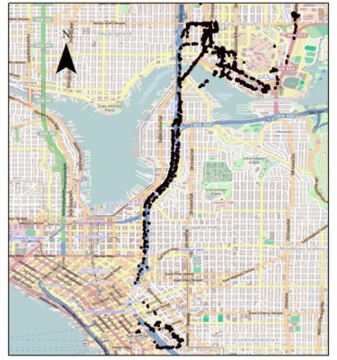
PacTrans researchers have developed an alternative system that uses Wi-Fi and Bluetooth signals from passengers’ mobile phones and devices. This method would enable the gathering of data about where transit users enter and exit the system, how many people use a given stop, and even how long they wait to transfer to another bus/train/light rail.
Each mobile device has a unique identifier called a Media Access Control (MAC) address. The system, which employs a $60 sensor (per vehicle), would simply detect MAC addresses as they board and exit each bus/train/light rail to offer complete and real-time travel data.
This technology has already been used to estimate vehicle travel times on highways and roads, but this is among the earliest attempts to investigate its possible use for collecting passenger origin and destination data on a transit system.
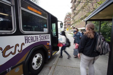
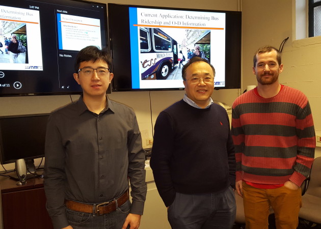
The PacTrans research team of Dr. Yinhai Wang, Kris Henrickson, Matthew Dunlap, and Zhibin Li tested the system in May 2015 by installing these sensors on the South Lake Union Shuttle and Health Sciences Express buses. “We were able to prove the concept and demonstrate that it’s much cheaper to collect data this way,” Wang said. “This is really just at the beginning stage, but this technology is going to become more universal in the age of smart cities.”
For more information, contact Wang at yinhai@uw.edu and Henrickson at henr2237@uw.edu.
In 2010, a reported 97% of people used safety belts in Oregon State.
Source: U.S. Dept. of Transportation, Research and Innovative Technology Administration, Bureau of Transportation Statistics
