
-
December 02, 2021
PacTrans Technology Transfer Success Story 2019 #5: Curbside Management Challenges and Pilot Project
Researchers at the University of Washington recently completed a very exciting, PacTrans-funded, Technology Transfer project involving a newly developed sensor, and its deployment for a pilot study in the City of Bellevue, WA. We sincerely hope you enjoy their story:
In the recent years, the demand for curbside parking has been overloading the curb with the rapid growth of delivery, ride-hailing (e.g., Uber, Lyft and taxis), and micromobility (e.g., shared bikes and scooters) services. This is especially true for certain urban areas and the cities are actively looking for solutions.
The City of Bellevue has been fully aware of such issue and conducted the 106th Avenue Northeast Curbside Management Pilot to study how the curbside area is currently used and how it might be used better in the future. Bellevue is conducting the pilot as part of the Smart Cities Collaborative, a group of cities doing similar curbside studies in 2020. Bellevue, Boston and Minneapolis were selected as pilot cities and are receiving technical support from Transportation for America, a national organization that supports a safe, affordable and convenient transportation system. The pilot will study curbside management on 106th Avenue NE, between Northeast 4th and 8th streets. The study will take a two-pronged approach — data collection and performance assessment — as it attempts to answer key questions.
- Data collection: Bellevue will use multiple data collection techniques to evaluate existing curbside trends and see where curbside “friction” occurs, such as vehicles parking illegally in travel lanes.
- System performance assessment: After collecting initial data, staff will evaluate the effectiveness and accuracy of the monitoring systems that are deployed on the corridor.
- Key questions to answer: What are some new best practices for curb management? How to ensure the safety and efficiency of Bellevue’s increasingly constrained street network? What’s the best technology for measuring curbside uses? How can Bellevue encourage commerce and mobility while ensuring livability?
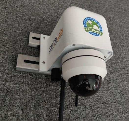
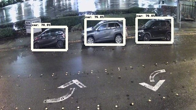
As one of the vendors providing technologies/solutions, the University of Washington Smart Transportation Applications and Research Laboratory (STAR Lab) utilizes edge computing and video-analytics based technology for curbside utilization monitoring. Specifically, Mobile Unit for Sensing Traffic (MUST), a device developed by the STAR Lab has been utilized for curbside activities monitoring. MUST is a comprehensive sensor fusion and edge computing device that can be used for traffic sensing, sensor data fusion, vehicle-to-everything (V2X) applications, roadway monitoring and control, and infrastructure security applications. It integrates multiple cutting-edge technologies developed by the STAR Lab for enhanced transportation safety, efficiency, and reliability. Multiple sensors, including video cameras, media access control (MAC) address detectors via Wi-Fi and Bluetooth signals, and temperature and humidity sensors, etc., are integrated together to address the diverse needs of applications in smart transportation.
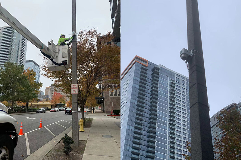
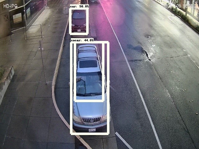
Two MUST devices were deployed at the 106th Avenue & 6th St S (Curb 1) and 106th Avenue & 6th St N (Curb 2) to monitor the curbside activities. Leveraging edge computing and artificial intelligence (AI) technologies, the MUST devices were able to monitor the curbside space activities in real-time. Specifically, MUST devices collected real-time data for the following six key attributes.
- Space availability within area. This attribute is to accurately report the utilization of a specific curb zone.
- Vehicle activity type within a specific area. This attribute is to capture vehicle activity within a specific area in terms of arrival and departure time.
- Dwell time. This attribute is to capture the length of time each vehicle occupied curb space.
- Vehicle type. This attribute is to capture a vehicle type (e.g., truck, car, van, etc.) when reporting a matching event.
- Location within area. This attribute is to capture the location/space within the curb zone.
- Length of vehicle. This attribute is to identify the vehicle length when reporting a specific event.
Ground truth data were collected by the City of Bellevue to compare with the MUST device’s data. The ground truth data included the following attributes:
- Event start time
- Event end time
- Dwell time duration in seconds
- Parking zone and space
- Vehicle type
- Vehicle length and pull in type
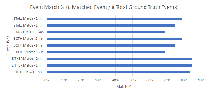
Out of the participating vendors, UW MUST demonstrated the highest accuracy in reporting vehicle activity within a specific area. The overall median time difference for arrival time and departure time is at 7 seconds for all matching events. In addition, UW MUST demonstrated the highest accuracy in reporting dwell time with a median time difference of 12 seconds for all matching events. UW MUST is the only sensor that provided direct vehicle length. By comparing to ground truth data, the results show an overall 83% high accuracy rate.
Detection accuracy results
Metric EITHER Match – 30s EITHER Match – 1min EITHER Match – 2min BOTH Match – 30s BOTH Match – 1min BOTH Match – 2min STALL Match – 30s STALL Match – 1min STALL Match – 2min # of Total Ground Truth Events 155 155 155 155 155 155 155 155 155 # of Vendor Events 154 154 154 154 154 154 154 154 154 # of Matched Events 129 131 131 107 116 122 107 116 122 Event Match Accuracy % 83.2% 84.5% 84.5% 69.0% 74.8% 78.7% 69.0% 74.8% 78.7% Event match accuracy
Commuting to Work: In 2010, a reported 73.03% of Washington State drivers drove alone to work, while 10.48% used car pools and 5.49% used public transit.
Source: U.S. Dept. of Transportation, Research and Innovative Technology Administration, Bureau of Transportation Statistics