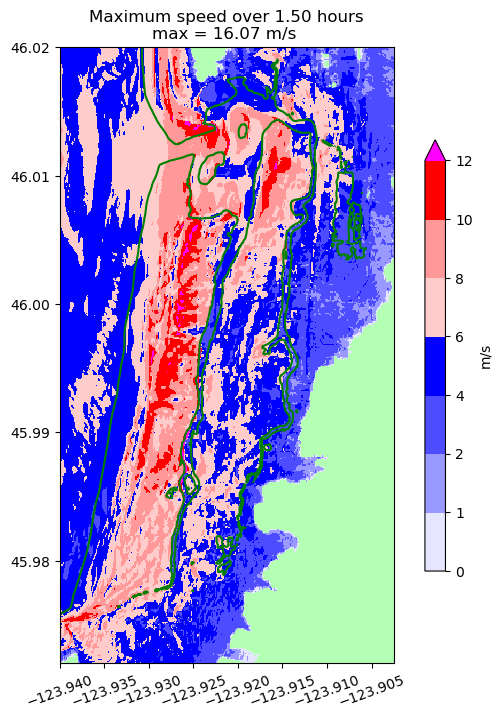
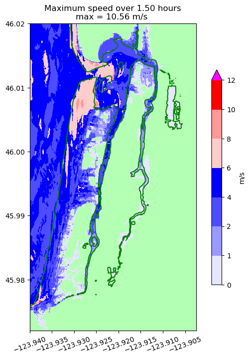
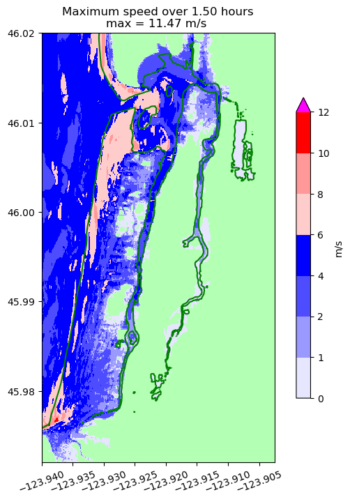
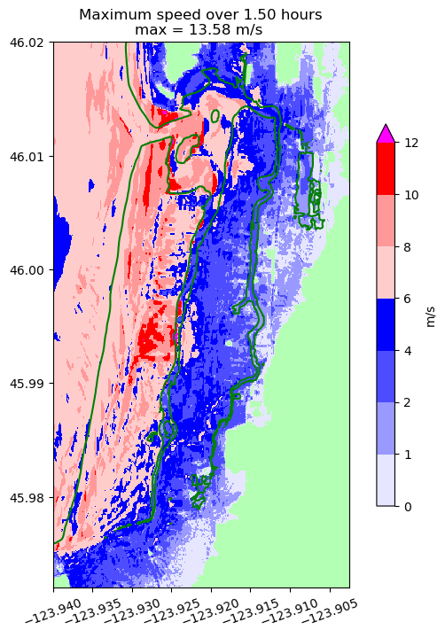
Inundation plots for Seaside
Computed from Cascadia CoPes Hub Ground Motions using the GeoClaw tsunami
model.
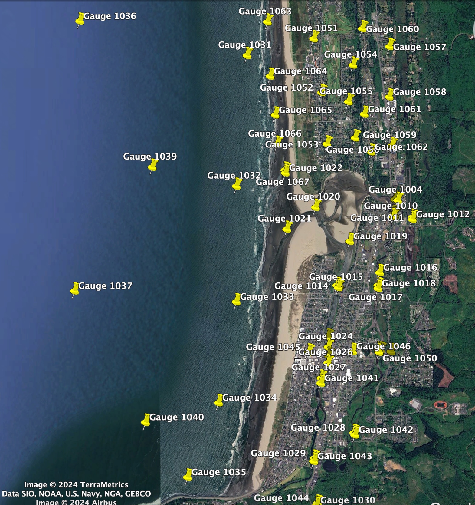
Gauge locations:
Download SeasideGauges.kml and open in
Google Earth.
Kinematic rupture events
buried-locking-mur13-deep


buried-locking-mur13-middle


buried-locking-mur13-shallow


buried-locking-skl16-deep


buried-locking-skl16-middle


buried-locking-skl16-shallow


buried-locking-str10-deep


buried-locking-str10-middle


buried-locking-str10-shallow


buried-random-mur13-deep


buried-random-mur13-middle


buried-random-mur13-shallow


buried-random-skl16-deep


buried-random-skl16-middle


buried-random-skl16-shallow


buried-random-str10-deep


buried-random-str10-middle


buried-random-str10-shallow


