This is a sample of 3D visualization of flooding on topography, using the PyVista software. See PyVista visualization experiments for more details and other examples.
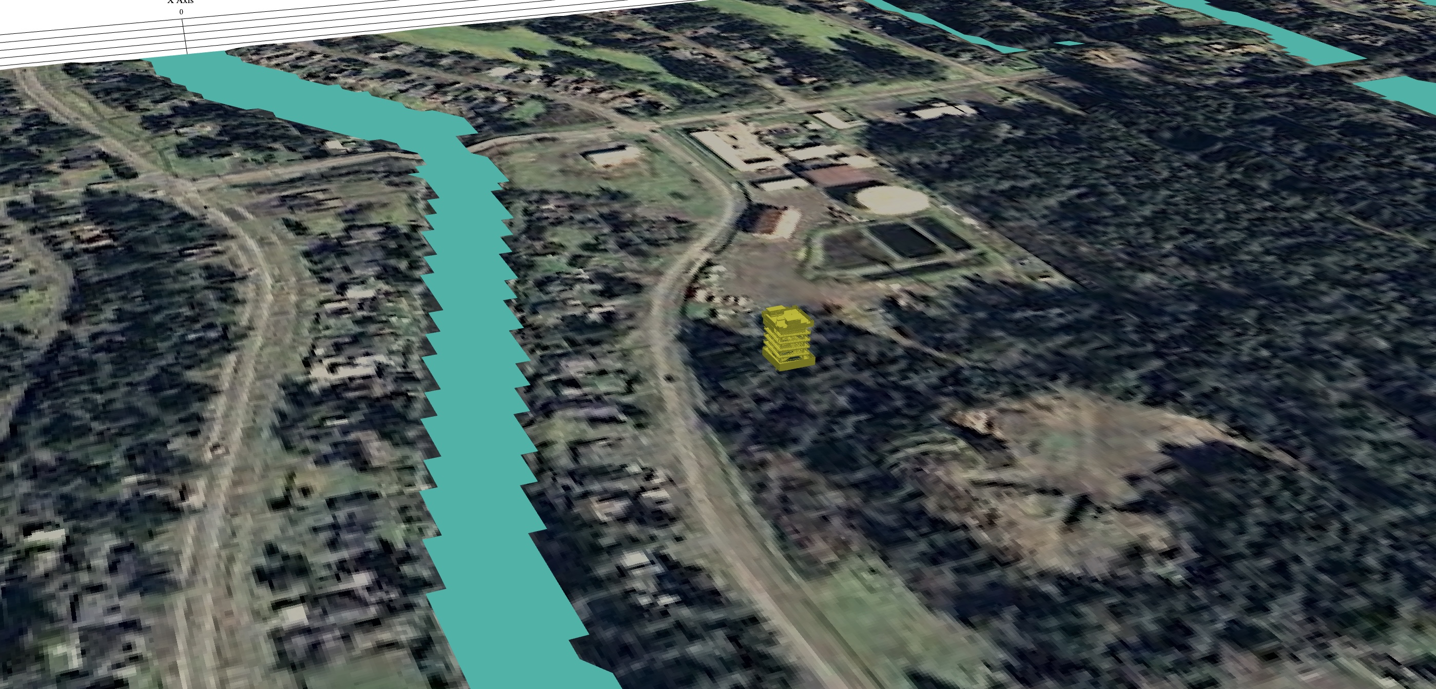
Using Google Earth imagery around Grays Harbor and Ocean Shores, WA as a texture, on top of topography used in a 2D depth-averaged tsunami simulation using GeoClaw.
The 3D model of a hypothetical Tsunami Vertical Evacuation Structure (VES) was provided by Rice Fergus Miller Architects, who have also worked on other tsunami-related projects. This tower was designed for the City of Ocean Shores, funded in part by a FEMA BRIC grant. The project is now on hold, along with several other VES projects, following cancellation of the BRIC program.
Combining this 3D model with tsunami simulations is still work in progress. Here's a first attempt, using a tsunami slightly larger than L1, chosen to be compatible with the ASCE 7-22 and Washington State Building Code requirements.