This web site is now online! Please use it and report any bugs you find to Lyatt Jaegle (jaegle@atmos.washington.edu). Some features are still in the process of being developped:
- Satellite ground tracks
- Saving as postscript files
- Displaying the GEOS-5 forecasts: for now you have access to the TC4 forecasts as the ARCTAS forecasts are not available yet.
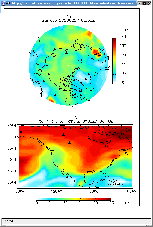
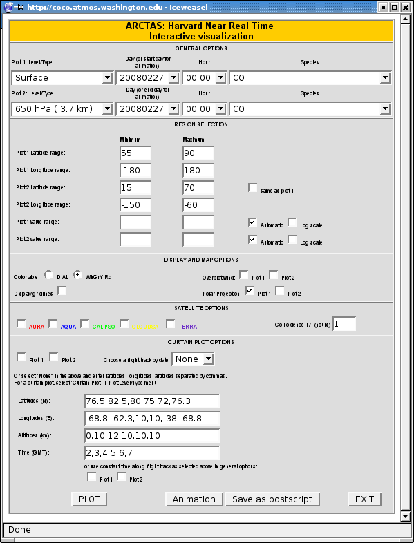
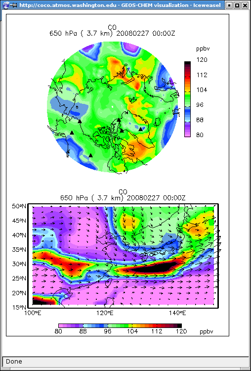
Maps
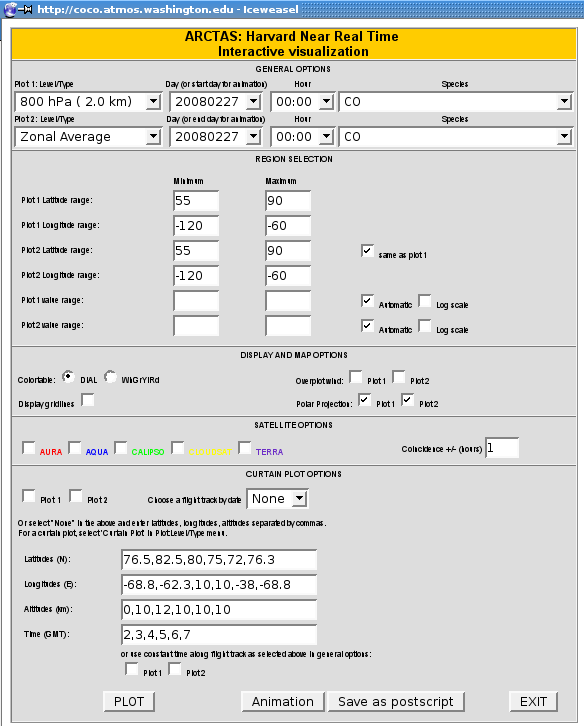
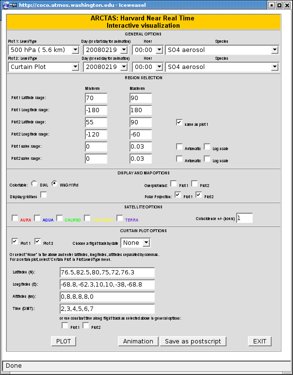
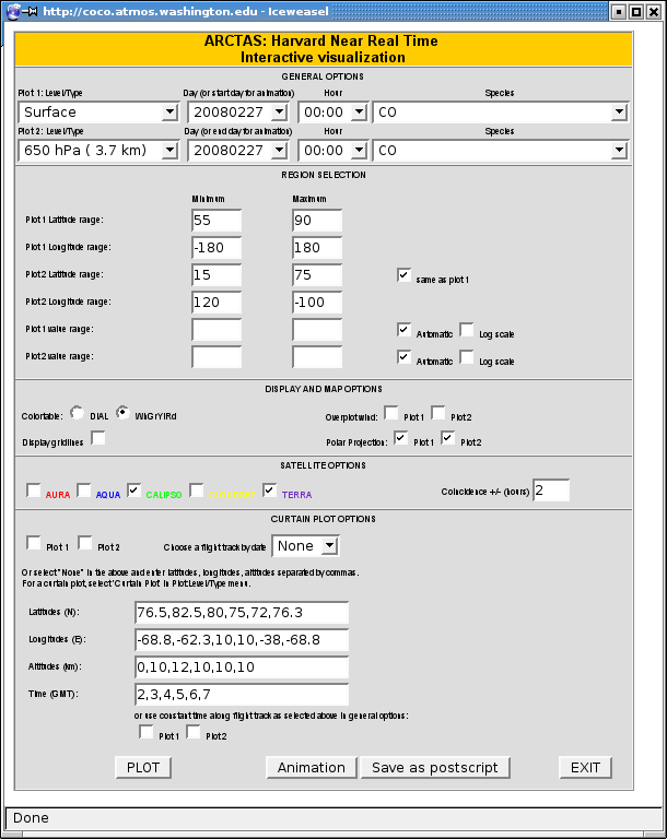
Select a vertical level, day, hour and species to be plotted. Then adjust the lat/lon of the region you would like to be displayed. In addition, you can select a number of options: Color Table, Grid Lines (on/off), overplotting wind vectors, polar projection (on/off). Then click on PLOT. You can further adjust the range of values to be displayed, region to be plotted, display options, etc...
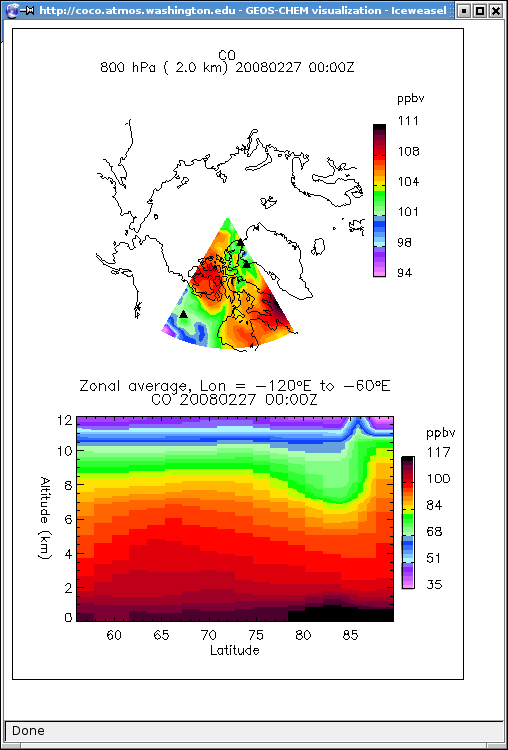
Zonal/Meridional Plots
In the top left drop down menus, you can select the "Zonal Plot" or "Meridional Plot" options. This will allow you to display Zonal/Meridional averages for the selected range of longitudes/latitudes. Note that if you select these options and enter the same values for latitude and longitude (for example Latitude range: 60 60, Longitude range: -100 -100, the interface will display a vertical profile.
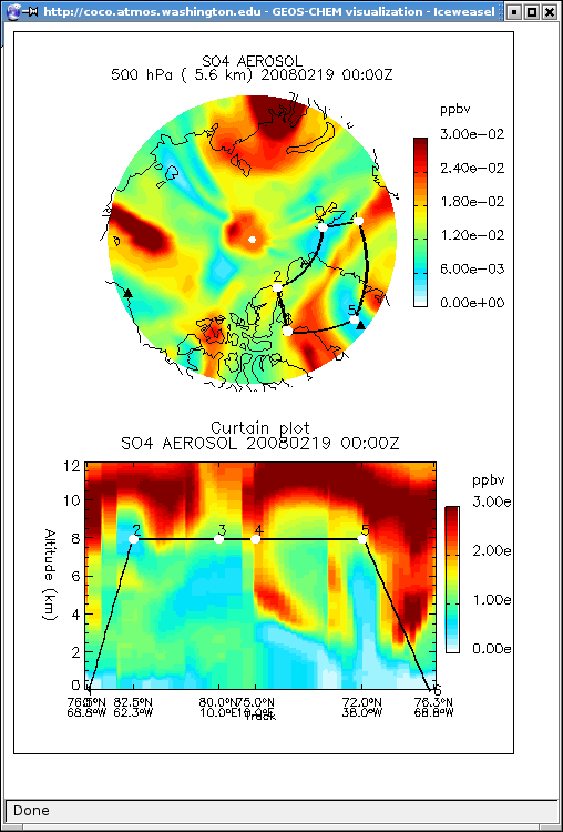
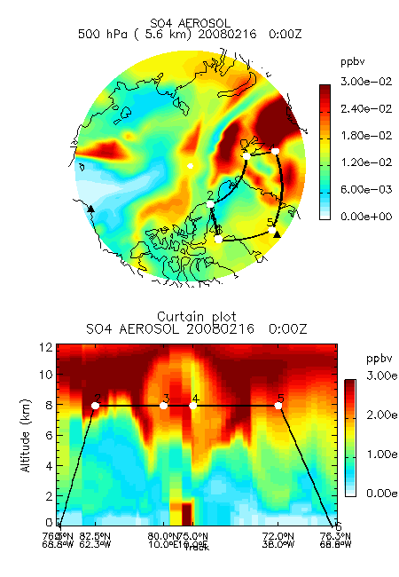
Curtain Plots
If you select the curtain plot options (by selecting the Plot1 and/or Plot2 boxes in the curtain plot options), the interface will display a flight track. To enter a flight track, enter the way points of the aircraft (Latitude, Longitudes, Altitudes, and Time) separated by commas. Once ARCTAS is under way, we will also enter the past flight tracks as the mission proceeds. Then click plot. If the plottype selected is a single vertical level, you will see the flight track displayed on top of a map. If the plottype selected is "Curtain Plot" then the model results will be sampled along the flight track. Note that the sampling between the ways points entered is done every 0.25 (GEOS-5) or 0.5 (NRT) degrees following a rhumb line (path of constant bearing).
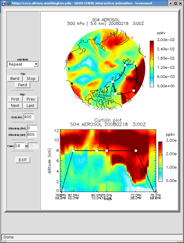
Animations
To generate an animation, select a start day and time for Plot1 and select the ending day and time for Plot2. Then click on "Animation". Once an image appears in the window, you can view/download the resulting animation:
1) Click here to view the animation --> will give you access to an interface where you view the animation and control the display speed
2) Click here to download the animation --> you can choose to download the animated gif image or download the individual png images in a tarred file.
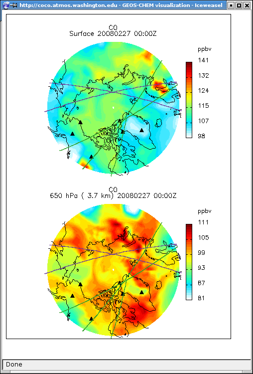
Satellite Ground Tracks (still under development)
In the "SATELLITE OPTIONS" you can select one or more satellites. The interface will display the corresponding ground tracks of the satellite on top of a map. The time of the ground tracks correspond to the Day/Hour selected in the general options +/- a coincidence time (the default is 1 hour). The satellite tracks will be displayed with the color listed in the menu (AURA-red, AQUA-blue, CALIPSO-green, CLOUDSAT-yellow, TERRA-purple). The example below shows maps with ground tracks for Terra and Calipso within +/- 2 hours of 20080227 0:00 GMT. Note that this is still under development!
The ground track predictions are downloaded daily from the GSFC Aura validation center: http://avdc.gsfc.nasa.gov/Data/FOV/index.html


The interactive visualization is using ION Script, which is a language for creating Web-based IDL visualization and analysis applications. The NRT simulations are generated at Harvard University and then transferred to this server. The GEOS-5 forecasts are generated at GMAO and are available on an OPeNDAP server. These forecasts are accessed using GraDS and the lats4d interface for GraDS.
In order to display the forecasts and NRT output, ION Script is using IDL routines from the GAMAP software package developed at Harvard
This web site is running on a linux pc at the University of Washington.
Links:
Last modified: 3/13/2008 11:09 AM