Glacial-Lake Outburst Floods in Central Asia: Introduction
Additional information on cosmogenic-nuclide dates for large gravel
dunes:
Summary
Details
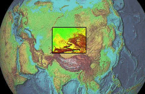
Some of the world's largest known floods, of comparable but slightly smaller magnitude to the well-known Lake Missoula outburst floods that formed the Channeled Scablands in Washington, USA, emanated from large ice-dammed basins in the Altai and Sayan Mountains of southern Russia at some point during the last glacial maximum and deglaciation.
These mountain ranges are located on the north slope of Central Asia and are part of the headwaters of the Ob and Yenesei Rivers which drain northward into the Arctic Ocean.
Looked at from slightly closer, this area is distinguished by a large number of fault-bounded basins, many of which are closed, but some of which (especially the northern ones) have narrow outlet canyons. Since these canyons are located in close proximity to some of the higher topography in the region, it's easily possible for them to be blocked by extended mountain glaciers during glacial-maximum conditions.
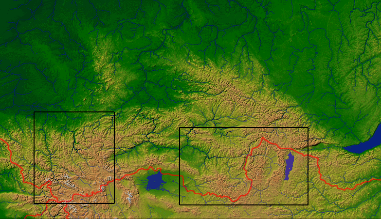
Although there are anecdotal reports of all sorts of floods in this part of the world, floods in two systems only (boxes above) have been studied in any detail. These are the Chuya/Kuray floods:
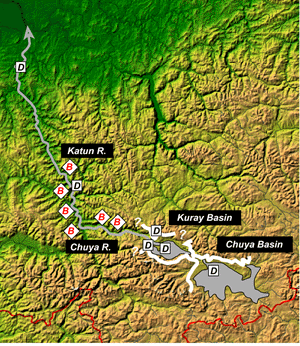
In the above image the white lines show the ice margin associated with the floods, the grey areas the maximum size of the lakes, and the "B"s and "D"s the location of giant flood bars and giant gravel dunes, respectively.
and the Darkhat Basin floods:
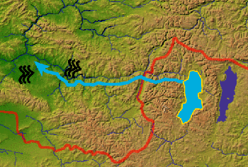
Showing the location of the lake, the route of the outburst flood, and the location of reported large gravel dunes.
In both of these cases large basins were dammed by glaciers, allowing proglacial lakes to form. Inevitable failure of these ice dams released massive floods to the downstream valleys. These floods had volumes similar to the total annual discharge of the Ob and Yenesei Rivers, which suggests that they may have wreaked at least mild havoc with Arctic Ocean dynamics during glacial-maximum conditions. Since the freshwater budget of the Arctic Ocean appears to be important to Northern Hemisphere climate, this probably warrants some further study.
| Basin name | Maximum lake size (cubic km) |
| Chuya | 600 |
| Kuray | 400 |
| Darkhat | 150-250? |
| Glacial lake Missoula, Montana, USA | 2500 |
| River | Annual discharge (cubic km) |
| Ob | 400 |
| Yenesei | 630 |
In addition, these floods created all sorts of spectacular sedimentary features. Here are some examples from the Chuya/Kuray flood system:
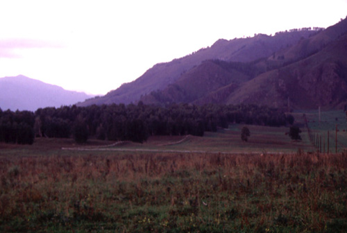
Gravel dunes at Chamal (wavy fence line shows dune profiles). Looking downstream.
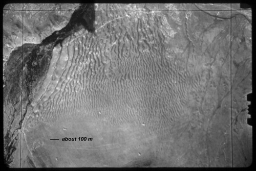
Air photo of large gravel dunefield in Kuray Basin. Water flow L (west) to R (east).
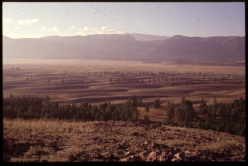
Ground view of same. Water flow from R to L. Dunes up to 10 m amplitude.
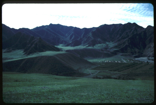
Giant gravel bar at Little Jaloman village. Present Katun River to right of frame, looking downstream. Floods followed river valley and were forced to flow hard right out of picture here. Large berm looming over village is a backwater deposit filling tributary valleys to L.
These features are what we are trying to determine the age of in this project.
The rest of the story about cosmogenic-isotope dates for large gravel dunes: