Characterizing Environmental Gradients at Garrison Bay
|
|
An environmental gradient is a zone of transition from one set of biological and physical conditions to another that is defined by a parameter(s) (e.g. depth, oxygen content) that changes at a measurable rate over a known distance. This distance can range from a few millimeters to many miles. At smaller scales, environmental gradients are useful because they represent a compact succession of overlapping habitats, each varying relative to the others in a moderately predictable way. Because the change in one or more parameters per unit of distance is known, distance may be used as a proxy for time along the gradient. Thus, environmental gradients are ready-made laboratories for studying ways in which organisms adapt to changes in environmental conditions over time. |
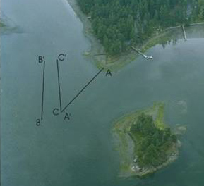
Mud Gradient - Primary Transect (A)
|
|
Garrison Bay contains an environmental gradient across the entire intertidal zone. Our primary transect (A-A') covers most of this gradient, beginning at the shoreline and running well into the lower intertidal. The transect is characterized by a gentle muddy slope, low oxygen conditions at relatively shallow depths within the sediment, diatomaceous ooze and algal clumps near the shore, patches of polychaete castings, and abundant burrows and mollusc shells. An important sediment feature is a layer of dense, resistant sub-surface material--clay and/or pebbles--that varies in its depth below the sediment across the intertidal. Based on our initial survey of the site, we considered a range of surface and subsurface variables prior to examining the primary transect in detail. |
At sediment surface
- Relative thickness of diatomaceous layer
- Frequency of algal clumps
- Percentage of shell cover
- Frequency of burrows (small and large)
- Frequency of polychaete fecal material
- Frequency of tubes (Phoronid and polychaete)Within sediment
- [Oxygen content]
- Temperature
- Depth to resistant layer
- Percentage of coarse material
- Faunal variation between shell
infill and surrounding sediment
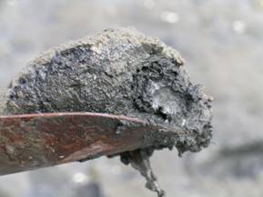
Oxygen content could not be measured within the sediment due to the sensitivity of the measuring device (mud would disrupt the sensor and damage the fragile membrane). Based on our observations (sight and smell!) we concluded that the distance from the sediment surface to anoxic sediment layers was shallow and remained relatively constant over the length of the transect.
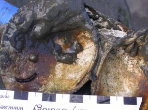
Clinocardium nutalli valves with associated polychaete, decapod, and gastropods |
During our initial survey of Garrison Bay, we found polychaete worms (commonly capitellids, glycerids, and hesionids) on the inner surfaces of dead bivalve shells that had been filled with sediment. Often, these worms were clumped together in masses of five or more individuals, many of them juveniles. In some cases, brittle stars (Amphipholis squamata) and crabs (Pinnixa sp.) were also present. The frequency of observed shell-dwellers led us to speculate that dead shells in Garrison Bay could serve as microhabitats and/or refuges for a variety of small benthic organisms. If this is true, then the faunal composition of shell infill could differ from that of the surrounding sediment. |
|
|
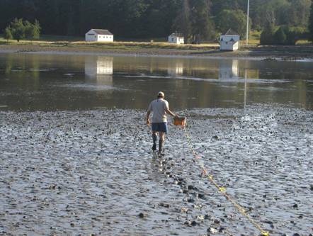
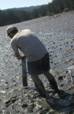
Team Mud & interhabitat liaison collect data
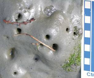
Surficial sediment, showing green-brown diatomaceous layer over gray-black sediment
|
|
|
|
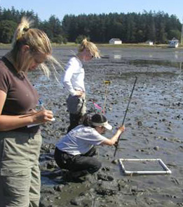
Technique 2: Shell/No-Shell Comparisons |