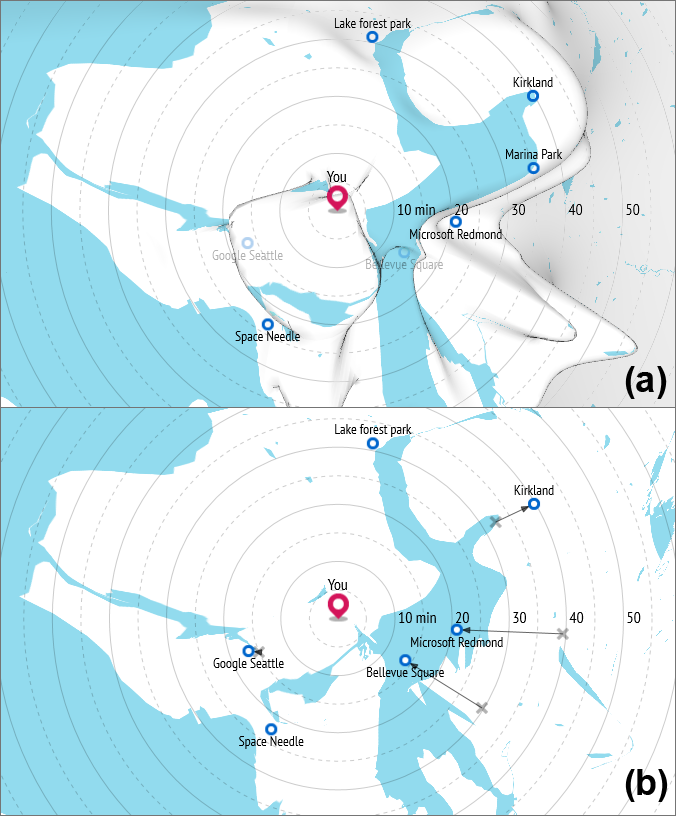
Project Overview: Maps can convey information from increasingly diverse data sources, and people are now using maps for a widening range of practical applications. Mapping technologies have the potential to help people better understand their transportation options and habits by conveying information about travel time, carbon dioxide emissions, expense, calories burned, and other metrics associated with transportation. But a review of previous literature reveals the difficulty in effectively presenting such information using the conventional equidistant projections that are widely adopted in the majority of mapping platforms. Therefore, the purpose of this research is to develop a new methodology for designing user-centered distance cartograms, and to build a platform that can be widely used by users, designers, researchers, and practitioners all around the world. This project is supported by the University of Washington, CoMotion.
See more information here.
Researchers
Ray Hong, University of Washington, Human Centered Design and Engineering, PhD student
Min-Joon Yoo, New York University, Postdoctoral Researcher
Yeaseul Kim, UW, iSchool, PhD Student, iSchool
Andrew Berry, UW, HCDE, PhD Student
Don-sub Rim, UW, Applied Math, PhD Student
Cecilia Aragon, UW, HCDE, Professor
Publications
Hong, S. R., Kim, Y. S., Yoon, J. C., and Aragon, C. R. Traffigram: distortion for clarification via isochronal cartography. In Proc. of the SIGCHI 2014, ACM Press (2014), 907-916. doi: 10.1145/2556288.2557224
