The Petroglyphs of Baga Oigor I
This page displays images of petroglyphs in Baga Oigor Sector I according to the mapping done by Jacobson et al. They are presented here first in the order of the numbering in Jacobson et al. 2001, followed by a few instances of the those numbered in Kubarev, and finally images which I have not been able to locate in the books. That is, there has been no effort to maintain a particular geographical order. The full bibliographic references will be found on the introductory page. For the images depicted in those publications, the authors indicate what part of the sector in which they are found and provide a measuring scale. Some of the images here also contain a 10 cm measuring scale.
There is a distinct topographical boundary between the east side of Tsagaan Salaa IV and the west side of Baga Oigor I. A small stream enters the main valley here from the north, flowing down through a fairly steep though small valley. Currently where it enters the floor of the main valley, there is a sizeable, smooth fodder pasture, surrounded by a low stone wall. Presumably the family which occupies the winter home on the south-facing slope of the west end of Baga Oigor II harvests this plot. In late August 2005 their fodder crib was already largely full. The homestead is visible in the first photo here and in photos on the opening page for Baga Oigor/Tsagaan Salaa.
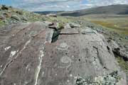
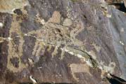
Jacobson 2001, fig. 709; Kubarev, fig. 774
|

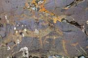
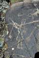
Jacobson 2001, fig. 715
|
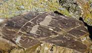
Jacobson 2001, fig. 715
|
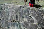
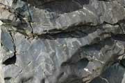
Jacobson 2001, fig. 731; Kubarev, fig. 792
|
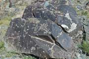
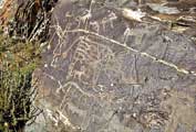
Jacobson 2001, fig. 753; Kubarev, fig. 811
|
Jacobson 2001, fig. 753; Kubarev, fig. 811
|
Jacobson 2001, fig. 759
|
Jacobson 2001, fig. 769
|
Jacobson 2001, fig. 783; Kubarev, fig. 840
|
Jacobson 2001, fig. 783; Kubarev, fig. 840
|

|
Photographs © 2005 Daniel C. Waugh
)
)
)
)
)
)
)
)
)
)
)