) The Tsagaan Salaa River flows into the Baga Oigor in the far western region of Bayan Olgiy aimag in the Mongolian Altay Mountains. As the joint Mongolian/American/Russian project "Altay" which began in 1994 determined, along the lower Tsagaan Salaa and upper Baga Oigor is "one of the largest rock art complexes in North and Central Asia, and the richest in terms of chronological age, quantity, and quality of imagery" (Jacobson et al. 2001, p. 1). The project spent six years documenting the site, mapping GIS coordinates and recording the more than 100,000 images. The results have been published in the volumes listed below, and the full database eventually is to be made available electronically.
The Tsagaan Salaa River flows into the Baga Oigor in the far western region of Bayan Olgiy aimag in the Mongolian Altay Mountains. As the joint Mongolian/American/Russian project "Altay" which began in 1994 determined, along the lower Tsagaan Salaa and upper Baga Oigor is "one of the largest rock art complexes in North and Central Asia, and the richest in terms of chronological age, quantity, and quality of imagery" (Jacobson et al. 2001, p. 1). The project spent six years documenting the site, mapping GIS coordinates and recording the more than 100,000 images. The results have been published in the volumes listed below, and the full database eventually is to be made available electronically.
The collection of images here was made during three days at the site in late August 2005. While the selection includes a range of interesting images, the short time limited the possibilities for exploration. Some very interesting subject matter is not represented here, simply because I did not locate it, not by any conscious omission. Unless one can systematically walk every foot of the complex and rock-strewn terrain, many of what may be the most important images will pass unnoticed. My images are from Tsagaan Salaa II-IV and Baga Oigor I-III. There was no time to explore the important sectors of Tsagaan Salaa I and Baga Oigor IV.
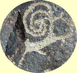
There are images of various animal species, hunting scenes, and scenes depicting aspects of human life in the region. We see humans riding and leading animals, loaded caravans and schematic drawings of what we assume are enclosures. Certain imagery seems clearly to have had some kind of religious/ritual significance (for example, bell-shaped anthropomorphs and birthing scenes, arguably amongst the earliest of the images. A great deal of the imagery may be connected with human and animal reproduction. While precise dating is impossible, there are plausible hypotheses which correlate certain themes with different periods, reflecting changes in climate and the patterns of human activity. Thus, some of the drawings arguably pre-date domestication of animals; the petroglyphs document a shift from dependence on hunting to pastoral nomadism in the period between about 2000 BCE (Bronze Age) and 1000 BCE (early Iron Age). At a certain point, chariots or wagons were being used and their images pecked into the rocks. Scenes with animals being ridden are arguably later. (For a detailed chart of the hypothesized relationships of imagery to climate change over time, see Jacobson et al. 2001, Chart I).
The photographs here can, at least, provide some sense of the site for those who cannot access the publications and, in many cases include images which are not yet published. Where possible, the captions identify the numbers of the corresponding drawings and photographs in the books, although it is possible that in a few cases there are published images which I failed to match with the photos. In many cases the image in the books shows only a part of the one in the photo or vice-versa. In cases where I found no image, I have tried to group the unidentified photos in the appropriate sector of the site, according to the map devised by the "Altay" project team. However, since the boundaries between sectors can be difficult to determine on the ground, and in a few cases my picture sequences did not provide requisite information, it is possible that a few of the images are mis-located.
The photographs were made both with a digital camera and using color transparency film. The color rendition varied considerably between the two, the digital camera tending to err on the cold side and the film oversaturated on the warm side. Without re-visiting the site, it is now difficult to be sure of the faithfulness of the colors; in any event, the primary consideration in adjusting the photos has been to ensure sufficient contrast for the images to be visible, even if this may have meant distorting original colors. Thus, photos of the same object may vary, depending on which medium was used. As those who have tried to photograph petroglyphs can well appreciate, the time of day and direction of incident light have a major impact on the results. In certain cases, if the light is direct and flat, the image will barely be visible, whereas it will stand out when the light is angled. In some cases the reflectivity of the patina of the rock creates glare which obscures images. Reducing the glare when processing the photos can induce color changes. The reality is that the hues of the rock vary considerably, some being a dark gray, some having a distinct reddish-brown patina.
To a considerable degree, there has been an attempt to situate the petroglyphs in the larger landscape; thus in many cases there are both wider views and specific details of the same rocks. Occasional details blown up from a portion of a 35 mm slide lack the sharpness of the full frame photos. I have also provided landscape images with no petroglyphs, where I hope I have captured the vivid range of colors of late summer in this beautiful valley.
The viewer of this web page is urged to read the essays in Jacobson et al. for interpretive information, including suggested datings and measurements, which have not been copied into the captions here.
Should you be so fortunate as to visit the Baga Oigor or any other petroglyph site in Inner Asia, please keep in mind the necessity to protect the images against any kind of possible damage. One should not follow the example of local herders who have occasionally inscribed their own graffiti on the same rocks, in some cases directly over the prehistoric art. Nor should one chip, peck, or probe at the images, walk on them, pull away lichens which may be covering them, or do rubbings. Tracing on a sheet of heavy plastic with a felt pen is acceptable, and by all means, take photos.
References:
) Map of the petroglyph complex section boundaries.
Map of the petroglyph complex section boundaries.
These images are arranged roughly from East to West in the Valley, starting with views of the area E and S of sector Baga Oigor III and then moving to views of the end of the valley where the Tsagaan Salaa enters. Most of the petroglyphs are on the south-facing slopes of the hills, and some of the most important groupings are to be found as backdrop to a current winter herder home. There is reason to suppose that even in the time when the petroglyphs were created, the winter homes of the herders were in the same locations, which were reasonably sheltered from the winter winds and received maximum exposure to the sun.
)
Winter home on S side of Baga Oigor |
)
View SE over herder home at edge of BOIII |
)
View SW over herder home, W edge of BOII |
)
A door... |
)
...and a wall |
)
Looking ESE from the northern slope |
)
View ESE, a rock altar in foreground |
)
View ESE from sector TSIV |
)
Looking SE from sector BOII |
)
Another view SE from BOII |
)
View S over rock altars, from BOII |
)
Another view across valley |
)
Looking WSW from sector BOII |
)
View WSW |
)
Small lakes on S side of valley |
)
Looking WSW from sector BOII |
)
Herder winter home, sector BOI |
)
View WSW from above herder home |
)
Fodder field below herder home |
)
The field from above, view toward TSIV |
)
The stream valley separating TSIV from BOI |
)
Looking up the Tsagaan Salaa from sector TSV |
Photographs © 2005 Daniel C. Waugh