A Novel Image Dataset to Help UAVs Find Lost Humans in the Wilderness
Accepted to IEEE/RSJ International Conference on Intelligent Robots & Systems 2022
Abstract
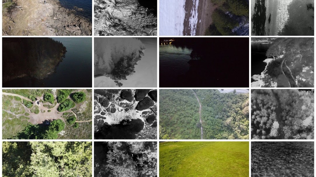
Sensor-equipped unoccupied aerial vehicles (UAVs) have the potential to help reduce search times and alleviate safety risks for first responders carrying out Wilderness Search and Rescue (WiSAR) operations, the process of finding and evacuating person(s) lost in wilderness areas. Unfortunately, visual sensors alone do not address the need for robustness across all the possible terrains, weather, and lighting conditions that WiSAR operations can be conducted in. The use of multi-modal sensors, specifically visual-thermal imagers, is critical in enabling WiSAR UAVs to perform in diverse operating conditions. However, due to the unique challenges posed by the wilderness context, existing dataset benchmarks are inadequate for developing vision-based algorithms for autonomous WiSAR UAVs. To this end, we present WiSARD, more than 56,000 labeled visual and thermal images collected from UAV flights in various terrains, seasons, weather, and lighting conditions. To the best of our knowledge, WiSARD is the first large-scale dataset collected with multi-modal sensors for autonomous WiSAR operations. We envision that our dataset will provide researchers with a diverse and challenging benchmark that can test the robustness of their algorithms when applied to real-world (life-saving) applications.
Check out Chris presenting the paper at IROS 2022 Kyoto, Japan! Photo credits: Danny Broyles.