Discussion Board
March 28-30, 2016, University of Washington
This joint workshop between the Center for Asian Urbanism and the UW faculty cluster for Resilience in the Built Environment highlights the UW’s capacities to apply cultural context-specific expertise to problems of urbanization across the Pacific. Preceding the 75th Anniversary conference of the Association for Asian Studies in Seattle (March 31-April 3, 2016), the UW Workshop on Resilience and Asian Urbanism gathers a unique group of leading scholar-professional-activists to inspire and facilitate creative and fundable long-term partnerships in both research and action. Cases and discussions of indigeneity and place-based resilience, water-sensitive urbanization, and new urban-rural relations will highlight the mutual relevance of expertise in global-area studies and the professional built-environmental disciplines; explore the potential for border-crossing applications of experience; and suggest new linkages within the university.
Sponsored by the UW College of Built Environments Dean’s faculty cluster funding for Asian Urbanism and Resilience in the Built Environment; the UW Jackson School of International Studies and East Asia Center; and the Confucius Institute of Washington.
Venue: University of Washington wǝɫǝbʔaltxʷ Intellectual House Gathering Hall, 4249 Whitman Court, Seattle, WA 98195.
Please direct inquiries about the workshop and seminar course to Dan Abramson, Associate Professor of Urban Design & Planning, at abramson@uw.edu, and Adnya Sarasmita at adnyaps@uw.edu.
Program Highlights
Monday, March 28, 5:00-8:00 PM
Welcome by John Schaufelberger, Dean, UW College of Built Environments
Keynote: Resilient Urbanism in the Anthropocene – The Rise of Progressive City Regions in Asia’s Urban Transition
Mike Douglass Lee Kuan Yew School of Public Policy and Asia Research Institute – Asian Urbanisms Cluster, National University of Singapore
Tuesday, March 29
Welcome by Reşat Kasaba, Director, UW Jackson School of International Studies
Session 1, 9:00 AM-12:30 PM Indigeneity and Place-Based Resilience
5 years after the Great East Japan Earthquake and Tsunami – Community Recovery in Tohoku, Japan Elizabeth Maly International Research Institute of Disaster Science (IRIDeS), Tohoku University
Post-earthquake Reconstruction and Architectural, Social and Cultural Change Among Ethnic Qiang of the Upper Min River, Sichuan Jing Geng Sichuan Institute for Ethnic Studies
Geographies of Community Resilience: Navigating Cross-cultural Differences in Recovery Planning after Typhoon Morakot Shumei Huang National Taiwan University
Adaptation and Resilience: Mountain Village Communities in the Upper Himalayas, Uttrakhand, India Manish Chalana University of Washington
Anticipating a Tsunami: Settlement Relocation and Adaptation on the Washington Coast Dan Abramson University of Washington
Panel Discussants: Himanshu Grover, University of Washington; Edwin Schmitt, Chinese University of Hong Kong
Session 2, 9:00 AM-12:30 PM Water-sensitive Urbanization
Potential of Rainwater in Urban Groundwater Recharge Ya Tang Sichuan University
Cities Under Siege: the Flood of 1931 and the Environmental Challenges of Chinese Urban Modernization Zhiguo Ye Seattle Pacific University
Resilience and Local Climate Adaptation: exploring governance arrangements to adapt to the risk of flash flooding in the city of Arnhem, the Netherlands Elen-Maarja Trell University of Groningen
Community flood groups and their influence on flood resilience at the local level in England Steven Forrest University of Groningen
How to Do Things with Software Etienne Turpin anexact / Peta Jakarta
Panel Discussants: Ken Yocom, University of Washington; Bob Freitag, University of Washington
Wednesday, March 30
Welcome by Jeffrey Riedinger, UW Vice Provost for Global Affairs and Director, Confucius Institute of Washington
Session 3, 9:00 AM-12:30 PM New Urban-Rural Relations
The Current Status of Resilient Urban Development in China Zhi Liu Peking University / Lincoln Institute of Land Policy
Threats to the resilience of a long-enduring system: The Redesign of the Chengdu Plain in the 21st century Stevan Harrell University of Washington
New Rural Design Guidelines in the Chengdu Plain: the Case of Tianfu New District Wei Zhao Southwest Jiaotong University
New Ruralism Shenglin Chang National Taiwan University
Resilient energy landscapes: a spatial quest? Christian Zuidema University of Groningen
Present Status of Resilient City Development in Sichuan, China Sizheng Nie Sichuan Provincial Bureau of Housing and Urban-Rural Development
Panel Discussants: Qing Shen, University of Washington; Nick Smith, Yale-NUS College, Singapore; Susan Whiting, University of Washington
Session 4, 1:30 PM-4:00 PM Full Group Discussion and Project Brainstorm
Presentations
Resilient Urbanism in the Anthropocene – The Rise of Progressive City Regions in Asia’s Urban Transition (slide presentation here) Mike Douglass Lee Kuan Yew School of Public Policy and Asia Research Institute – Asian Urbanisms Cluster, National University of Singapore
This discussion weaves together 5 main dimensions of resilient urbanism in Asia. The first is that Asia’s urban transition is part of planetary “globopolis” processes of citymaking and governance that are no longer making cities, with cities understood as theatres of social action and political community. The neo-developmental globopolis with its high inequalities and erosion of the city as polis of public decisionmaking is not only unable to keep pace with rising vulnerabilities and frequencies of disasters, it is substantially abetting them as well. Second, as rural areas are increasingly absorbed into a global matrix of urbanization and as urban form radically changes into rural-urban mixes of land uses, rather than continue to use rural-urban dichotomies to frame spatial development issues, focusing on city regions offers the most salient frame for policy and action. Third, the position is taken that the currently ascendant idea of resilience is inadequate in terms of these same processes are generating new landscapes that are making rural-urban distinctions anachronistic. Fourth, when critically examining the idea of resilience in the Anthropocene and from a perspective of compound disasters, the pursuit of resilience is not so much about recovery from a disaster, though important, but rather about governance. Fifth, as Asia transitions to highly urbanized society, resilience as process and outcome rests on the rise of progressive city regions, some of which are already appearing.
5 years after the Great East Japan Earthquake and Tsunami – Community Recovery in Tohoku, Japan Elizabeth Maly International Research Institute of Disaster Science (IRIDeS), Tohoku University
On March 11, 2011, northeast Japan’s Tohoku region was devastated by a the massive Great East Japan Earthquake (GEJE) and massive tsunami that followed, which inundated over 500 square kilometers in coastal areas. Around 20,000 people lost their lives, and 350,000 were displaced. As well as severe damage from the earthquake and tsunami, the GEJE was a complex disaster, causing fires and a nuclear meltdown at the Fukushima Daichi reactor. As a country at high risk for various natural disasters and experience with disaster and recovery, Japan has established policies and programs to support recovery post-disaster. After the GEJE, the Japanese national government created a menu of options for disaster recovery of the affected areas; municipal governments have the main responsibility for disaster response as well as recovery planning. Even before the GEJE, Japan was already facing a challenge of aging and shrinking population, and the affected Tohoku region was already experiencing this issues at a higher rate than Japan as a nation. Along with regional economic decline, this demographic context made recovery more difficult. Programs that were made available for recovery in the Tohoku region tend to focus on large scale infrastructure improvements, including massive land raising, relocation to high land areas, or the construction of pubic housing. Five year after the GEJE, the ongoing progress of many physical infrastructure rebuilding projects is visible throughout the disaster affected areas. Focusing on large scale projects, official national government recovery programs do not always address more local community/neighborhood level needs for recovery. Most examples of successful initiatives of community rebuilding include some additional support or tapping into some unique capacity in addition to official programs of government support for recovery.
Post-earthquake Reconstruction and Architectural, Social and Cultural Change Among Ethnic Qiang of the Upper Min River, Sichuan Jing Geng Sichuan Institute for Ethnic Studies
Geographies of Community Resilience: Navigating Cross-cultural Differences in Recovery Planning after Typhoon Morakot Shumei Huang National Taiwan University
Based on a long-term study of the making of Rinari, a reconstruction village (Dec 2006 to Feb 2016) in Southern Taiwan, this presentation starts by questioning the notion of “permanent housing” in recovery planning. It intends to understand how the indigenous communities navigate cross-cultural differences in post-disaster planning, which is especially important in the context of post-Typhoon Morakot recovery because many of the indigenous tribes were asked to relocate and become neighbors to one another at new reconstruction villages given limited lands and reconstruction funding. Taken a process approach, it asks the following questions: how is community resilience shaped by cross-cultural relationship? How does geography matter in understanding community resilience? Paying attention to how the three tribes – Makazayazaya, Kucapungane, and Tavalan – learn to counter displacement and a variety issues resulting from cohabitation, it rethinks some normative terms adopted in post-disaster planning, such as identity, displacement, and territory. It recognizes that living with others is not a new issue but a historical and geographical process, in which the indigenous communities adapt to changes in their migration/relocation/extension, which is integral to the indigenous way of territorialization and reterritorialization. It concludes that a community is more resilient than others if it is better connected with other places in the region and therefore a more extensive geography of negotiation for the community to adapt to changes. The increased communication between Rinari and its neighboring villages for growing quinoa and coffee is one example to the point. In the course of negotiating for opportunities and locating resources, the relocated communities may sustain diversified connections with other places, including their previous settlement or “settlement by extension,” that is, geographies of community resilience. The research would like to argue that geographies of community resilience is a key for the indigenous communities to navigate cultural differences exposed by inadequate recovery planning that overemphasizes stability and permanency.
Adaptation and Resilience: Mountain Village Communities in the Upper Himalayas, Uttrakhand, India Manish Chalana University of Washington
Nature and culture are inextricably linked, and nowhere is this more apparent than the Johar Valley of the Indian Himalayas. For centuries, Botia inhabitants of the small remote high-altitude villages here have followed a system of life that is integrated closely with the natural landscape. However, climate change—marked locally by shifting monsoons, increasing landslides and retreating glaciers—pose a serious threat to the local populations and livelihoods in both the Johar Valley and its gateway town of Munsiyari. Political shifts and rural development programs and policies have aggravated the situation further in recent decades. This work draws on data from two study abroad exploration seminars and interprets it using a resilience framework to understand the patterns of risks and vulnerability impacting this area, and to illuminate how the communities are adapting to the new realities of the natural and built environment. The case showcases the combination of environmental and political/policy threats that mountain communities in India face and seeks to understand how resilient they remain in the face of change.
Anticipating a Tsunami: Settlement Relocation and Adaptation on the Washington Coast Dan Abramson University of Washington
Indigenous rural communities have a rich store of traditional ecological knowledge and sense of environmental history that includes time-tested hazard mitigating practices, even as their cultures resist standard approaches to planning. Cases of tsunami preparedness planning for the Makah American Indian Tribe and other indigenous and White settler communities on the Olympic Peninsula, Washington State, illustrate the difficulties that conventional disaster recovery and hazard mitigation present for indigenous cultures, especially with respect to relocation, property rights, and disaster insurance. These communities have experienced no disaster in recent memory, but are preparing for an expected 9.1 magnitude earthquake in the Cascadia Subduction Zone and its subsequent tsunami (similar to that experienced by northern Japan in 2011), by participating in a state program to plan vertical evacuation structures, and by planning new development above the tsunami inundation zone. With varying degrees of continued dependence on the sea for livelihood and cultural identity, these communities must pursue different paths to integrate hazard mitigation with everyday place-making. Given that the hazard under consideration is as rare as it is severe, any mitigation measure must serve other purposes, and take the form of gradual adaptive development on the basis of the community’s whole identity, while also addressing short-term and immediate challenges and opportunities. Conventional hazard mitigation and disaster planning processes typically begin with hazard scenarios and vulnerability analyses. They typically end with preparations for disruptive events, and emphasize “hardening” of built-environmental assets or the removal of those assets outside threatened areas altogether. The conventional approach typically ignores natural and social sources of adaptive capacity. As a result, conventional hazard mitigation plans are not well integrated with the community’s more general plans, values and aspirations. Our new approach, supported by FEMA and NSF research grants, uses participatory GIS for community workshop-type exercises in which community stakeholders self-identify their own sources of resilience and adaptive capacity before discussing the hazard and vulnerabilities. As a result, visions for future development tend to embrace a more creative and adaptive range of land use decisions, sensitive to social and ecological identity.
Potential of Rainwater in Urban Groundwater Recharge Ya Tang College of Architecture and Environment, Sichuan University
No. 24, South Section One, First Ring Road, Chengdu, Sichuan, 610065, China
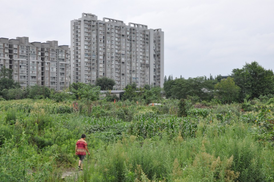
With 56.1% of its present 1.374 billion population in urban areas, fast urbanization in China is one of the most striking features in the past three decades. Urbanization has caused great changes in land use, land cover, hydrology, and water cycle in cities. Increasing exploitation and reducing recharge of groundwater are common challenges in almost each city in China. Focusing on groundwater exploitation and ignoring groundwater recharge through natural systems have caused drawdown of groundwater table, land subsidence and increasing flooding. Green areas in urban areas can play an important role in improving groundwater recharge and reducing flooding risks. Appropriate design and management of green areas in cities can improve considerably surface runoff infiltration and groundwater recharge. Change in urban planning and management of green belts may contribute to enhancement of city resilience.
Cities Under Siege: the Flood of 1931 and the Environmental Challenges of Chinese Urban Modernization Zhiguo Ye Assistant Professor, History Department, Seattle Pacific University
The paper explores the connection between China’s urban modernization and the resulted environmental vulnerabilities revealed in the 1931 flood. The flood in 1931 is believed to be the deadliest disaster in 20th century China with one-fourth of China’s population affected. The conventional view on the flood as an “unavoidable” natural disaster mainly caused by bad weather conditions does not explain why key urban centers along the Yangzi appeared unusually vulnerable and suffered great loss in the flood of 1931. The paper thus takes the worst affected urban region in 1931—Wuchang, Hankou and Hanyang as the focus of the study. Flood prevention was historically important to the three riverine cities. In traditional China the walled cities with designed hydraulic schemes often provided shelters for people from rural hinterland during the time of flooding. However the three cities were only found defenseless in 1931 after experiencing the rapid urban modernization since the late 19th century. The study specifically examines the urban reconstruction efforts made in the Qing and the Republic and their impacts on the urban flood protection prior to 1931. It explores how the shifting focus of the government from agriculture to industry and commerce prioritized the urban developmental pattern incompatible with the traditional water-control design. For instance, the rapid urban sprawl since the late Qing caused the reclamation of wetlands and lakes outside city walls originally preserved as high-water discharge zone. The dismantling of the flood-resistant city walls, locks and moat seriously weakened the traditional urban drains system. In addition, the birth of “the developmental state” and the urban social reconfiguration after 1927 marked a drastic rupture in the government’s policy and societal practice in water control. The concentration of power on the revolutionary government and technocratic confidence led to the decline of local organizations/groups used to play roles in water control at the community level. They were replaced by governmental bureaus and centrally appointed planners who were often ignorant about local wisdom and traditional practice on water control.
Resilience and Local Climate Adaptation: exploring governance arrangements to adapt to the risk of flash flooding in the city of Arnhem, the Netherlands Elen-Maarja Trell and Marijn van Geet University of Groningen
Climate change increases the risk of pluvial and fluvial floods in cities across the world, including the Netherlands. Consequently, governments face increasing pressures to take strategic adaptation decisions to increase urban resilience to (flash) flooding. It is therefore not surprising that in past decades, policy-makers, planners as well as academics have been exploring ways to adapt to the growing risks and more specifically, to find strategies to make urban areas more resilient to flooding. However, despite a growing body of literature on adaptation governance, knowledge on effective governance for climate adaptation on the local level remains limited. Addressing this knowledge gap, this paper focuses resilience to flash flooding in the city of Arnhem, The Netherlands and aims to identify governance arrangements for effective climate adaptation / resilience to flooding on the local level. The paper considers resilience to flash flooding as a complex configuration of interdependencies and interactions between key stakeholders (municipality, residents, housing associations and insurance companies) within the flash flood ‘governance landscape’. Using the city of Arnhem as a case study this research aims to unpack these interdependencies and interactions and to discuss the roles and capacities of each key actor in the flash flood governance landscape. By doing that, insights into barriers and opportunities to achieving effective governance of climate change adaptation and resilience to flash flooding are created. The findings reveal five adaptation bottlenecks and propose governance arrangements that contribute to local level resilience to flash flooding.
Community flood groups and their influence on flood resilience at the local level in England Steven Forrest, Elen-Maarja Trell, Johan Woltjer University of Groningen
The shift from traditional flood hazard control approaches towards flood resilience approaches in many European countries has led to a change in the governance arrangements, roles, and responsibilities of local flood actors. It has also led to the emergence of new civil society groups that participate in flood risk management. In England, this has manifested itself in the emergence of community flood groups (CFGs), which are now playing a more prominent role in local flood risk management than before. These groups consist of citizens and attempt to exert influence (through action and advocacy) at the local level. However, to date, not much is known about the (potential) influence of these community flood groups on flood resilience at the local level. This presentation addresses this knowledge gap and analyses the role of community flood groups in the ‘flood risk management landscape’ in general and their influence on community resilience to flooding in particular. The presentation analyses the CFG’s influence and role using theoretical insights from disaster management (disaster cycle) and resilience literature (state of return; progressive / conservative returns). Data for this research was collected through a survey of 40 flood groups and semi-structured interviews with national actors and members of seven flood groups in England.
How to Do Things with Software Etienne Turpin anexact / Peta Jakarta
Understanding the role of software within complex urban systems is critical to building more dynamic, transformative, and efficacious forms of advocacy, protest, and political struggle in cities. Based on design research conducted in Jakarta, Indonesia, the presentation will discuss how social media can be appropriated by organizations and communities fighting for social and environmental justice. By considering social media as “readymade infrastructures” that enable geospatial data gathering and information dissemination through social networks, the presentation argues for a reassessment of the role of software to create, coordinate, and appropriate various urban initiatives. By moving beyond the logic of the interface toward a collective repurposing of the operative capabilities of networked infrastructure in urban environments, software enabled co-research becomes a critical trajectory of urban design.
Etienne Turpin is a philosopher studying, designing, curating, and writing about complex urban systems, political economies of data and infrastructure, visual culture, art, and aesthetics, and Southeast Asian colonial-scientific history. Etienne is founding director of anexact office, his design research practice based in Jakarta, Indonesia, founding coordinator of the Urban Lab Network Asia, and co-founder and co-principal investigator of PetaJakarta.org. He is also the editor of Architecture in the Anthropocene (Open Humanities Press, 2013) and co-editor of Art in the Anthropocene (Open Humanities Press, 2015) and Jakarta: Architecture + Adaptation (Universitas Indonesia Press, 2013). http://anexact.org
The Current Status of Resilient Urban Development in China Zhi Liu Peking University / Lincoln Institute of Land Policy
Threats to the resilience of a long-enduring system: The Redesign of the Chengdu Plain in the 21st century Stevan Harrell University of Washington
The Chengdu Plain ecosystem has produced high agricultural yields for over two thousand years, ever since the Dujiangyan irrigation works was designed and built by Li Bing in the 3rd century BCE. Its resilience has depended on several factors, including the steady supply of water from the Min River, diverted by the Dujiangyan; the spatial and temporal diversity of crops grown on the plain; the pattern of dispersed housing known as linpan landscape; the market system that integrated rural households with town and city populations; and the heterarchic system of multiple governance at various levels. The CCP state, however, has shown itself to be less interested in resilience than in increasing agricultural output, and at a certain point the two are incompatible. Recent policies to “integrate city and country,” “build a new socialist countryside,” and “implement concentrations of housing, land, and services” are intended to make agriculture more productive and efficient in the context of a growing and urbanizing economy and society. However, the ways in which these policies are being formulated and implemented pose threats to the continued resilience of the agro-ecosystem and thus to the integration of city and country. These threats include dependence on food imports, increasing pollution by fertilizers and pesticides, and the increased vulnerability of large-scale, monocrop agriculture to disturbances including weather events and pest infestations.
New Rural Design Guidelines in the Chengdu Plain: the Case of Tianfu New District Wei Zhao Professor and Department Chair, Urban Planning, Southwest Jiaotong University, Chengdu
New Ruralism Shenglin Chang National Taiwan University
Resilient Energy Landscapes: a Spatial Quest? Christian Zuidema Assistant Professor, University of Groningen
The integration of renewable energy into our physical and socio-economic landscape is among the newly emerged challenges facing spatial planners. It is also a daunting challenge as renewable energy will have vast spatial implications; renewables are often highly visible and require vast amounts of space as compared to the traditional fossil fuel based energy production. The result is that renewable energy can easily be contested, especially in communities where their spatial consequences become manifest. In the meantime, engagement of spatial planners with renewable energy has remained limited, largely confined to individual projects and their allocation. Wider engagement of spatial planners with the integration of energy production and distribution in our physical and socio-economic landscape, therefore, is pending. It is this integration that I will target. I do so by drawing from the notion of ‘resilience’ to explain why such integration is not only a societal challenge, but might have important benefits too. Such benefits can firstly relate to regional resilience, where renewable energy might well allow for enhanced regional capacities to cope with societal pressures such as climate change, population decline or economic stagnation. Secondly, benefits also exist for the resilience of the energy system itself; most notably as renewable energy might well stimulate variation in relying on alternative technologies, institutional arrangements and business-cases that are both in time and place able to balance supply and demand. To elaborate on the viability of both arguments, empirical data is drawn from two EU funded projects that both focussed on the Northern-Netherlands. The region is targeted for being faced with rural decline and economic difficulties whilst it is also considered by governments as being a site for developing renewable energy. I will conclude by suggesting a resilience lens indeed proves helpful in illuminating the relevance of integrating energy initiatives in their physical and socio-economic landscapes offers interesting opportunities.
Present Status of Resilient City Development in Sichuan, China Sizheng Nie Sichuan Provincial Bureau of Housing and Urban-Rural Development
Fast urbanization in China has caused a series of problems in cities. Frequent flooding, increasing water pollution and water shortage in cities emerge as urgent issues facing many cities. In responding to these challenges, central government has issued a number of policies that require facilities promoting uses of rainwater in groundwater recharge, floods control and urban ecosystem restoration. Sixteen cities have been selected from different provinces as national demonstration sites of resilient city development and each province has also issued its own policies to promote this. Goals, objectives, principles, main contents, and financial modes are set nationally and provincially. Suining Municipality of Sichuan is designated as a national demonstration city. As a national demonstration, Suining will receive RBM 1.2 billion in three years. Information about the demonstration of Suining and all Sichuan Province is presented. Challenges and opportunities are also discussed.
Tags: architecture, city-region, disaster recovery, indigeneity, planning, resiliency, urban, water
