All posts by trac

Preparing for Traffic Signal Operations in a Multimodal Connected and Autonomous Vehicle Environment

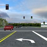
Connected and autonomous vehicle (CAV) technology and information may greatly help reduce congestion, especially in urban settings. However, currently there is no real-time, reliable, and multimodal approach for controlling the timing of signalized intersections in a connected or semi-connected arterial or urban street network. In addition, research is needed to explore the ability to communicate basic traffic signal controller information such as signal phase and timing (SPaT) to connected vehicles to allow them to directly respond to and coordinate with ongoing signal operations. Because WSDOT maintains 1,000 signalized intersections throughout the state, it is important for WSDOT to plan for this emerging and revolutionary technology and to develop ways to use the additional information that CAVs will provide to improve traffic operations. This project will help WSDOT to identify technological issues and requirements of integrating CV hardware in existing traffic signal systems.

Principal Investigator: Ali Hajbabaie, Civil and Environmental Engineering, WSU
Sponsor: WSDOT
WSDOT Technical Monitor: Ted Bailey
WSDOT Project Manager: Doug Brodin
Scheduled completion: December 2020

Design of Coarse Bands and Channel Shape for Stream Simulation Culverts

This project is working to establish guidelines for placing coarse bands in streambed simulation culverts to maintain the form of the stream channel and enhance fish passage. At road crossings, restoring fish passage is recognized as a key priority. Stream simulation is one of the design methods that are allowed, and one kind of stream simulation utilizes coarse bands, which are relatively thin regions of sediment that are coarser than the natural streambed material and are placed horizontal to the flow to enhance stream channel stability. They are intended to simulate the natural stream in terms of both bed material and geometry. Of the 3,175 fish passage structures that WSDOT owns, the Washington Department of Fish and Wildlife has determined that 60 percent are barriers to fish passage. More than 800 of these structures must be fixed by 2030, and many will be replaced with stream simulation culverts. Results of this project will include recommendations for the layout, dimensions, and composition of the coarse bands to maximize longevity of the simulated streambed. A key component of this project will also be a standardized procedure for quantifying the performance of a simulated streambed.

Principal Investigator: Nicholas Engdahl, Civil and Environmental Engineering, WSU
Sponsor: WSDOT
WSDOT Technical Monitor: Julie Heilman
WSDOT Project Manager: Jon Peterson
Scheduled completion: December 2020

Field Analysis of Wood Guardrail Post Decay

This project is investigating the integrity of wood guardrail posts in strategic locations of Washington state. Guardrail systems protect motorists involved in a crash by dissipating energy and keeping them from leaving the roadway. The guardrail post is an important part of the system. Unfortunately, wood guardrail posts are susceptible to failing during a crash event because of a loss of strength from wood decay.  Wood decay may be due to fungal growth or insect intrusion and is difficult to detect by visual inspection alone because decay commonly occurs inside the post.  Phase I of this research proposed utilizing a stress wave timing (SWT) device for non-destructive field testing of wood posts.  This Phase II study is focusing on quantifying the factors that affect wood post service life in the Northwest, including the post’s age, location, and physical properties such as wood species, treatment method, and lumber grade.  WSDOT will be able to use the information provided to consider the need to revise wood treatment specifications and/or design guidance for wood guardrail posts.

Principal Investigator: Adam Phillips, Civil and Environmental Engineering, WSU
Sponsor: WSDOT
WSDOT Technical M0nitor: Brad Manchas
WSDOT Project Monitor: Doug Brodin
Scheduled completion: June 2018

Developing Extended Strands in Girder-Cap Beam Connections for Positive Moment Resistance

This project sought to increase the seismic safety of the state’s bridges by improving the connections among bridge components. A typical Washington state concrete bridge bent consists of cast-in-place piers, precast, pre-stressed girders, and a cap beam. Successful interaction among all three components must be achieved to transfer induced loads effectively and provide adequate resistance to seismic shaking. The cap beam comprises a precast crossbeam and a cast-in-place diaphragm, flush with the girders. To create the tension connection between the bottom girder flange and the cap beam, it is common to extend some of the bottom steel strands into the cast-in-place diaphragm, where they are anchored with strand vices and bearing plates. The goal of this project was to create a reliable, effective, and practically applicable way of anchoring strands extended from the girder into the cap beam.

... Read More about Developing Extended Strands in Girder-Cap Beam Connections for Positive Moment Resistance
Washington State School Walk Score

Active travel to school helps children be healthy. It also reduces air pollution and noise, as well as traffic congestion. To ensure that parents and teachers support and encourage walking, active school travel must be safe. This project is developing a School Walkability Score that WSDOT can use to rate all K-12 schools in Washington state. The score will help parents and teachers assess walkability levels around individual schools, and it will guide WSDOT staff in selecting strategies that will improve walkability and safety. The score will be derived from measures of the built and transportation environment around each school, such as sidewalks, crosswalks, traffic volumes, parks, and vacant lands. It will be validated by using school-level mode splits from Washington State Student Travel Surveys.

Principal Investigator: Anne Vernez Moudon, Urban Design and Planning, UW
Sponsor: PacTrans
Scheduled completion: August 2019

Enhancing Traffic Incident Management: Phase 2

Traffic incident management (TIM) is the process of coordinating the resources of various partner agencies and private sector companies to detect, respond to, and clear traffic incidents as quickly as possible to reduce the impacts of incidents on congestion while protecting the safety of on-scene responders and the traveling public. This project is looking at how TIM in the Puget Sound region can be improved by incorporating congestion management (CM). Researchers at the UW Center for Collaborative Systems for Security, Safety, and Regional Resilience are building on Phase I of their research to design, prototype, and test three innovations: a Congestion Analysis Engine that will assess the status of real-time congestion and include pre-planned options for implementing planned TIM-CM strategies such as rerouting or signal timing; an enhanced information sharing system that will share real-time data across the TIM and CM teams; and an enhanced system for public communication that will include collaboration with private industry and existing commercial traffic information providers in response to major incidents. The enhancements to our regional TIM system will promote the safety of first responders and the public and will improve the efficacy and coordinated efforts of multiple agencies engaged in incident response and related services.

Principal Investigator: Mark Haselkorn, Human Centered Design and Engineering, UW
Sponsor: WSDOT
WSDOT Technical Monitor: Ron Vessey
WSDOT Project Manager: Doug Brodin
Scheduled completion: June 2019

WSDOT Road-Weather Information Systems (RWIS) 9

In cooperation with and with support by WSDOT, researchers at the UW have developed innovative, Web-based applications to provide current and forecast weather conditions for cross-state travel on state highways to WSDOT personnel and the traveling public. The resulting websites combine complex meteorological and roadway data from numerous sources and present them through user-friendly, intuitive Web interfaces. These websites have become extraordinarily popular among the citizens and businesses of Washington state, and during periods of adverse weather they play a crucial role in informing travelers crossing the mountain passes of delays and dangerous conditions.  This project is continuing the complex work necessary to collect, process, maintain, and disseminate such a wide range of weather and roadway information.

Public websites:
I-90 View I-5 North, I-5 Central: I-5 South: SR-101:   WSDOT Weather:

Principal Investigator: Clifford Mass, Atmospheric Sciences, UW
Sponsor: WSDOT
WSDOT Technical Monitor: James Morin
WSDOT Project Manager: Doug BrodinScheduled completion: October 2018

Advancing Multimodal Safety through Pedestrian Risk Reduction

The objective of this project is to develop models for identifying locations of high risk for pedestrian-related crashes at urban and suburban locations throughout WSDOT’s roadway networks. The research will develop pedestrian risk models to identify the locations most likely to benefit from investments aimed at reaching WSDOT’s Target Zero goal of zero pedestrian fatalities and serious injuries. The models will also identify the characteristics that contribute to the most severe pedestrian crashes. A recognized challenge to developing these tools is the availability of data sources. Hence, the project team will develop data-driven tools that consider the data necessary and associated data sources for capturing pedestrian crashes, crash locations, and pedestrian density; the types of pedestrian risk models that can be developed with existing data sources; and the abilities and limitations of the developed models to predict crashes and injury severity for various factors such as location types, time of day, pedestrian/bike/car mix, and individual socio-demographic and behavioral attributes. The outcomes of this project can have an impact on WSDOT’s operational programs and help the agency prioritize safety-related pedestrian projects.

Principal Investigators:
Linda Ng Boyle, Civil and Environmental Engineering, UW
Anne Vernez Moudon, Urban Design and Planning, UW

Sponsor: WSDOT
WSDOT Technical Monitor: John Milton
WSDOT Project Manager: Jon Peterson
Scheduled completion: December 2020

WSDOT Traffic Operations Support and Congestion Analysis

To better inform its decision making about where to deploy and how to operate its traffic management systems, WSDOT needs information on the performance of its traffic management strategies.  It also needs decision support tools that describe predicted and actual performance benefits. These tools must provide integrated, real-time information that feeds each step in WSDOT’s business process, from initial needs identification through performance monitoring and reporting. As part of ongoing work, TRAC has developed, improved, and operated a data archive and decision support system called TRACFLOW, which produces performance measures that both WSDOT and TRAC staff commonly apply in a variety of analyses. This project will provide technical and analytical assistance in support of the TRACFLOW software and its use. WSDOT staff will benefit from the software support in the operational, planning, and policy decisions that are based on TRACFLOW monitoring and analysis activities. Analytical results will also support long-range planning activities by regional agencies such as the Puget Sound Regional Council.

Principal Investigators:
Mark E. Hallenbeck
John Ishimaru
Washington State Transportation Center, UW

Sponsor: WSDOT
WSDOT Technical Monitor: Monica Harwood
WSDOT Project Manager: Doug Brodin
Scheduled completion: June 2019

A Data-Driven Safety and Operations Assessment of Various Left-Turn Phasing Strategies

Because drivers respond differently to different signal phasing sequences, engineers need to evaluate how drivers interpret the message that each phasing sequence is trying to convey. This research evaluated the safety and operational impacts of different left turn movement treatments at signalized intersections by using crash, video, and survey data. The results should help decision makers select more suitable signal phasing plans under various operational conditions.

... Read More about A Data-Driven Safety and Operations Assessment of Various Left-Turn Phasing Strategies