Cowlitz County earns the dubious distinction of having recorded the highest percentage of restricted properties among all the counties of Washington. With more than 8,000 identified so far, it ranks second in number to King County whose population and housing stock is 20 times that of Cowlitz. Many of the restrictions were imposed by the owners of the Long-Bell lumber company which planned and developed the city of Longview starting in 1923, wrapping most of its subdivisions with restrictive covenants banning "any person who is not of the white race."
The links below lead to four resources featuring different kinds of maps, lists, and information showing the neighborhoods impacted by racial restrictive covenants and the history of segregation and exclusion.
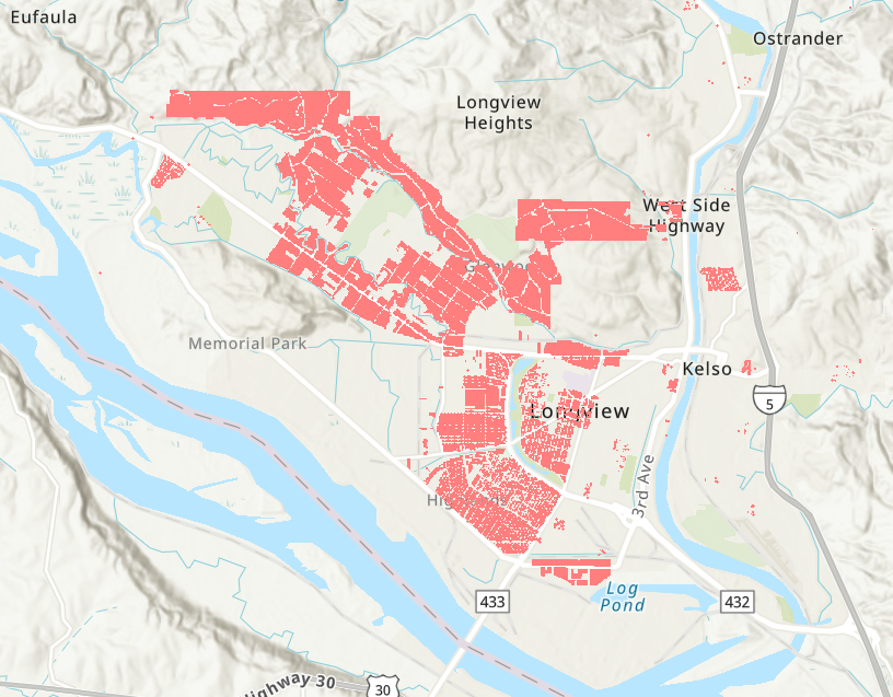
8,000 restricted parcels
This interactive map shows shows the exact location of properties that carried racial restrictions, including most of the city of Longview. Zoom to street level or search by address.
.png)
Longview's History of Racial Exclusion, Segregation, and Housing
This report details the history of racial exclusion in Cowlitz County, highlighting the efforts of Long-Bell lumber company to restrict the city of Longview.
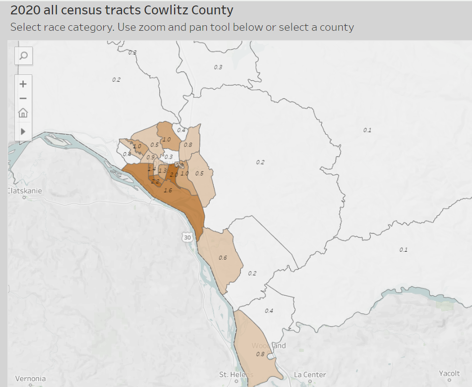
Race and segregation maps
1980-2020
Here we map the neighborhood-by-neighborhood distributions of African Americans, Asian Americans, Indigenous Americans, Latinos, and Whites across four decades.
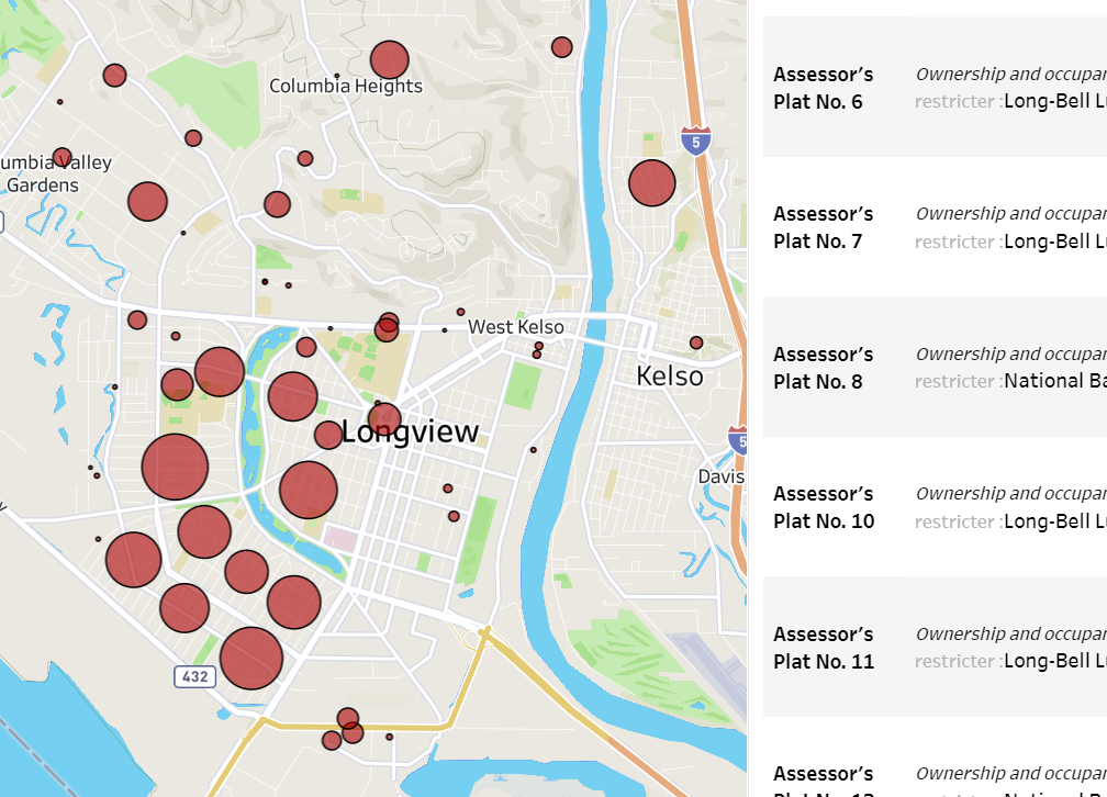
Restriction documents and data
Downloadable documents for 62 subdivisons with known restrictions. Scroll the list, read the language of restrictions, learn the names of the developers.