Here we map and provide documents for neighborhoods where racial restrictive covenants were imposed in the decades when they were legal. Most restrictions Mason County date from 1940s and 1950s and covered a large percentage of subdivisions developed in that period. We have documented more than 1,600 restricted properties in 37 subdivisions. Do not assume that areas without circles were unrestricted. Neighborhoods without covenants often practiced racial exclusion by other means. And the practice extended throughout the county. The 1960 census counted only 5 African Americans, 35 Asian Americans, and 363 Indigenous Americans, members of the Squaxin Island Tribe and Skokomish Tribal Nation. The county population was 97.5% white.
The map below is still in progress. For a searchable map of individual properties go to our Kitsap parcels map.
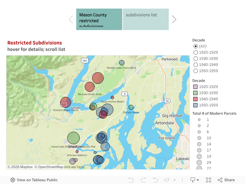
Neighborhood list with attached documents
Click the link to see a pdf copy of a restrictive document for each subdivision. There are three types of documents. Some subdivisions were restricted in the original plat; some in covenants (CCR) that applied to the full subdivision. In other cases the developer/seller included the restrictions in deeds of sale.