 |
||||
|
|
|
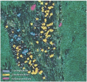
IKONOS-Based Juniper Extraction
|
|
|
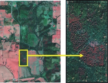
A satellite image from the IKONOS sensor, captured on February 6th, 2002 used in the project. The multispectral imagery resampled to 1 m per pixel resolution donwgraded to internet format can be explored through one of the VRM on the geovisualization page of this project. Red areas in the yellow box of the IKONOS image below indicate juniper presence.
|
|
|||
| Dr. L. M. Moskal @ UW | RSGAL @ UW | Wilsons Creek National Battle Field |
This
project was funded by National Park Service through the Cooperative Ecosystems
Studies Units (CESU) |
||
© 2003 - 2011 Dr. L. M. Moskal - Last updated on
07.01.11 19:23
|
||