 |
||||
|
|
|
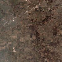
IKONOS-Based Juniper Extraction
|
|
Geovisualization work utilizing geospatial technologies and techniques was undertaken. The field database and various WICR GIS datasets were utilized to produce simple animations based on geographic datasets called geovisualizations. The animations include a preliminary fly-through of the park based on present land use / land cover as well as a historic and present 360 degree look at the geographic centre of the park (along Wilson's Creek). The trees visible in these visualizations are placed on the landscape randomly within land use land cover polygon boundaries. They do not represent actual trees on the ground but only probable tree locations, species and sizes for a particular GIS based land cover.
|
|
|||||
|
VRM
(Vritual Reality Models)
|
||||||
|
|
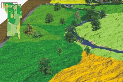
A very small area of the landscape was extracted and can be navigated through. The tree locations, species and size are all based on field observations. An animated fly through of this geo-VRM was also produced. |
|||||
| Dr. L. M. Moskal @ UW | RSGAL @ UW | Wilsons Creek National Battle Field |
This
project was funded by National Park Service through the Cooperative Ecosystems
Studies Units (CESU) |
||
© 2003 - 2011 Dr. L. M. Moskal - Last updated on
07.01.11 19:23
|
||