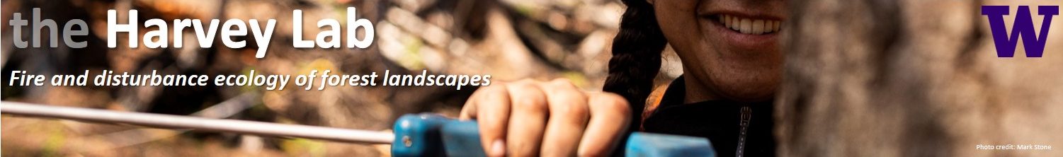
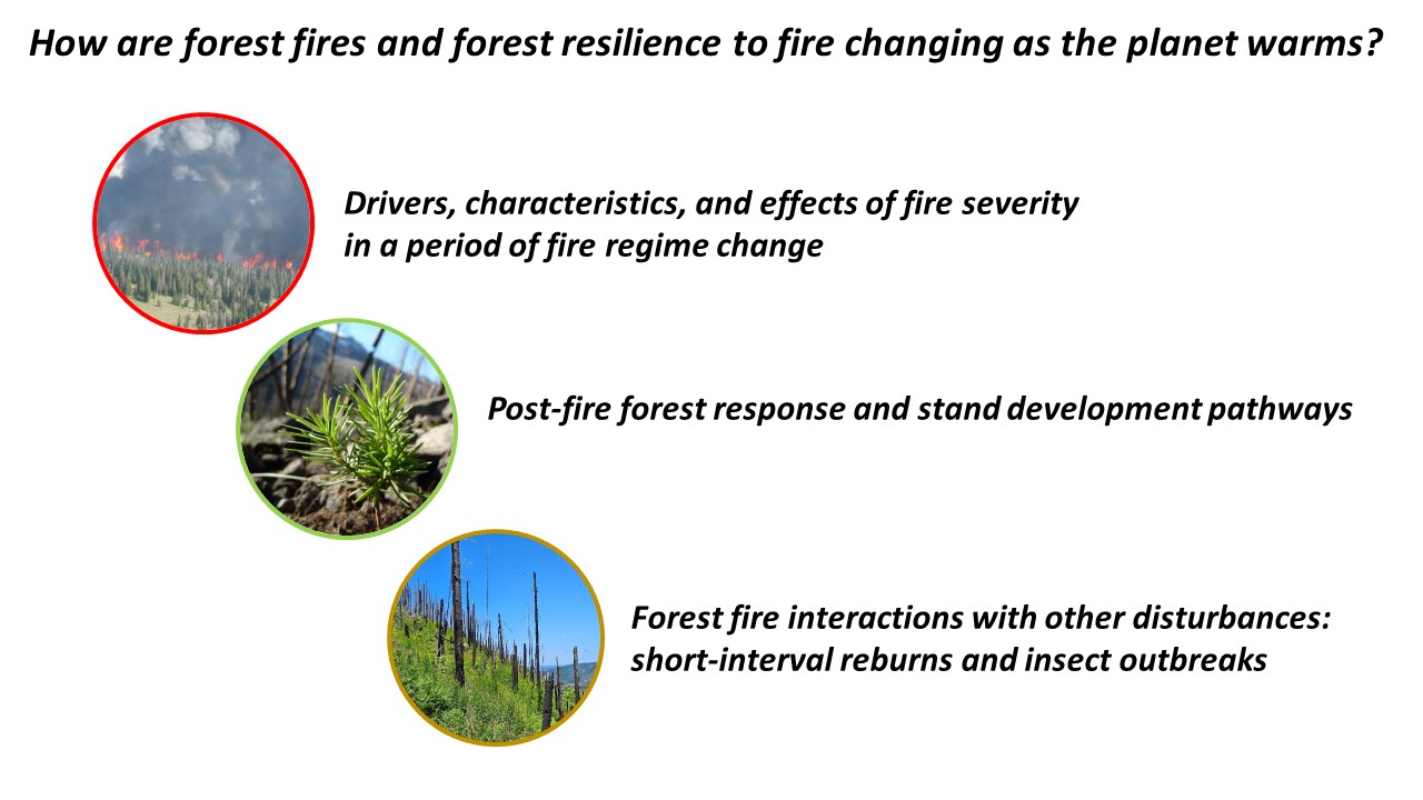
These are just a few of the core research themes in the Harvey Lab, where our mission is to conduct cutting-edge scientific research in forest | fire | landscape | disturbance | ecology. We co-develop most of our research with partners and stakeholders to collaboratively broaden understanding of forest ecosystems and to support forest management and policy that fosters resilience to fire and other climate stressors.
–
Our research projects and funded grants
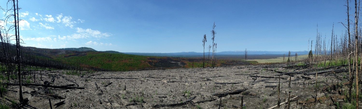
Extreme severity ‘reburn’ in 2016 of the 1988 Yellowstone Fires in WY.
Current (ongoing) funded research projects:
2024 – 2029. National Science Foundation. CAREER: Mechanisms of ecological and fire regime change in temperate maritime forests: disturbance, heterogeneity, and resilience. Learn more about this project here!
2024 – 2026. Science for Nature and People Partnership (SNAPP): Salmon, Forests, and Fire. Learn more about this project here!
2024 – 2026. USDA Forest Service: Evaluating and modeling dry forest restoration and fuel treatment effects through time and across stand successional stages.
2024 – 2026. USDA Forest Service: Interacting influence of forest management and fire on forest resilience, carbon, fish, and wildlife habitat in the Mt. Hood and Willamette National Forests, Oregon, USA.
2023 – 2026. Joint Fire Science Program: A rare opportunity to evaluate landscape fuel reduction effectiveness in a high-severity fire regime. Learn more about this project here!
2023 – 2026. Joint Fire Science Program: Longevity of fuel treatments in eastern Cascades following restoration treatments and wildfire. Learn more about this project here!
2023 – 2026. Joint Fire Science Program (Graduate Research Innovation Award, Jenna Morris): Stand-level drivers and management impacts on trajectories of reburn potential in western Cascadia. Learn more about this project here!
2023 – 2025. Gordon and Betty Moore Foundation: Western US Fire Ecology and Forest Resilience Science Collaborative. Learn more about this project here!
2022 – 2025. FEMA – Building Resilient Infrastructure and Communities: Tulalip BRIC Partnership Proposal for the development of a project-scoping framework for hazard mitigation plans to maximize effectiveness and efficiency of natural hazard mitigation strategies.
2020 – 2026. USDA Forest Service – Region 6 Ecology Program: Landscape assessment: New horizons for a changing world.
Past (completed) funded research projects:
2022 – 2024 Joint Fire Science Program Graduate Innovation Award (Don Radcliffe): Effects of fuel treatment configuration on avian diversity in western dry forests.
2022 – 2023. USDA Forest Service: Calibration and validation of satellite burn-severity indices with field data in forests of the Interior Pacific Northwest.
2022 – 2023. USGS Northwest Climate Adaptation Science Center Fellowship (Jenna Morris): Post-fire forest trajectories in western Cascadia: simulating vegetation, reburn potential, and user-defined management scenarios under climate change.
2022 – 2023. Washington Department of Natural Resources: Drivers of post-fire tree regeneration in the Eastern Cascades, Washington.
2022 – 2023. UW Earth Lab Innovation Grants: Cultural Ecosystems in a changing world: building a network across the Northwest to support food sovereignty, climate adaptation, and land rights.
2021 – 2022. USGS Northwest Climate Adaptation Science Center Fellowship (Michele Buonanduci): Potential impacts of future fires in the western Cascades: insights from spatial metrics of burn severity.
2021 – 2022. Joint Fire Science Program Graduate Innovation Award (Michele Buonanduci): Does high-severity patch structure scale consistently with fire size across the Northwest US?
2021 – 2023. USDA National Institute of Food and Agriculture: Consequences of forest fires in western Cascadia: post-fire woody carbon and future fire risk.
2020 – 2023. USDA Forest Service: Short-term post-fire dynamics following stand-replacing fire in the Western Cascades.
2019 – 2022. USGS Northwest Climate Adaptation Science Center: Forest fires in western Cascadia: Evaluating drivers and effects to inform climate-adaptive management responses.
2020 – 2021. Washington Department of Natural Resources: Assessing and monitoring forest and fuels restoration needs in Eastern Washington.
2020 – 2021. Joint Fire Science Program Graduate Innovation Award (Michele Agne): The race between fuels and fruits: testing mechanisms of serotinous forest resilience to short-interval severe reburns.
2019 – 2023. National Science Foundation: Spatiotemporal interactions among biotic disturbance agents, biological legacies, and compensatory responses: Consequences for temperate forest resilience.
2019 – 2020. USGS Northwest Climate Adaptation Science Center Fellowship (Michele Agne): Is there evidence of post-fire recruitment failure in serotinous forests of the Pacific Northwest.
2019 – 2020. UW Royalty Research Fund: A rare opportunity: Gaining insights into current and future forest resilience to wildfire in the western Cascade Mountains.
2019 – 2021. USDA National Institute of Food and Agriculture: Effective duration of fuels treatments on resistance to severe wildfire and post-fire resilience in interior Pacific Northwest forests.
2017 – 2019. USDA Forest Service: Calibration and validation of satellite burn-severity indices with field data in forests of the Interior Pacific Northwest.
2017 – 2019. USDA National Institute of Food and Agriculture: Do stand-thinning treatments promote resistance and resilience of forests to insects and fire? Unlocking insights from over seven decades of USFS Experimental Forest plots.
2017 – 2018. National Science Foundation (RAPID): COLLABORATIVE RESEARCH: The 2016 Yellowstone Fires: early indicators of ecosystem transitions in a more fiery future?
2017 – 2018. USGS Northwest Climate Science Center: Changing wildfire, changing forests: A synthesis on the effects of climate change on fire regimes and vegetation in the Pacific Northwest
2017 – 2019. Australian Research Council – Discovery Projects: Fire regimes and demographic responses interact to threaten woody species.
–
Our approaches
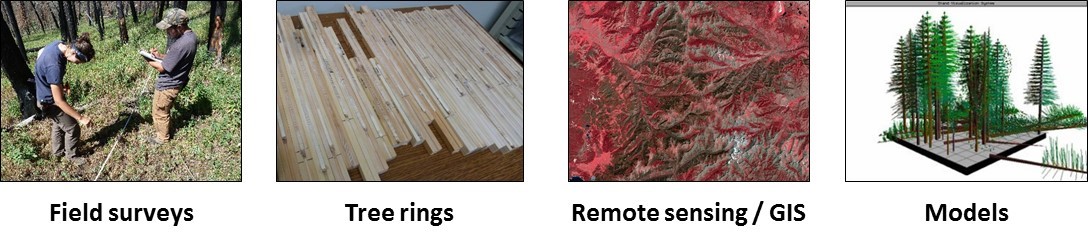
In our research we use a variety of tools and methods, letting the interesting and important questions guide our approach. We strive to connect insights across spatial scales (e.g., trees –> tree-neighborhoods –> forest stands –> watersheds –> regions), temporal scales (e.g., hours –> days –> weeks –> years –> decades –> centuries), and gradients (e.g., elevation, land use, management context). Doing so allows us to link a deep understanding of ecological processes anchored in the field with big data streams available from networks of satellites and sensors.
Our study areas
Our research is primarily focused in conifer forests of the western US, with particular focus on forests in the Pacific Northwest, Rocky Mountains, and Coastal California. Our research is in forests that span gradients in elevation (ranging from sea level to ~3500 m), management (ranging from active to passive management treatments), biophysical settings (ranging from rainforests to dry woodlands), and disturbance regimes (ranging from frequent low-severity fires to infrequent high-severity fires). We utilize and support continued measurements at long-term research sites (e.g., NSF Long-term Ecological Research stations, USFS Experimental Forests, PNW Permanent Sample Plot Network), an extensive network of > 1,600 field plots across the western US, and publicly available geospatial data (e.g., satellite burn severity maps).
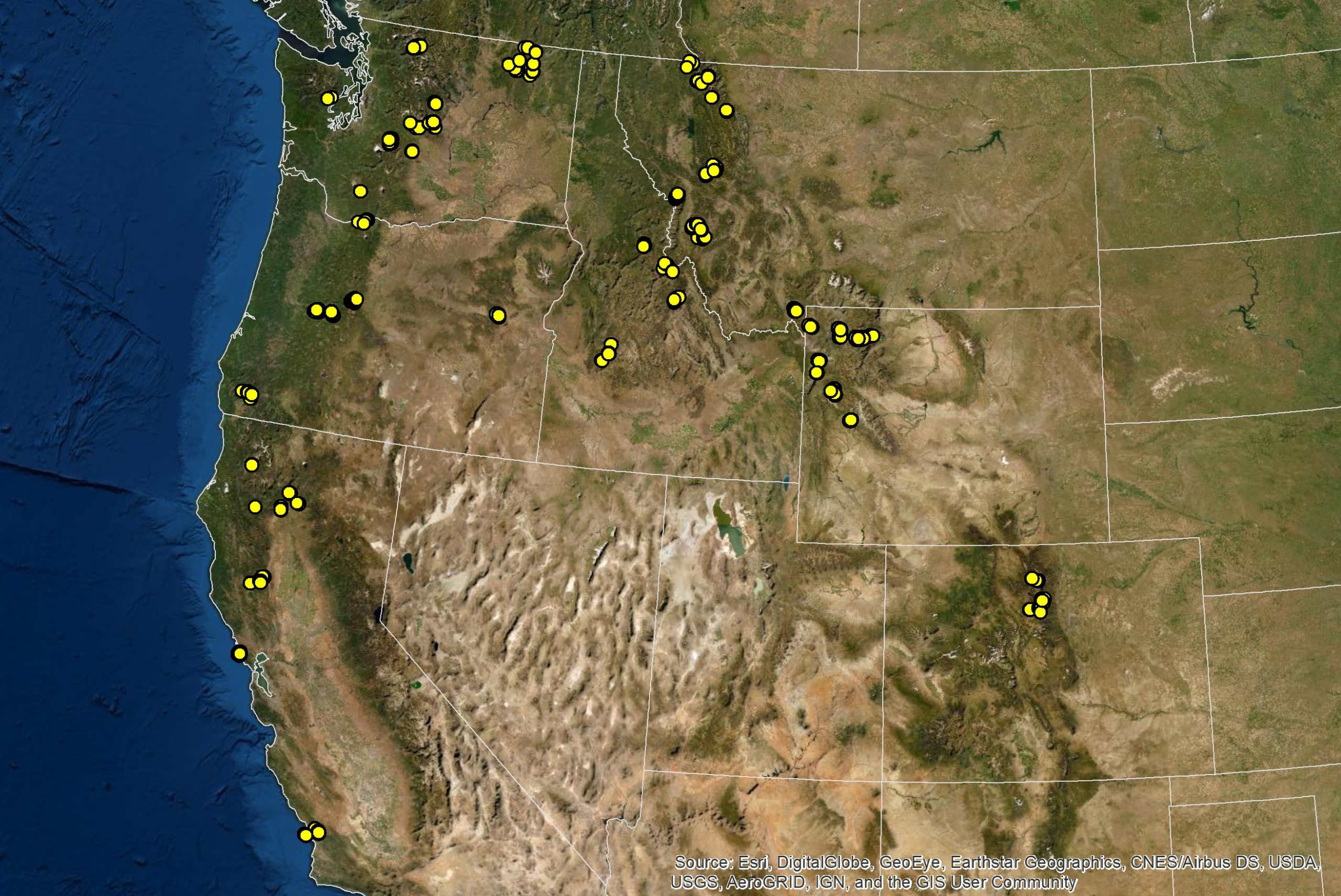
Network of >1,600 field plots that support our research in the Harvey Lab. Study sites include locations where we have continued measurements on plots installed >80 years ago – e.g., USFS Experimental Forests – as well as plots we have initiated and installed for new projects in recently disturbed forests – e.g., post-fire plots in the Cascades, Rocky Mountains, and Coastal California pine forests.
–
Our partners and support
–
We acknowledge that our research in the Pacific Northwest and beyond is located on homelands of Indigenous peoples, and we have a responsibility to critically reflect on the histories of dispossession and forced removal of the original inhabitants, as well as the resilience and vibrancy of their cultures today.