
UNDER CONSTRUCTION
This project produces free interactive maps showing the historical geography of Nativist and White Nationalist movements that have influenced American life and politics since the 1850s. This is part of the Mapping American Social Movements Project based at the University of Washington. Our maps, data, and reports show where social movements were active and where not, helping us better understand patterns of influence and endurance.
We do this by developing detailed geographic data about each movement, identitying locations where membership, activities, or other measures of support were concentrated. In the months ahead we expect to provide maps and geographic date for the following social movements and white-supremacist laws:
Here are our developing projects:
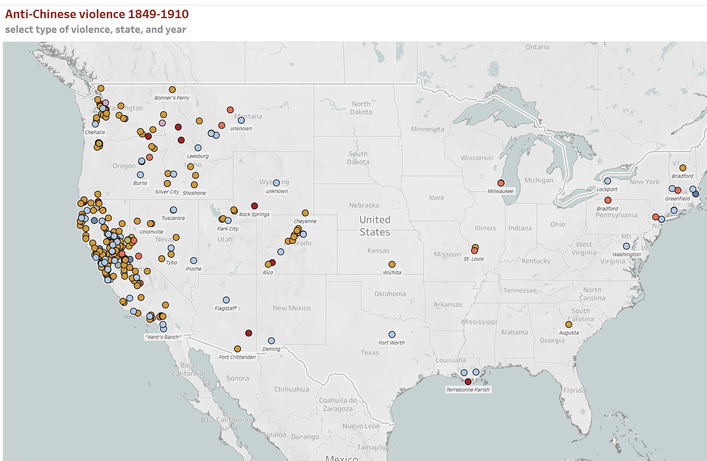 Anti-Chinese Violence 1850-1910
When the first Chinese immigrants arrived in the United States in large numbers during the California Gold Rush, they found not only abundant economic opportunity, but also violent racial hatred. This project maps and documents more than 600 episodes of anti-Chinese violence in the United States; incidents that claimed hundreds of lives.
.jpg) Mapping American Eugenics: Sterilization laws by state
Mapping American Eugenics: Sterilization laws by state
American eugenics refers to compulsory sterilization laws adopted by over 30 states that led to more than 60,000 sterilizations of individuals. Many were sterilized because of a disability or because they belonged to socially disadvantaged groups living on the margins of society. This project complements the University of Vermont project led by Prof. Lutz Kaeber: Eugenics: Compulsory Sterilization in 50 American States. Here with Professor Kaelber's help we map some of the data.
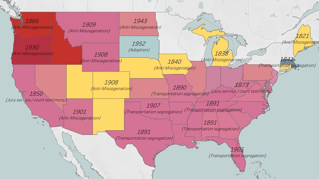 Jim Crow and racial subordination laws state by state
The term "Jim Crow law" typically refers to restrictions imposed on Black Americans in the South in the generations after Reconstruction, but historians now emphasize that laws enforcing racial subordination were not limited to the South nor aimed only at Black Americans. Here we identify hundreds of state laws aimed at Asians. Latinos, and Indigenous Americans as well as African Americans, and implemented in the North and West as well as the South.
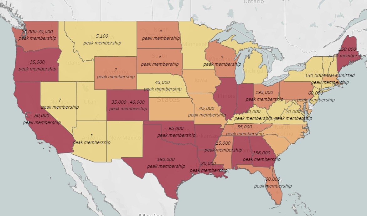 KKK in the 1920s - History and Geography
The second iteration of the Ku Klux Klan gained momentum after World War I and by 1924 claimed 4 million members and chapters (Klaverns) in every state. This project explores that geography, assessing membership numbers, Klavern numbers, episodes of violence, and the political influence of the Klan in each state.
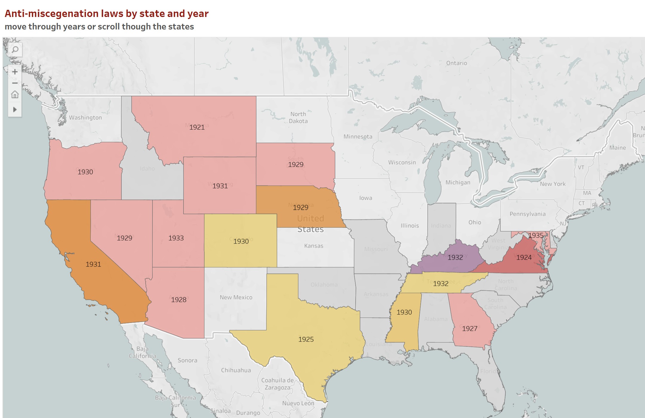 Timeline and Maps of Interracial Marriage (anti-miscegenation) Laws by State 1660-1967
The colony of Maryland enacted in 1692 one of the first laws banning marriages between persons deemed white and those deemed black. Over the next three centuries, especially after the Civil War, anti-miscegnation laws were enacted in all but nine states. Not until the Supreme Court ruled in the 1967 Loving decision did the practice of restricting marriages on the basis of race end. These maps trace the history and geography of anti-miscegnation legislation showing state by state and year by year, laws as they were enacted, modified, and repealed.
![thumbnail linked to interactive map]() Test map of German-American Bund 1937-1941
Test map of German-American Bund 1937-1941
Here are more interactive maps and charts that show the geography of