
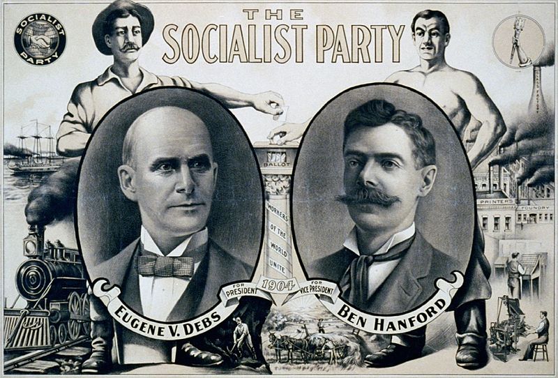
Founded in 1901, the Socialist Party grew rapidly in the years before World War I, claiming 113,000 members in 1912, making it, briefly, one of the largest socialist movements in the world. The SP won more than 900,000 votes in elections in 1912 and again in 1920. The movement's strength was evident also in the hundreds of party affiliated newspapers and the election of mayors, council members, and other officials in more than 300 cities. The Red Scare that began in 1917 and the loss of the majority of members to the two communist parties founded in 1919 severely damaged the movement, but through the 1920s and 1930s the SP enjoyed significant strength in some states and cities.
The changing strength and geography of the movement is revealed here is two dozen interactive maps and charts showing (1) votes for SP candidates for president, governor, and congress in every county and state from 1904 to 1948; (2) party membership by state and year; (3) locations of 380 newspapers associated with the Socialist Party; (4) 353 towns and cities that elected Socialists to public office prior to 1920.
Click to see map and photos Key maps: votes, membership, newspapers, and elected officials
Start with this set of seven introductory visualizations that show the distribution of votes for socialist candidates by county, party membership numbers by state, the locations of 380 party affiliated newspapers and 353 cities and towns that elected Socialist mayors and other officials. More detailed versions of each of the key maps are below
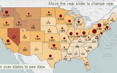
Click to see map and photos Membership by state 1904-1940
These interactive maps and charts track Socialist Party membership by state during the party's heyday from 1904 to 1919 and then from 1923 to 1940. Party membership reached a high of 113,000 in 1912. Advance the slide to see changing membership by year. Interactive controls allow you to compare particular states.
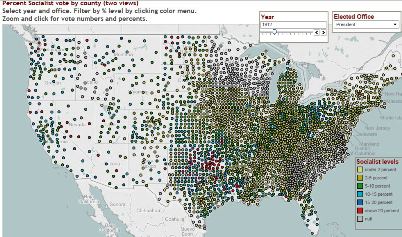
 Votes for SP candidates for president, governor, and congress by county, 1904-1948
The SP secured over 900,000 votes for Eugene Debs in 1912 and large totals in other races as late as 1938. Here are seven maps and charts showing vote totals for Socialist Party candidates in each presidential, gubernatorial, and congressional election for each county and state.
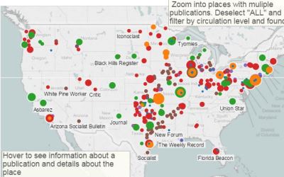
Click to see map and photos Newspapers 1900-1920
This interactive map identifies 380 newspapers linked to the Socialist Party, providing detail about editors, circulation, and about the towns and cities where they were published.
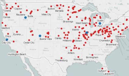
Click to see map and photos Socialists elected to office 1901-1960
This interactive map shows 353 cities and towns that elected Socialist Party candidates to public office, including mayors, congressmen, legislators, and many other offices, more than 1,000 in all.
 Scandinavian Socialist Federation - Socialist Party of America 1910-1919
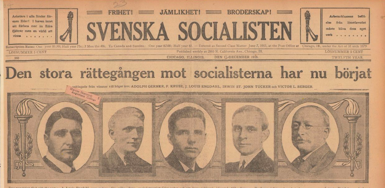
Many members of the Socialist Party of America (SPA) were immigrants. Some joined English-speaking party locals, but others organized in their own language, creating what the SPA called Foreign Language Federations. The Scandinavian Socialist Federation (SSF) formed in 1910, combining Swedish, Danish, and Norwegian socialists. Starting with local branches in 7 cities, the federation expanded steadily, counting 66 branches and more than 1,100 members in 1914, and 88 locals with 2,200 dues paying members in 1917. Here are interactive maps showing the location of the SSF branches from 1914 to 1918. The page also features an article "Class struggle and sectarianism: A story of the Scandinavian Socialist Federation" by Love Karlsson.
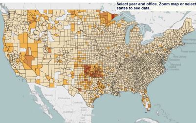
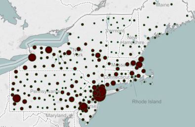 Socialist Activities by States and Regions
These maps and charts zero in on regions and subregions, displaying county by county electoral support for socialist candidates for the Northeast, Midwest, Northwest, Southwest, and subregions of the South. They make it possible to follow hotspots of party support from election to election.