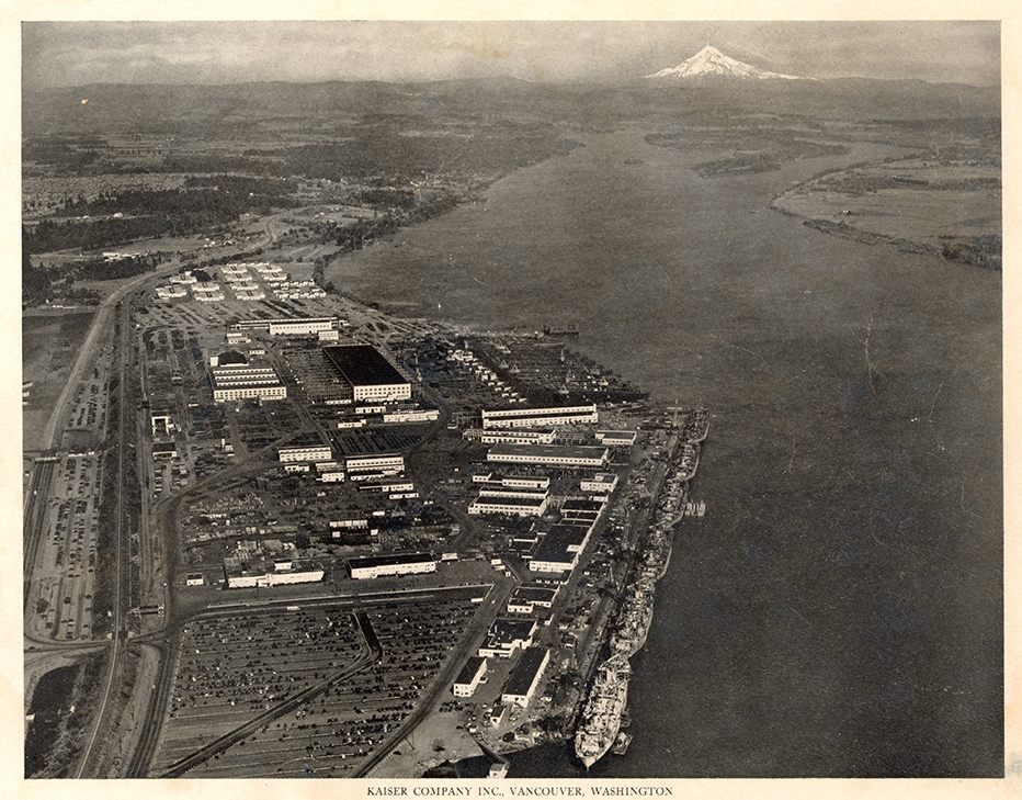
Restrictive covenants were one of the reasons that across many generations people of color found it difficult to live in Clark County. In 1970, 99% of the residents of Clark County identified as White. Only 548 Black folks, 398 Indigenous Americans, 371 with Asian/PI ancestries, and 151 with Hispanic backgrounds resided in the county, many in an impoverished Vancouver neighborhood near the I-5 bridge across the Columbia River. In a sense, they were survivors, remnants of what had been a much larger nonwhite population. In 1944, a wartime census survey estimated that more than 8,000 African Americans lived in the greater Vancouver area working in the Kaiser shipyards. After the war they were pushed out, denied jobs and housing, forced to leave. Racial deed restrictions played a role in this history of exclusion.
The links below lead to four resources featuring different kinds of maps, lists, and information showing the neighborhoods impacted by racial restrictive covenants and the history of segregation and exclusion.
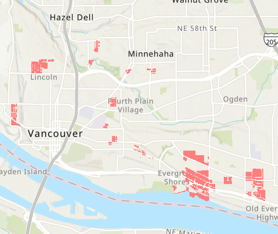
1,367 restricted parcels
This interactive map shows shows the exact location of 1,367 properties that carried racial restrictions. Zoom to street level or search by address.
Vancouver History of Racial Exclusion, Segregation, and Housing
This essay details the history of racial exclusion, charting the legal and social enforcement of racial covenants and the struggles against them.
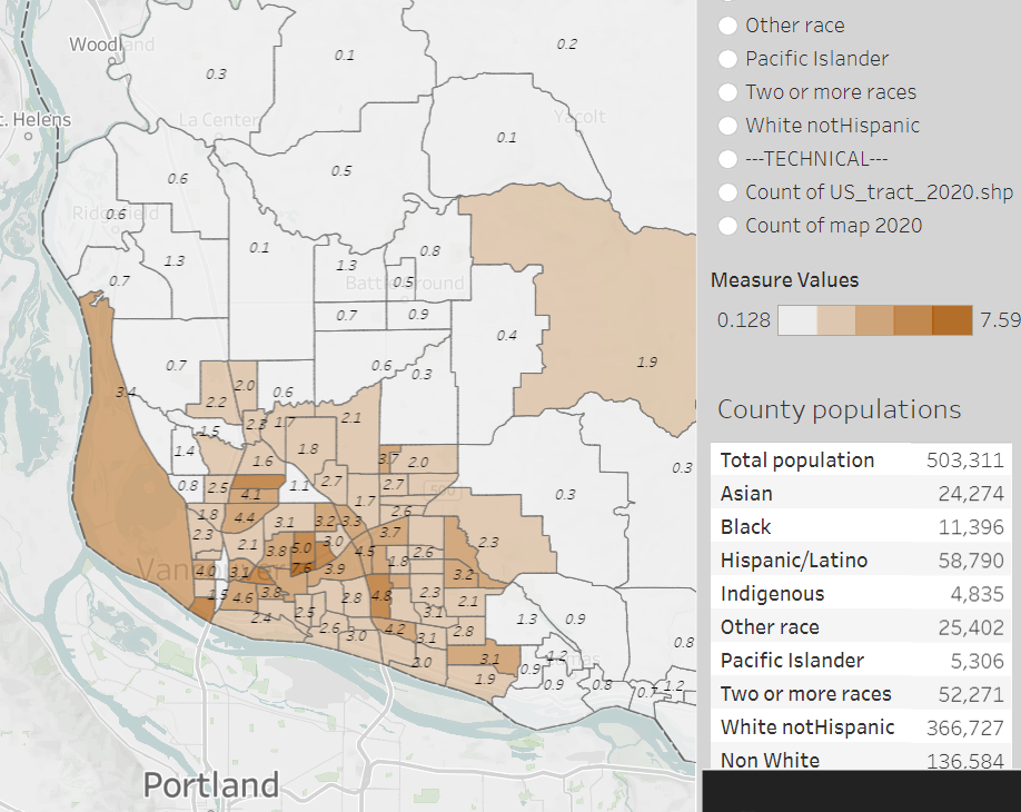
Race and segregation maps
1980-2020
Here we map the neighborhood-by-neighborhood distributions of African Americans, Asian Americans, Indigenous Americans, Latinos, and Whites across six decades.
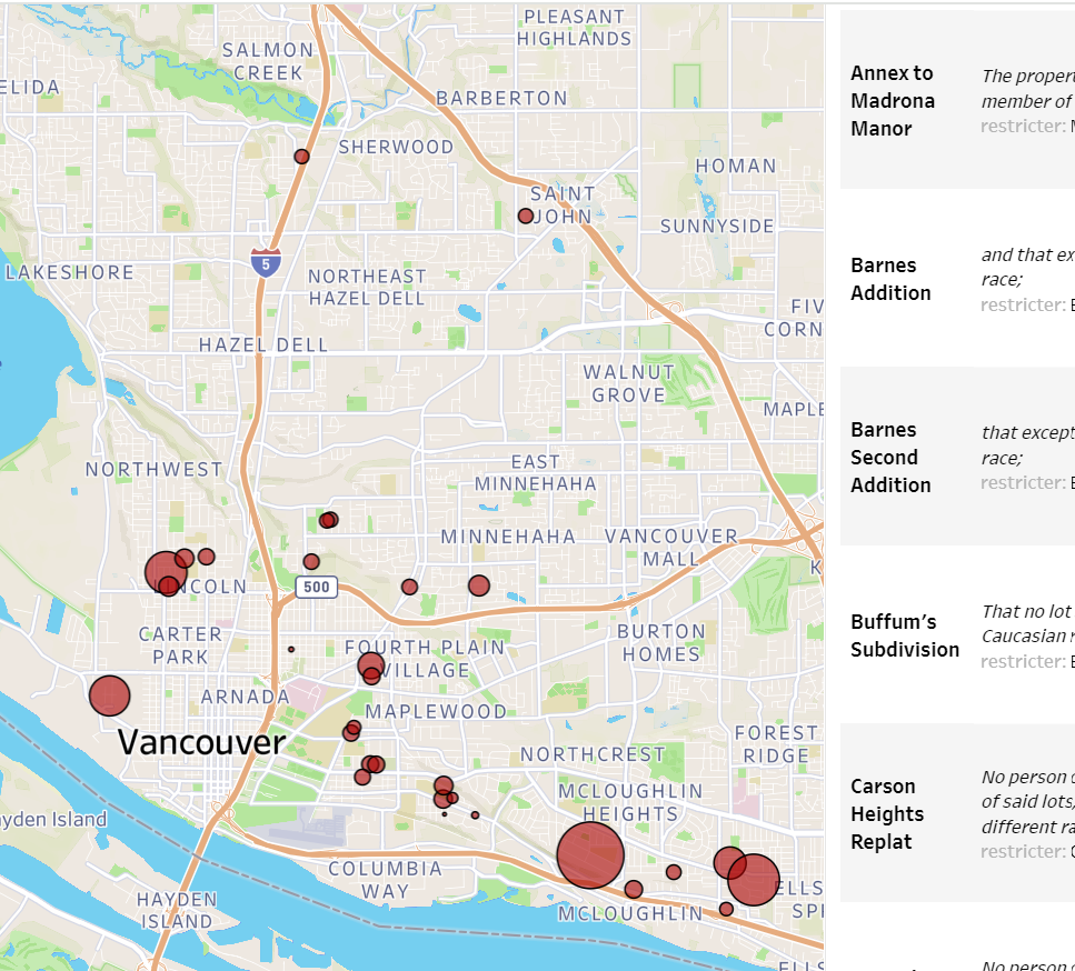
Restriction documents and data
Downloadable documents for 34 subdivisons with known restrictions. Scroll the list, read the language of restrictions, learn the names of the developers.