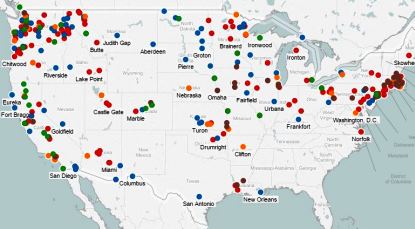
These interactive maps locate more than 1,800 strikes, campaigns, arrests, and persecution events involving the IWW from 1905 to 1920. Events can be filtered by year, state, and type of event. Hover to see short descriptions.
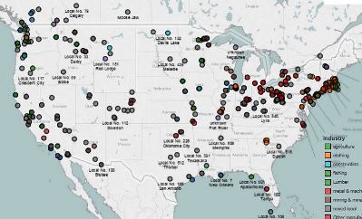
This set of maps locates more than 900 IWW unions in more than 350 cities and towns in 38 states and territories of the United States and 5 Canadian provinces. They are color coded by industry and you may filter by industry and state.
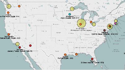
Here are maps showing the 90 newspapers and periodicals affiliated with the IWW. They were published in 19 different languages. These data were compiled by Kenyon Zimmer.
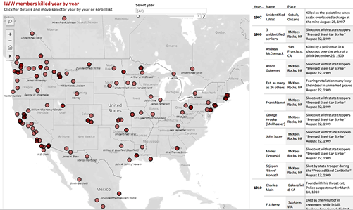
I.W.W. members and innocent bystanders who were killed while organizing, striking, taking direct action, or for carrying a Red Card. These members and bystanders were shot, stabbed, beaten, tortured, starved, strangled, lynched, drowned, disappeared, or executed. Data were compiled by DJ Alperovitz.