This is a work in progress. We will be adding data and refining tools in the months ahead.
Sources: Most of the events and descriptions are derived from articles in the Industrial Union Bulletin, 1907-1909; Industrial Worker, 1909-1912, 1916-1917, 1920; Solidarity, 1915-1917. Details have not been independently confirmed. Each event is listed, described, and sourced in the IWW yearbooks. Dates on these maps can be either the date of the event or the date of the newspaper article covering the event.
Research: Arianne Hermida, Nick Bragg, Alison Cheung, Morgan Cottle, Michael Handley, Oliver Janders, Michael Kirkman, Christopher Mulcahey, Danielle Simmons, and Austin Upton. Becca Flores developed and manages the database.
Maps: James Gregory
Additional IWW maps and charts
|
|
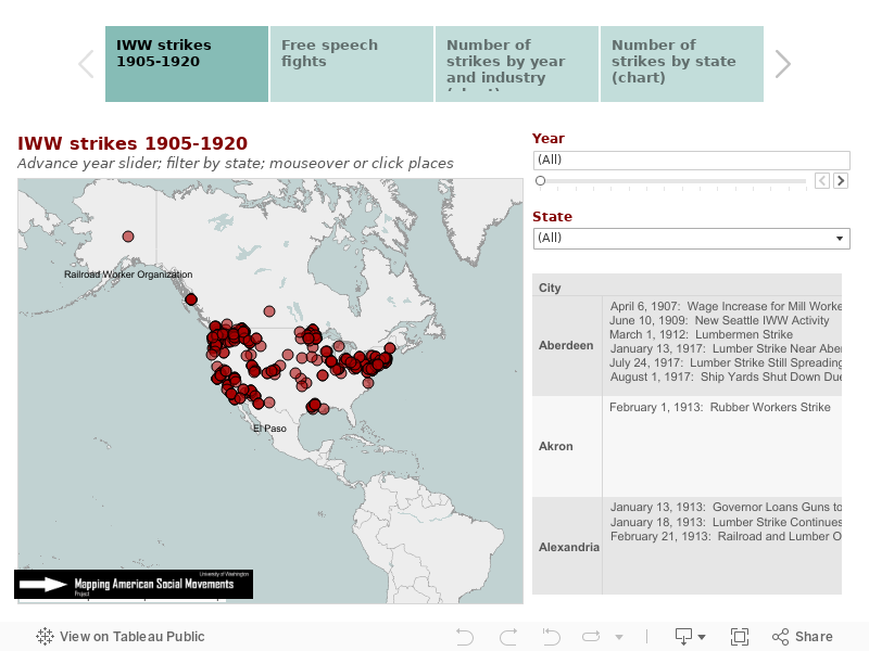
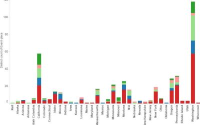
These interactive maps locate more than 1,800 strikes, campaigns, arrests, and persecution events involving the IWW from 1905 to 1920. Events can be filtered by year, state, and type of event. Hover to see short descriptions.
|
|
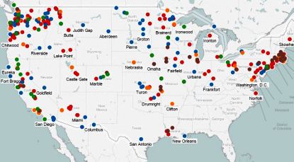
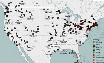
This set of maps locates more than 900 IWW unions in more than 350 cities and towns in 38 states and territories of the United States and 5 Canadian provinces. They are color coded by industry and you may filter by industry and state. |
|
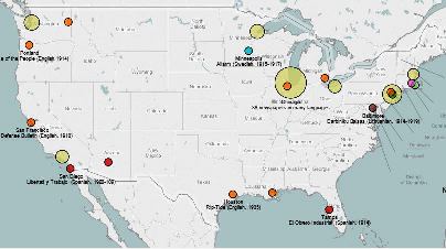
Here are maps showing the 90 newspapers and periodicals affiliated with the IWW. They were published in 19 different languages. These data were compiled by Kenyon Zimmer. |
 Other interactive maps, charts Other interactive maps, charts
More than 450 strikes are mapped. Filter by year. Hover for details on each one. Charts show numbers by state and years.
More than 350 incidents of persecution from 1906 to 1920. |